US 19/129 to US 19/129 at Turners Corner
Linked via: Nhdplus discovery 90% confidence Synced 6mo ago
Gauge Conditions
Runnable: 1,000.0 – 3,000.0 CFS
Data from American Whitewater & USGS
Run Map
Description
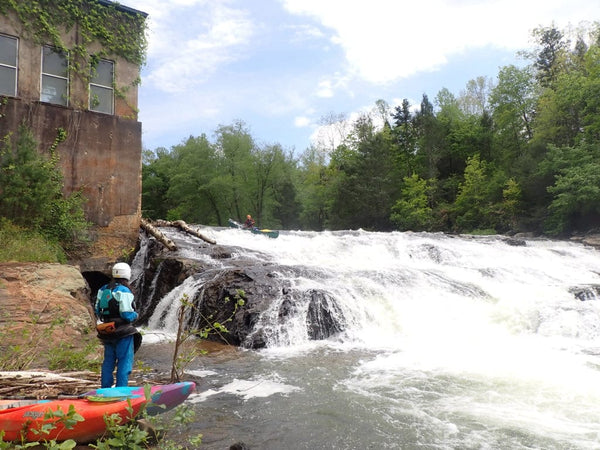
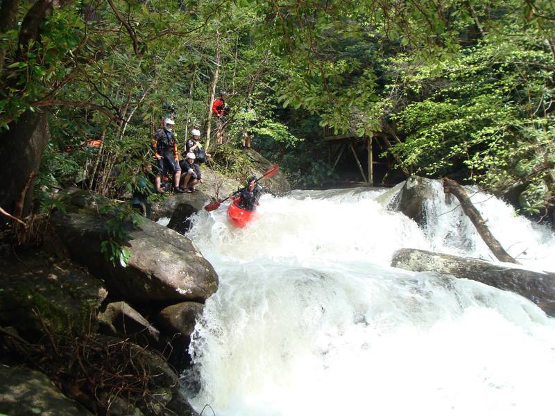
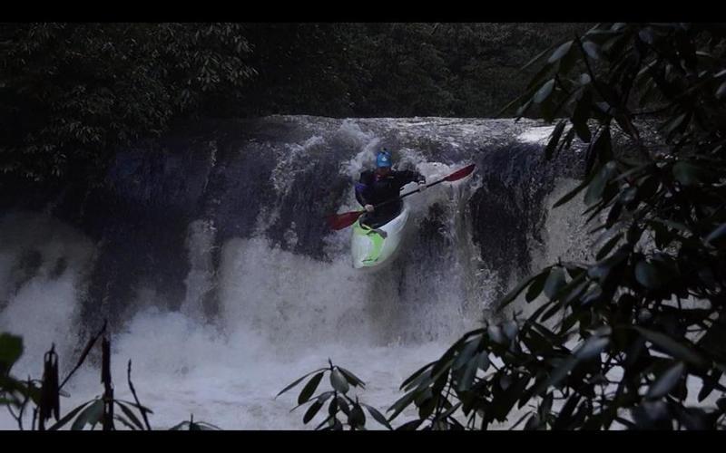
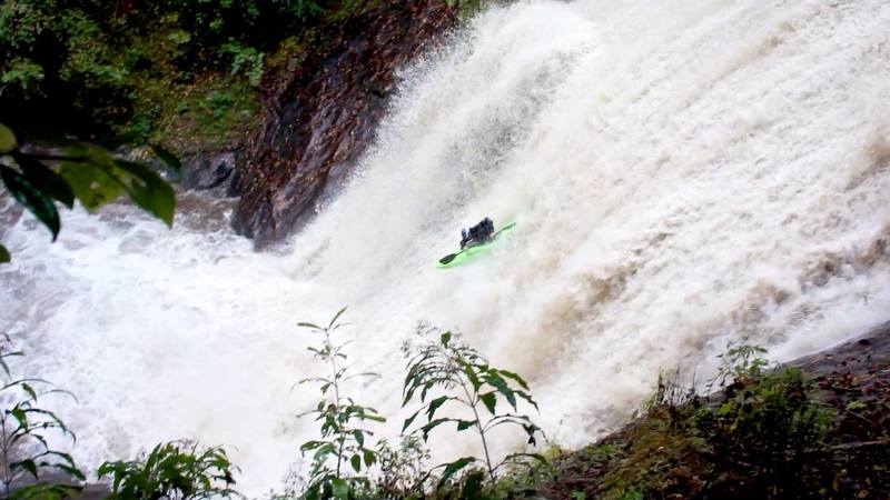
**\*\*\*\*\*\*\*\*\*\*DO NOT attempt to scout Cannon falls unless you are boating on the creek. All trails surrounding the area are private property and should not be used by boaters! Failure to do this could result in losing access to the wonderful creek!****\\*\\*\\*\*\*\*\*\*\*\***
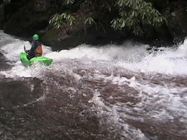
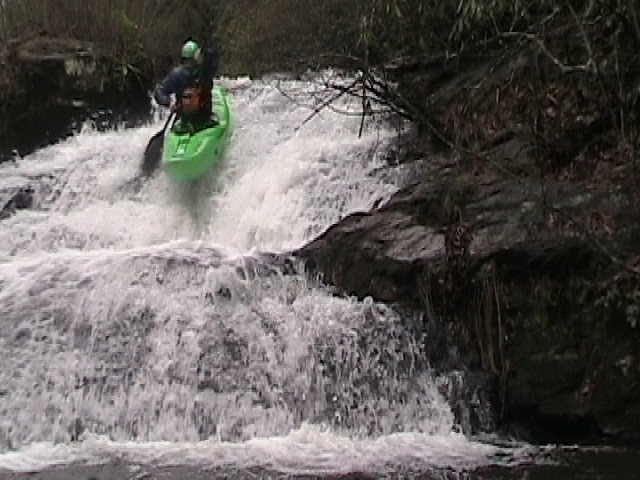
Frogtown Creek is a waterfall laden steep creek. At least one of the falls was run back in the late 80's and Neil Frost, who lives along the river, says all have been run.
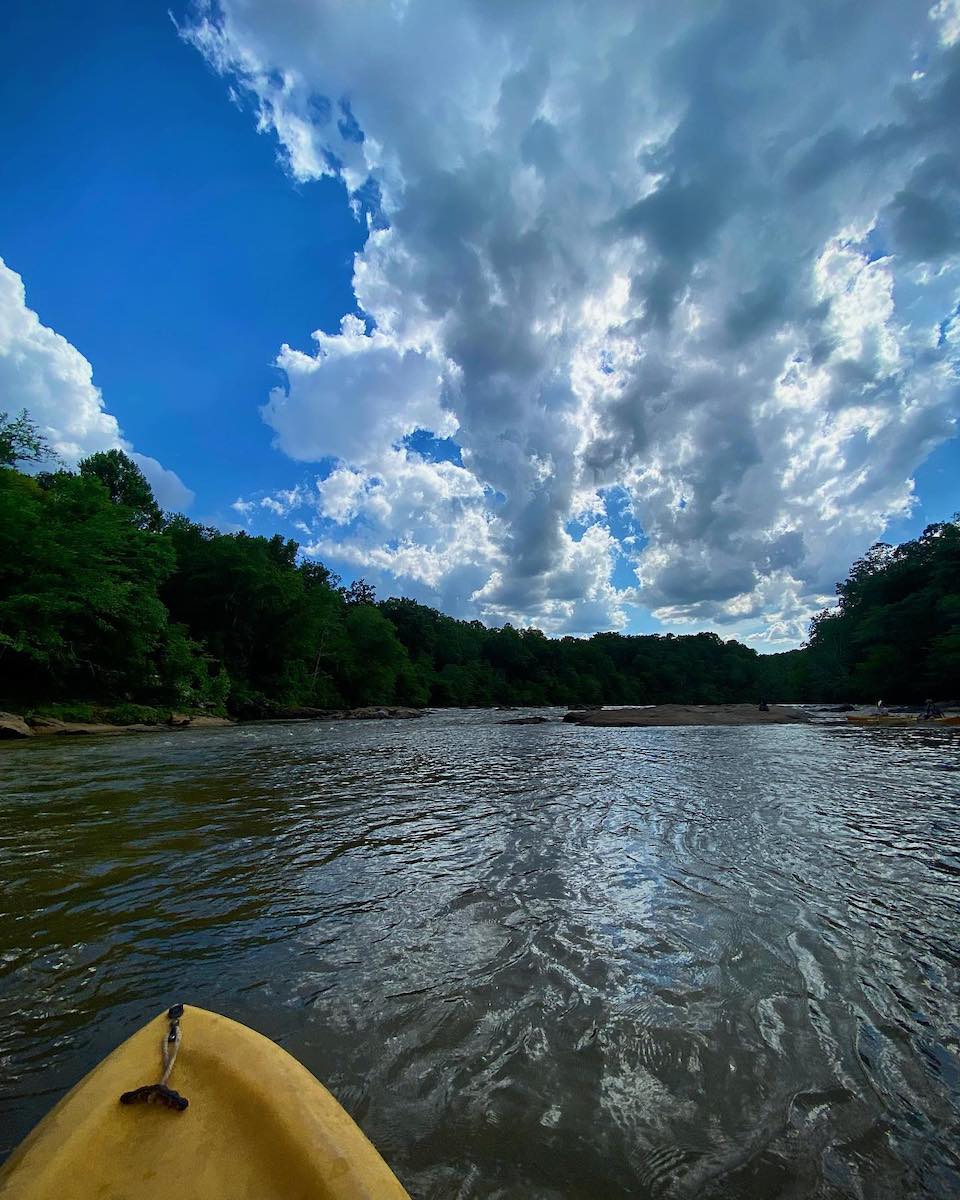
The creek starts and ends on US 19/129 as the road curves up Blood Mountain through the Blue Ridge range of the southern Appalachians. The takeout is at Turner's Corner on the Chestatee River.
Be careful of the three rather large drops on this run and please note that much of Frogtown Ceek is on private property. Many of the property owners do not care for boaters, especially those who trespass on their property.
There are three possible put-ins:
1\. The best option is a very short road off Highway 19/129 2.5 miles north of Turner's Corner. There is parking on the short dirt road and along the highway, the carry is short and the bank is minimal.
2\. There is an alternate put-in at a small, primitive campground accessed via a short road from Highway 19/129 1.65 miles north of Turner's Corner. The road is passable only to high-clearance 4WD vehicles, the carry from the highway is a couple of hundred yards and parking along the highway is minimal.
3\. The bridge on Edwards Parkway (turn left off Highway 19/129 1.5 miles north of Turner's Corner and go 0.4 mile to the bridge) can be used for a drop-and-drive access, but do not leave a vehicle parked: there is no parking area and the surrounding property is all private.
4\. Here is a link to a video that walks through the largest rapids on the river
https://www.youtube.com/watch?v=YYchTCd0W8A
Rapids in this Run (5)
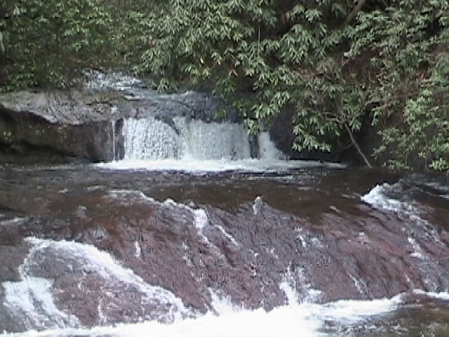
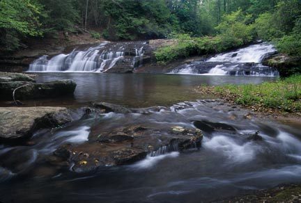
Waterfalls (5)
Hazards & Portages (2)
Caution: The following locations may require scouting or portaging. Always check current conditions.
Difficulty
Class III-V(V+)
Length
2.9 mi
Gradient
135 ft/mi
max 215
Rapids
5
2 Hazards
Access Points
Difficulty Classes
I Easy
II Novice
III Intermediate
IV Advanced
V Expert/Extreme
VI Unrunnable
Current Conditions
5-Day Forecast
Whitewater data from
American Whitewater
American Whitewater