US 27 Bridge to Clear Fork River
Linked via: Nhdplus discovery 90% confidence Synced 6mo ago
Gauge Conditions
Runnable: 500.0 – 5,000.0 CFS
Data from American Whitewater & USGS
Run Map
Run Time Estimate
Select put-in and take-out to estimate time.
Unlock Advanced Trip Planning
See wind-adjusted speed maps, forecast planning, and detailed time estimates.
Sign in to generate an AI timing estimate for this run.
Whitewater timing varies with scouting, portages, and group pace. Use as a planning baseline.
Description
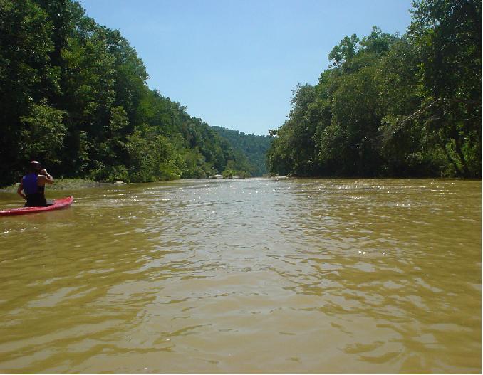
Five miles of flatwater then 4 miles of II-III
Put In: at the U.S. Hwy 27 bridge between Onieda, TN & Wartburg, TN or more specifically between Robins, TN & Helenwood, TN (there is an access road on river right just past the bridge that takes you under the bridge to a concrete put in ramp with lots of parking)
Take Out: The take out is the same as the Put In for the Big South Fork if you are running from the confluence down. From the put in travel north on US Hwy 27 for about 5-6 miles & turn left at the Subway onto Niggs Creek Rd. Cross the RR tracts & take your immediate left onto Detour Rd. aka Helenwood Detour Rd. Go about a 1 mile & turn right onto Airport Rd. Take the left split at the Airport onto John Long Rd. The airport will be on your right and the road will be gravel as you go into the gorge. You will also pass a cemetery on the way. Eventually the road will end at the parking lot. (Taking out at the confluence requires carrying your boat uphill about a 1/4 mile)
Distance: 8.9 Miles (US Hwy 27 to Confluence with Clear Fork)
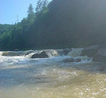
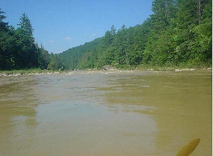
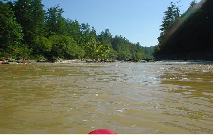
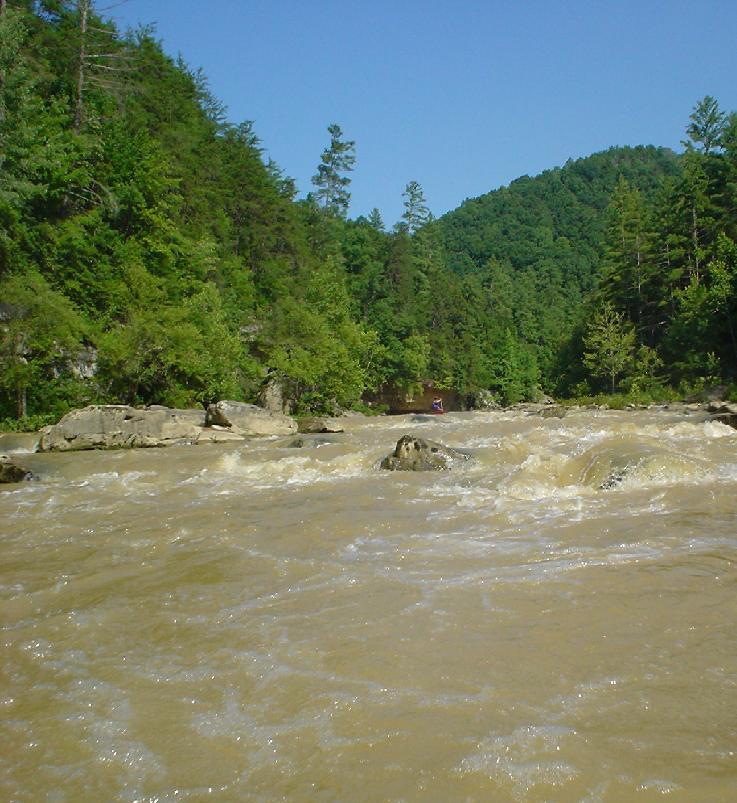
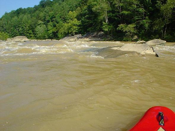
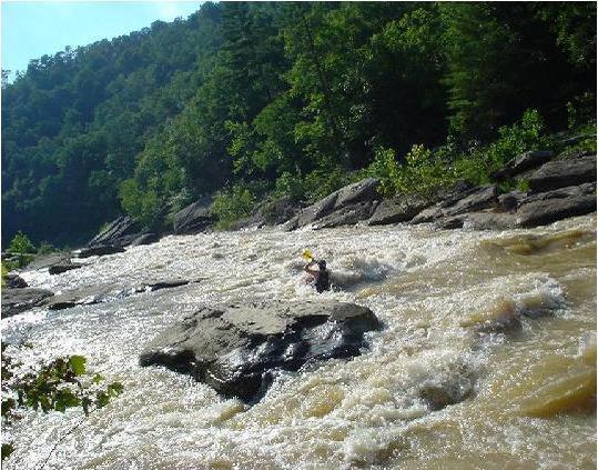
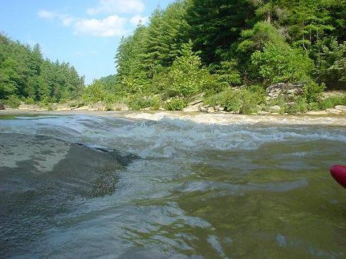
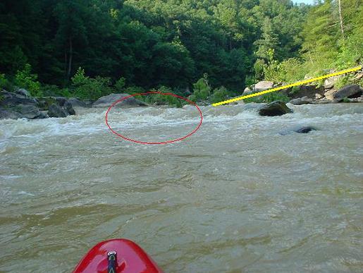
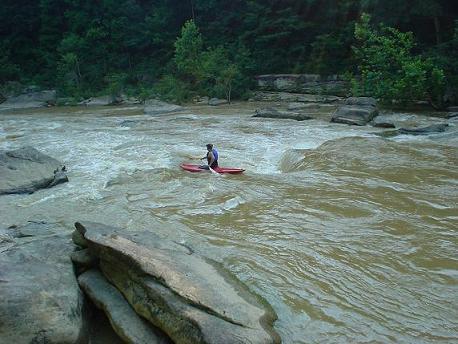
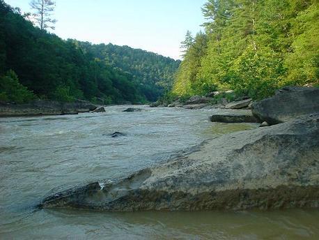
Description: This run gets overlooked due to the fact the the first five miles are flatwater and the water quality is suspect. However people are overlooking the bottom 4 miles which have about 12 Class II and 2-4 Class III. The first five miles are completely flat and are barely broken up by a few class I shoals. Finally, rock banks instead of mud banks and obvious gradient signals the start of the whitewater section. A few class II's lead to an obvious horizon line and the first Class III. This rapid is a 2-3 foot ledge on the left 2/3's that has pin rocks all over the landing zone and a spiral hole at one point that feeds an undercut. The middle has a pourover boof move and the right is a large shoal. Scout this rapid as it has undercuts & pin rocks on the leftside(see photo). Several more Class II's takes you to the 2nd Class III, WaBash Cannonball, the biggest rapid on this section. This rapid constricts the 70 foot wide river to about 30 feet causing a flume that gets pretty pushy. 1/2 way down the rapid is a large wave/hole that must be punched followed by another ledge just before several megaboulder pillow rocks to dodge.(see photo) This rapid marks the start of the last two miles which is where most of the gradient is lost. Immediately below is a Class II surfing ledge followed by another Class II + ledge. This ledge is marked by a huge pile (20-30 feet tall) of small boulders on river left that chokes the channel. The rapid has a tree blocking 3/4 of the ledge from river left.(see photo) There are a handful of more Class II's down to the take out at the confluence with the Clear Fork.
If you look at a topo map it looks like the last 2 miles could be accessed from John Long Rd. a 1/4 mile through the woods from the cemetery. Never tried it, but it would shorten the shuttle to a mile & would cut out the flat water.
Rapids in this Run (11)
 Rapid
Rapid
5 Miles of Flatwater
 Rapid
III
Rapid
III
First Class III Ledge
 Rapid
II
Rapid
II
Typical of the Class II
 Rapid
II
Rapid
II
More Class II
 Rapid
II
Rapid
II
Solid Class II Drop
 Rapid
II
Rapid
II
More Class II
 Rapid
III
Rapid
III
Wabash Cannonball
 Rapid
II
Rapid
II
Surfing Ledge
 Rapid
II+
Rapid
II+
Class II+ Ledge
 Rapid
II
Rapid
II
Class II near the end
 Rapid
II
Rapid
II
Final Class II drop
Difficulty
Class II-III
Length
9.4 mi
Rapids
11
Access Points
Difficulty Classes
I Easy
II Novice
III Intermediate
IV Advanced
V Expert/Extreme
VI Unrunnable
Current Conditions
5-Day Forecast
Whitewater data from
American Whitewater
American Whitewater