Buckhorn Creek (Route for Hiking Back Upstream)
Cape Fear - 1. Buckhorn Dam to Lillington (NC)
Gauge Conditions
Approximate - nearest available gauge. Use as general reference only.
Photo
Description
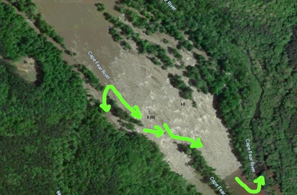
If you do not want to continue downstream and you do not want to try and attain, work river left of the island about 3/4 of the way through the rapids. On the far left after the rapids end, you can paddle up Buckhorn Creek. It is easiest to paddle till you reach the rapids on the creek and get out upstream left (river right on the creek) and follow the muddy trail back to the parking area by the dam. It is about a one mile hike. You can also use this trail to hike up to the rapids on the creek, which are fun if there is at least 100 cfs reading on the Buckhorn Creek gage at hwy 42.
Location

Current Conditions
5-Day Forecast
American Whitewater