Gauge Conditions
Runnable: ? – ? CFS
Approximate - nearest available gauge. Use as general reference only.
Data from American Whitewater & USGS
Description
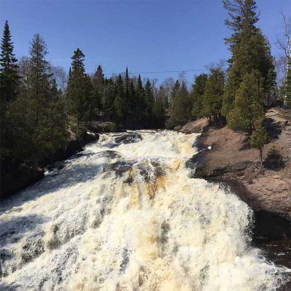
There are a couple of choices for your put-in. The easiest is if you park at the ski lodge, where you can carry/drag (or snow kayak?) down the ski slope to the river. Otherwise, our coordiantes are based upon driving about 1/4 mile up the road to park in a (maybe 3 or 4 vehicle sized) pull-off. You will bushwack about 125 yards downslope to the river to be rewarded with an incredible view upstream of a steep rock-filled cascade. (A bridge for SHT (Superior Hiking Trail) crosses at the head of this suicidal gradient.) Put in where meet the river (or as high up as you feel comfortable), to have a great rip-roaring class II technical start.
Location
Other Rapids on This Run (11)
View Full Run
Lutsen ski hill to golf course bridge above Hwy 61 (2.2 miles)
Poplar
II-IV+(V)
2.2 mi
Current Conditions
5-Day Forecast
Whitewater data from
American Whitewater
American Whitewater