Confluence W.Br.Red
Red - A) W.Town Hall Road to Morgan Rd. (3.8 miles) ** ACCESS ISSUES ** (WI)
Gauge Conditions
Description
AW does have a listing for this tributary, but (like the Upper Red above this point) it is 'off-limits'.
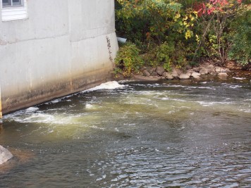
While the West Branch does have a few fine bits of gradient, but most are choked with wood (being a smaller stream). The best and final gradient on it lies about a mile upstream of this confluence.
From this point, to most any take-out point downstream, the vast majority of land surrounding the river is no longer Stockbridge-Munsee/Mohican reservation property. However, there are a few random disconnected bits of reservation land, and an assortment of (non-tribal) private properties, making anyplace other then our listed access largely off-limits.
Location
Other Rapids on This Run (12)
 Hazard
N/A
Hazard
N/A
 Waterfall
N/A
Waterfall
N/A
 Waterfall
IV
Waterfall
IV
 Rapid
III
Rapid
III
 Playspot
II
Playspot
II
Current Conditions
5-Day Forecast
American Whitewater