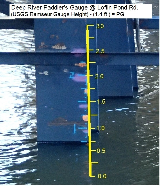
Gauge Conditions
Runnable: 1.2 – 4.5 FT
Can be a boney run. Only consider this range if flows peaked above this and are now holding. Common in summer.
Data from American Whitewater & USGS
Photo

Photo courtesy of American Whitewater
Description
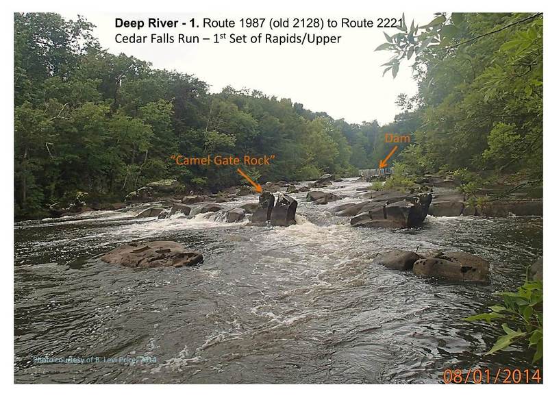
Dam #2 is an unmarked hazard located near the end of Franklin Drive that requires careful navigation due to potential underwater infrastructure or debris from the old dam site. Paddlers should scout carefully and be prepared for potential submerged obstacles or uneven riverbed conditions that could impact boat handling and safety.
Location
View Full Run
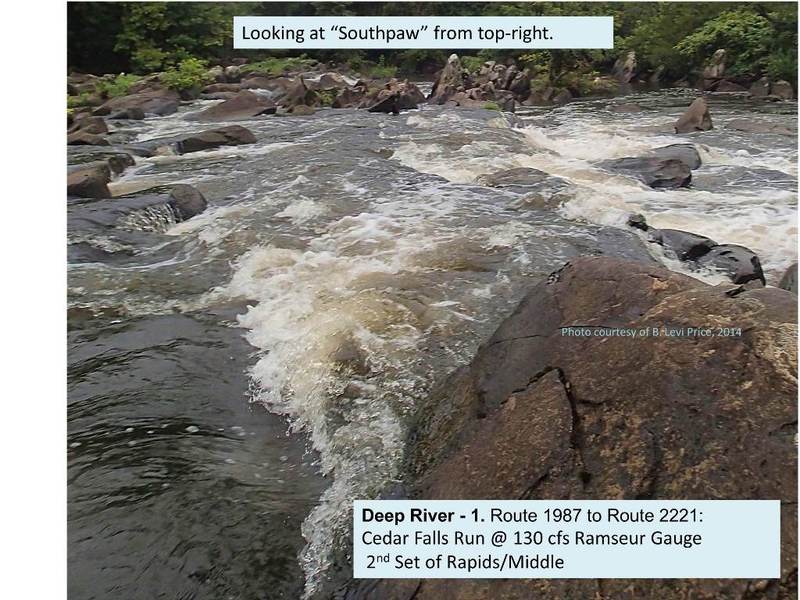
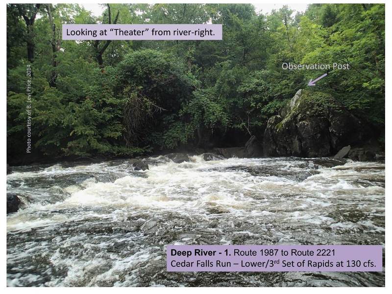
1. Route 1987 (Randleman) to Route 2221 (Cedar Falls)
Deep
I-II(III)
8.5 mi
Hazard — Exercise extreme caution. Portage recommended — scout before running.
Current Conditions
5-Day Forecast
Whitewater data from
American Whitewater
American Whitewater