How's Your
River
×
Explore
Explore Map
Water Bodies
Gauges
Access Sites
Tidal Stations
Whitewater
Pricing
Login
Sign Up
Hazard Warning:
Hazard information may be user-submitted and unverified. Conditions change frequently. Always scout rapids and obstacles yourself.
Whitewater
New Hampshire
Pemigewasset - 4) Woodstock–Campton
Map of the Mid Pemi region
Put-in
NH
Map of the Mid Pemi region
Pemigewasset - 4) Woodstock–Campton (NH)
Monitor this Rapid
Water Body
This Run
Map
Gauge
Weather
Directions
Gauge Conditions
Pemigewasset River at Woodstock, NH
Upstream
Primary
Runnable: 250.0 – 20,000.0 CFS
Data from
American Whitewater
&
USGS
Photo
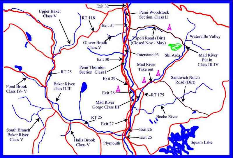
Photo courtesy of
American Whitewater
Location
Radar
Counties
Cell
Verizon
AT&T
T-Mobile
Dark
Satellite
Terrain
Type
Put-in
Mile Marker
0.0 mi
Directions
Navigate
View Full Run
4) Woodstock–Campton
Pemigewasset
I
11.4 mi
Current Conditions
5-Day Forecast
Whitewater data from
American Whitewater
Map of the Mid Pemi region