Put-in
NH
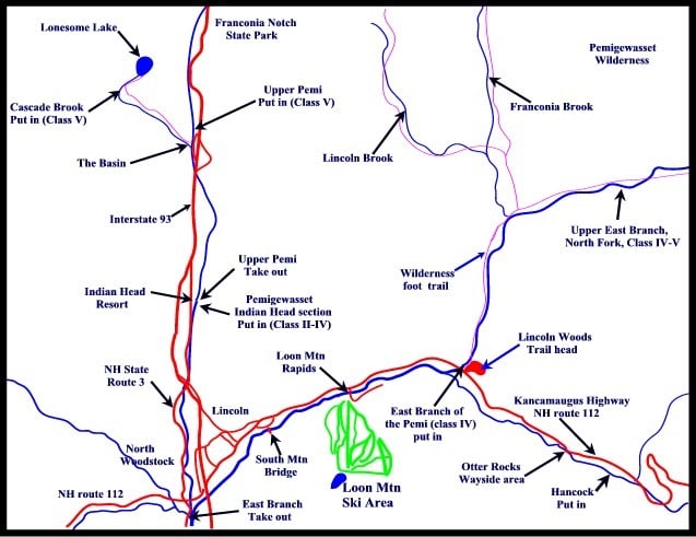
Map of the Upper Pemi region
Pemigewasset - 2) Indian Head–East Branch confluence (NH)
Gauge Conditions
Runnable: 4.5 – 10.0 FT
Upper limit for best boatability uncertain. Please help your fellow boaters with a comment or report.
Data from American Whitewater & USGS

View Full Run
2) Indian Head–East Branch confluence
Pemigewasset
II-IV
3.7 mi
Current Conditions
5-Day Forecast
Whitewater data from
American Whitewater
American Whitewater