Rapid
NH
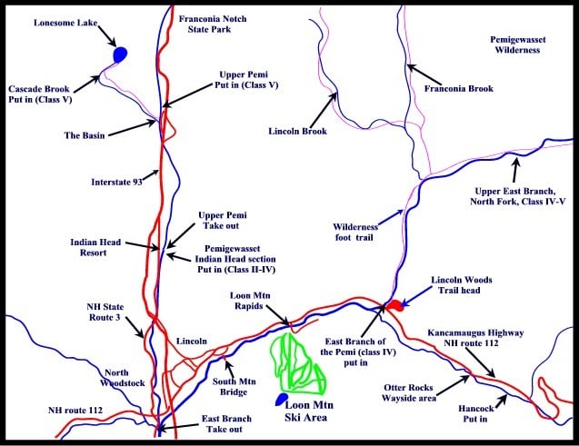
Map of the Upper Pemi region
Pemigewasset, Hancock Branch - Cheney Trail–East Branch Confluence (NH)
Gauge Conditions
Data from American Whitewater & USGS

View Full Run
Cheney Trail–East Branch Confluence
Pemigewasset, Hancock Branch
V
4.0 mi
Current Conditions
5-Day Forecast
Whitewater data from
American Whitewater
American Whitewater