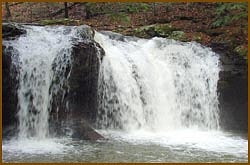
How's Your
River
×
Explore
Explore Map
Water Bodies
Gauges
Access Sites
Tidal Stations
Whitewater
Pricing
Login
Sign Up
Hazard Warning:
Hazard information may be user-submitted and unverified. Conditions change frequently. Always scout rapids and obstacles yourself.
Whitewater
Tennessee
Flat Fork, North Prong - Panther Branch & Emory Gap Branch Confluence to Parking Lot
Parking Lot
Hazard
TN
Class II
Parking Lot
Flat Fork, North Prong - Panther Branch & Emory Gap Branch Confluence to Parking Lot (TN)
Monitor this Rapid
Water Body
This Run
Map
Other Rapids
Gauge
Weather
Directions
Gauge Conditions
Emory River at Oakdale, TN
Downstream
Primary
Runnable: 50,000.0 – 100,000.0 CFS
Data from
American Whitewater
&
USGS
Photo
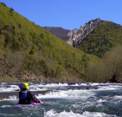
Photo courtesy of
American Whitewater
Description
This is the last parking lot at the end of the road in Frozen Head State Park. There's a concrete culvert that the creek flows through that you don't want to take your boat through. Make sure you know where the last eddy is located.
Location
Radar
Counties
Cell
Verizon
AT&T
T-Mobile
Dark
Satellite
Terrain
Other Rapids on This Run (2)
Rapid
II
Emory Gap Branch & Panther Branch Confluence
0.0 mi
Waterfall
IV
Debord Falls
0.3 mi
Type
Hazard
Difficulty
Class II
Mile Marker
0.9 mi
Directions
Navigate
View Full Run
Panther Branch & Emory Gap Branch Confluence to Parking Lot
Flat Fork, North Prong
II-III(IV)
0.8 mi
Hazard
— Exercise extreme caution in this area.
Current Conditions
5-Day Forecast
Whitewater data from
American Whitewater
Parking Lot