Gauge Conditions
Runnable: 500.0 – 10,000.0 CFS
Upper limit for best boatability uncertain. Please help your fellow boaters with a comment or report.
Data from American Whitewater & USGS
Photo
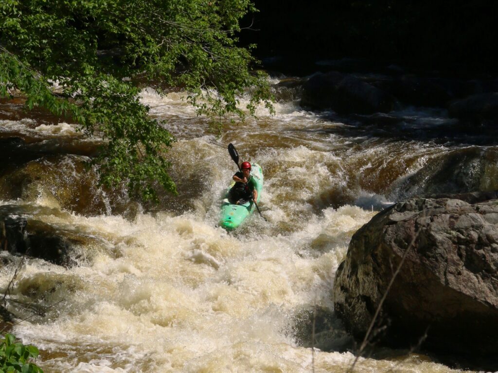
Photo courtesy of American Whitewater
Description
Put In rapid marks the start of the Lamoille River whitewater run, providing an initial gauge of river conditions and technical requirements. The entry point can vary significantly with water levels, potentially presenting submerged rocks or shifting channels that demand precise boat positioning and reading the water. Paddlers should scout the rapid carefully and be prepared for potential route adjustments depending on current flow and seasonal variations.
Location
Other Rapids on This Run (1)

View Full Run
1. Johnson to Jeffersonville
Lamoille
I-II
13.4 mi
Current Conditions
5-Day Forecast
Whitewater data from
American Whitewater
American Whitewater