Take-out
AZ
Take Out
Black, E. Fork - 01. Diamond Rock 6.0 mi to Buffalo Xing, 12 mi to Wildcat Point (AZ)
Gauge Conditions
Runnable: ? – ? CFS
Approximate - nearest available gauge. Use as general reference only.
Data from American Whitewater & USGS
Photo
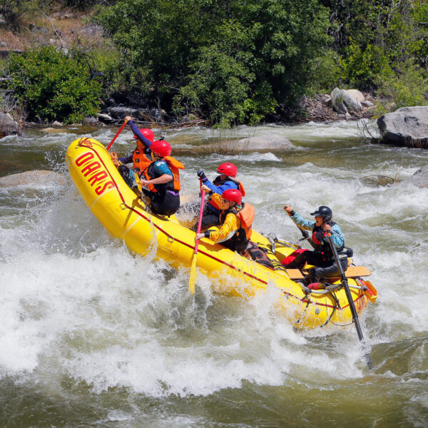
Photo courtesy of American Whitewater
Description
Take Out rapid offers a straightforward descent with minimal technical challenges at this section of the Black River's East Fork. While specifics are limited, paddlers should be prepared for potential submerged rocks and typical river conditions characteristic of the Diamond Rock to Buffalo Crossing segment. Standard river navigation skills and awareness of local water levels are recommended when approaching this location.
Location
Other Rapids on This Run (1)
View Full Run
01. Diamond Rock 6.0 mi to Buffalo Xing, 12 mi to Wildcat Point
Black, E. Fork
I
21.0 mi
Current Conditions
5-Day Forecast
Whitewater data from
American Whitewater
American Whitewater