Gauge Conditions
Runnable: ? – ? CFS
Approximate - nearest available gauge. Use as general reference only.
Data from American Whitewater & USGS
Photo
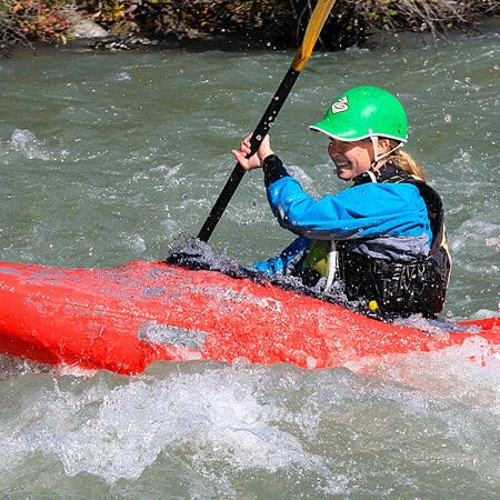
Photo courtesy of American Whitewater
Description
Take Out rapid marks the end of this river section, requiring careful navigation through a series of scattered boulders and potential undercut rocks near the bank. Paddlers should be prepared for potential shallow spots and stay alert for shifting lines during different water levels, particularly watching for hidden obstacles that could impede a clean exit from the rapid.
Location
Other Rapids on This Run (1)
View Full Run
01. Hades Campground to Rock Creek
Duchesne
I-III
35.3 mi
Current Conditions
5-Day Forecast
Whitewater data from
American Whitewater
American Whitewater