Gauge Conditions
Runnable: ? – ? CFS
Approximate - nearest available gauge. Use as general reference only.
Data from American Whitewater & USGS
CDEC Flow Data California
Data from California Data Exchange Center (CDEC)
Photo

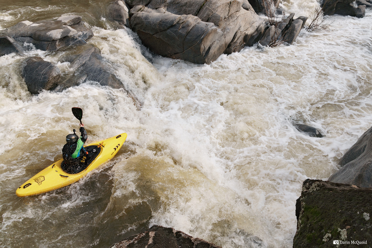
Photo courtesy of American Whitewater
Description
Take Out rapid marks the conclusion of the Fresno River's Goldside section, characterized by a complex boulder garden that demands precise boat placement and technical maneuvering. Paddlers must carefully navigate between large, closely spaced rocks and potential undercuts, with the line shifting significantly at different water levels and requiring constant route assessment.
Location
Other Rapids on This Run (1)
View Full Run
1) Goldside Drive, off Highway 49, to Road 600
Fresno
III-V
3.6 mi
Current Conditions
5-Day Forecast
Whitewater data from
American Whitewater
American Whitewater