Take-out
OK
Take Out
Mountain Fork - 1. Hwy 246/59 near Hatfield, AR to the Narrows (3 to 28 miles) (OK)
Gauge Conditions
Data from American Whitewater & USGS
Photo
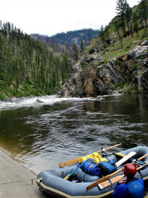
Photo courtesy of American Whitewater
Description
Take Out marks the end of the Mountain Fork River run, typically signaling the conclusion of a paddling trip near Hatfield, Arkansas. While specific details about this rapid's characteristics are limited, paddlers should be prepared for potential takeout challenges such as shallow water, rocky terrain, or limited access points that could complicate boat extraction and gear management.
Location
Other Rapids on This Run (2)
View Full Run
1. Hwy 246/59 near Hatfield, AR to the Narrows (3 to 28 miles)
Mountain Fork
I-II+(III)
28.0 mi
Current Conditions
5-Day Forecast
Whitewater data from
American Whitewater
American Whitewater