Gauge Conditions
Runnable: ? – ? CFS
Approximate - nearest available gauge. Use as general reference only.
Data from American Whitewater & USGS
Photo
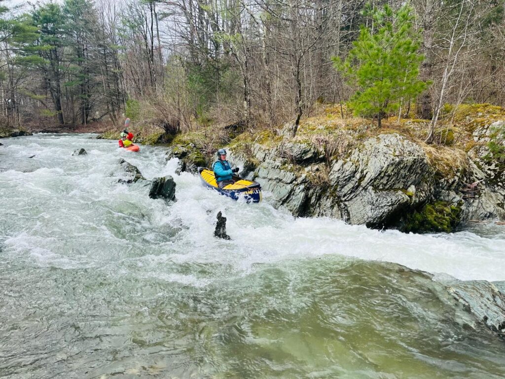
Photo courtesy of American Whitewater
Description
Take Out rapid on the Rock River presents an unmarked transition point with potential hazardous debris and tight maneuvering near the river's exit point. Paddlers should be prepared for potential shifting shoreline conditions and assess the best line carefully, maintaining situational awareness during the transition from river to takeout zone.
Location
Other Rapids on This Run (1)

View Full Run
1.) Upper
Rock
II-III
3.3 mi
Current Conditions
5-Day Forecast
Whitewater data from
American Whitewater
American Whitewater