Gauge Conditions
Runnable: 450.0 – 6,000.0 CFS
Flow range for best boatability uncertain. Please help your fellow boaters with a comment or report.
Data from American Whitewater & USGS
Description
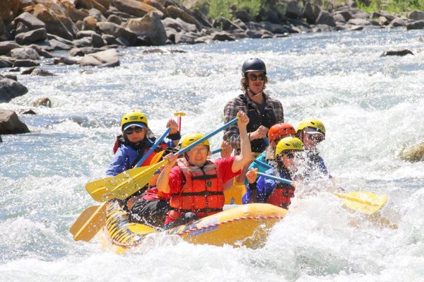
Take Out rapid marks the end of this river section, requiring careful navigation through a series of tight boulder gardens and potential ledge drops. Paddlers should be alert for submerged rocks and potential hydraulics, especially during higher water flows, and scout the rapid carefully to identify the cleanest line through the technical terrain.
Location
Other Rapids on This Run (1)
View Full Run
1. Yellowstone Nat. Park to W. Fork Gallatin
Gallatin River
I-II
21.1 mi
Current Conditions
5-Day Forecast
Whitewater data from
American Whitewater
American Whitewater