Gauge Conditions
Runnable: 400.0 – 2,400.0 CFS
Range for best boatability uncertain. Please help your fellow paddlers by providing a comment or report.
Data from American Whitewater & USGS
CDEC Flow Data California
Data from California Data Exchange Center (CDEC)
Description
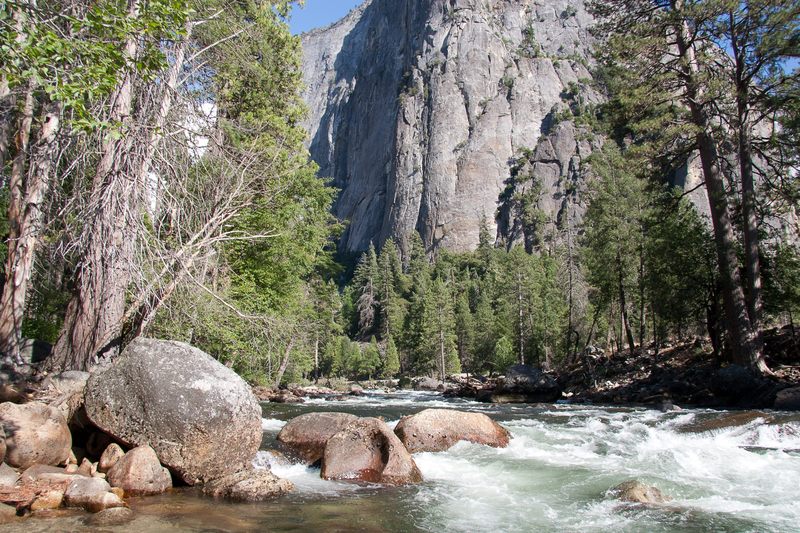
Take Out marks the end of a challenging stretch on the Merced, characterized by a narrow constriction that funnels water through a technical section with potential for undercut rocks and shifting hydraulics. Paddlers should scout carefully and be prepared for quick maneuvering, as the rapid's exit can be obstructed by debris and requires precise boat positioning to avoid potential hazards.
Location
Other Rapids on This Run (4)
View Full Run
2) El Cap Meadow to Highway 120 / 140 junction.
Merced
III-IV
3.3 mi
Current Conditions
5-Day Forecast
Whitewater data from
American Whitewater
American Whitewater