Gauge Conditions
Runnable: ? – ? CFS
Approximate - nearest available gauge. Use as general reference only.
Data from American Whitewater & USGS
Photo
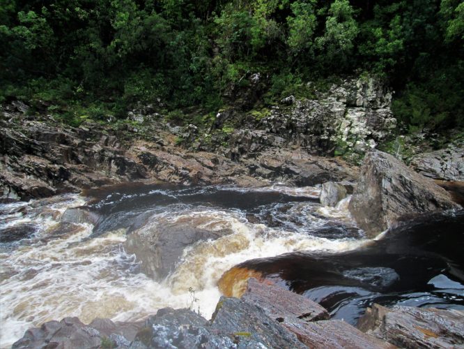
Photo courtesy of American Whitewater
Description
Take Out rapid marks the end of the Devil's Canyon run, requiring paddlers to navigate a technical exit from the river near Highway 215. The rapid features a complex approach with potential shallow rock formations and varying water levels that demand precise maneuvering. Paddlers should scout carefully and be prepared for potential boat-scouring obstacles during lower water conditions.
Location
Other Rapids on This Run (1)

View Full Run
Devil's Canyon to Hwy 215 (5.2 miles)
Mill Creek (Franklin Co.)
III+
5.2 mi
Current Conditions
5-Day Forecast
Whitewater data from
American Whitewater
American Whitewater