Take-out
TN
Take Out
Lower Cane Creek - Hwy 30 to Hickory Valley Road (or Owl Hole down when low) (TN)
Gauge Conditions
Runnable: ? – ? CFS
Approximate - nearest available gauge. Use as general reference only.
Data from American Whitewater & USGS
Photo
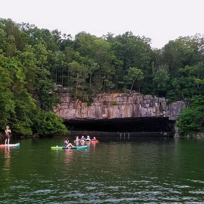
Photo courtesy of American Whitewater
Description
Take Out rapid marks the end of the Lower Cane Creek run, typically signaling the takeout point for paddlers. At certain water levels, the rapid can feature a mix of rocks and potential hydraulics, requiring careful boat positioning and line selection to navigate safely.
Location
Other Rapids on This Run (1)
View Full Run
Hwy 30 to Hickory Valley Road (or Owl Hole down when low)
Lower Cane Creek
I-II
7.3 mi
Current Conditions
5-Day Forecast
Whitewater data from
American Whitewater
American Whitewater