Take-out
VA
Take Out
Stony Creek (New trib.) - Jefferson National Forest (Route 635) to New R. (Route 684) (VA)
Gauge Conditions
Runnable: ? – ? CFS
Approximate - nearest available gauge. Use as general reference only.
Data from American Whitewater & USGS
Photo
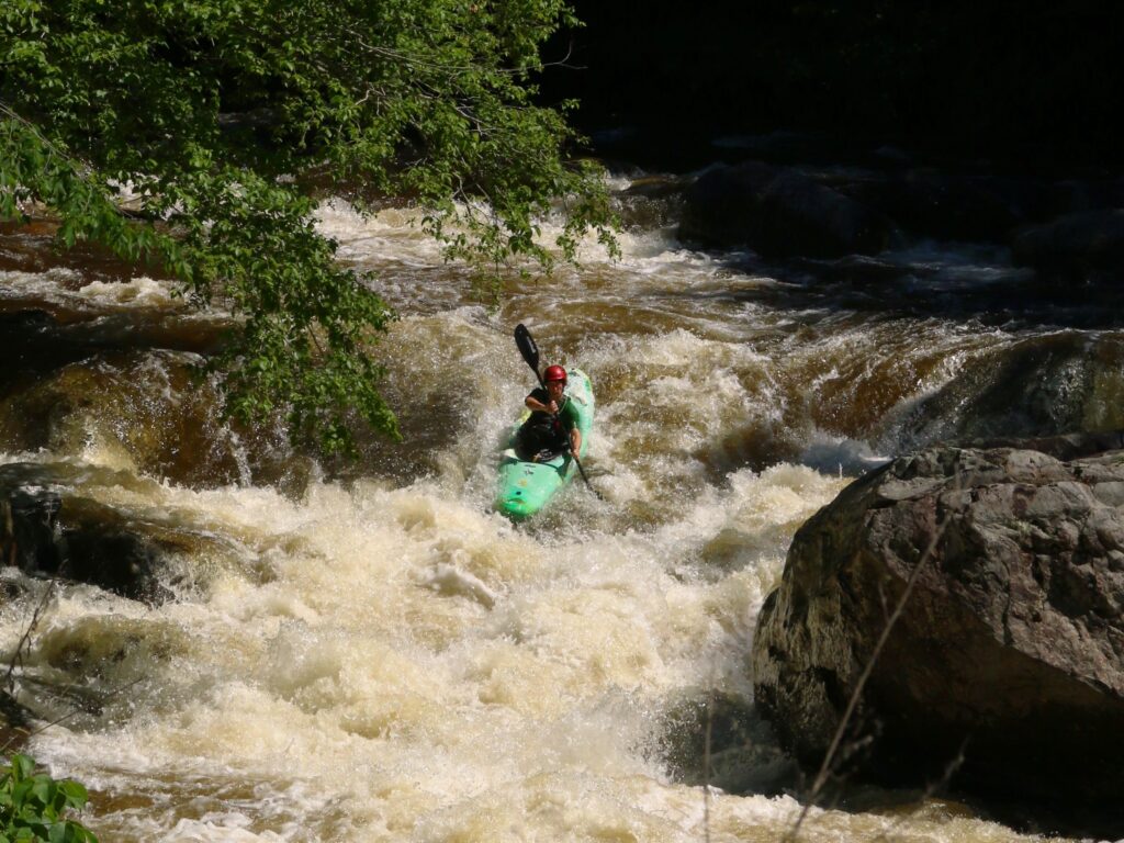
Photo courtesy of American Whitewater
Description
Take Out rapid marks the end of the Stony Creek run, presenting a complex exit point with multiple potential channel routes through scattered rock gardens. Paddlers should carefully scout the rapid, as the varied riverbed demands precise navigation and potential portage routes exist along the banks. While not exceptionally technical, the rapid requires attentive route selection to avoid pin hazards and potential boat damage.
Location
Other Rapids on This Run (1)
View Full Run
Jefferson National Forest (Route 635) to New R. (Route 684)
Stony Creek (New trib.)
III-V
6.9 mi
Current Conditions
5-Day Forecast
Whitewater data from
American Whitewater
American Whitewater