Gauge Conditions
Runnable: ? – ? CFS
Approximate - nearest available gauge. Use as general reference only.
Data from American Whitewater & USGS
Photo
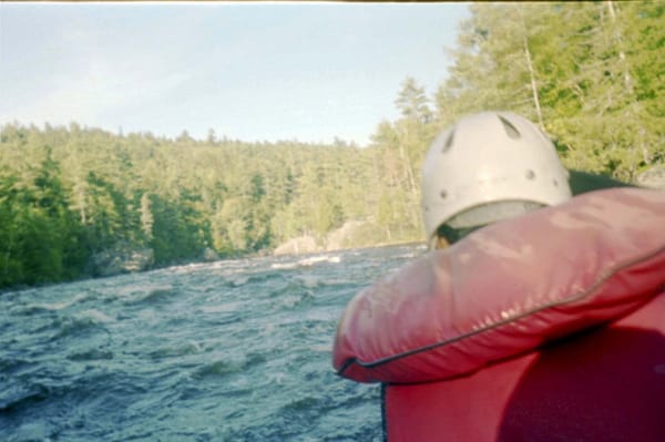
Photo courtesy of American Whitewater
Description
Take Out rapid marks the transition from Lower Sabao Lake to the Machias River, serving as a critical navigation point for paddlers. While specific difficulty details are unclear, the rapid likely presents technical challenges related to water flow, potential obstacles, and transition characteristics typical of lake-to-river passages. Paddlers should carefully assess current conditions and potential hazards before proceeding through this section.
Location
Other Rapids on This Run (1)

View Full Run
Lower Sabao Lake to Machias R.
Machias, W. Branch
I-III
11.6 mi
Current Conditions
5-Day Forecast
Whitewater data from
American Whitewater
American Whitewater