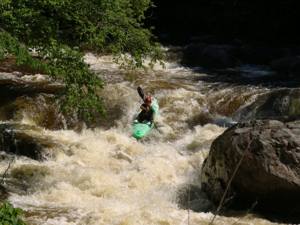
Take-out
WV
Take Out
Muddy Creek (Greenbrier trib.) - Mill Creek Confluence near Blaker Mills to Greenbrier River confluence near Alderson (WV)
Gauge Conditions
Runnable: ? – ? CFS
Approximate - nearest available gauge. Use as general reference only.
Data from American Whitewater & USGS
Photo

Photo courtesy of American Whitewater
Description
Take Out rapid marks the end of the Mill Creek section, characterized by a tight constriction between boulder-strewn banks that funnels flow into a complex series of ledge drops. Paddlers should be alert for potential pin hazards and shifting underwater rocks, with the primary line requiring precise boat positioning and careful momentum management through the final descent to the Greenbrier River confluence.
Location
Other Rapids on This Run (1)
View Full Run
Mill Creek Confluence near Blaker Mills to Greenbrier River confluence near Alderson
Muddy Creek (Greenbrier trib.)
I-II
5.8 mi
Current Conditions
5-Day Forecast
Whitewater data from
American Whitewater
American Whitewater