Gauge Conditions
Runnable: 250.0 – 1,000.0 CFS
Likely under 50 cfs. Likely too low for any real whitewater.
Data from American Whitewater & USGS
Photo

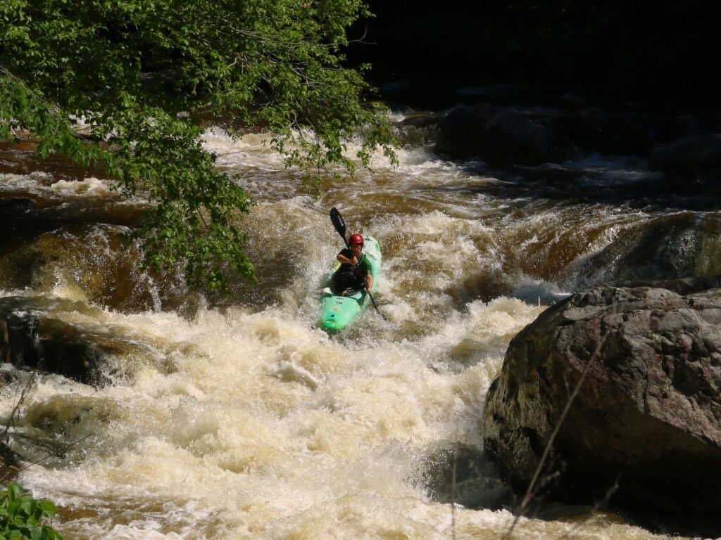
Photo courtesy of American Whitewater
Description
Take Out rapid marks the end of the Roxbury Creek run, featuring a complex boulder garden that demands precise navigation through tight channels and potential pin hazards. Paddlers should carefully scout the rapid from river left, identifying the clearest line between large, partially submerged rocks and watching for potential undercut formations that could trap boats or swimmers.
Location
Other Rapids on This Run (2)
View Full Run
Roxbury to Hwy.78 (2-3 miles)
Roxbury Creek
I-II
2.2 mi
Current Conditions
5-Day Forecast
Whitewater data from
American Whitewater
American Whitewater