How's Your
River
×
Explore
Explore Map
Water Bodies
Gauges
Access Sites
Tidal Stations
Whitewater
Pricing
Login
Sign Up
Hazard Warning:
Hazard information may be user-submitted and unverified. Conditions change frequently. Always scout rapids and obstacles yourself.
Whitewater
New Jersey
West Brook - Snake Den Rd. to Magee Rd.
Take Out
Take-out
NJ
Take Out
West Brook - Snake Den Rd. to Magee Rd. (NJ)
Monitor this Rapid
Water Body
This Run
Map
Other Rapids
Gauge
Weather
Directions
Gauge Conditions
West Brook near Wanaque NJ
Downstream
Primary
Runnable: 300.0 – 1,000.0 CFS
Data from
American Whitewater
&
USGS
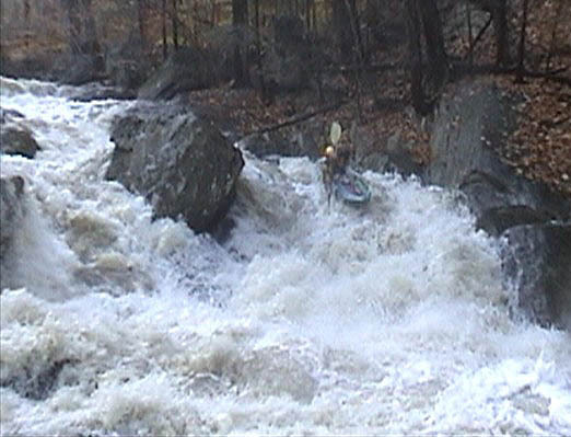
Description
Take out where Magee Rd. crosses the creek.
Location
Radar
Counties
Cell
Verizon
AT&T
T-Mobile
Dark
Satellite
Terrain
Other Rapids on This Run (4)
Rapid
N/A
Put In
0.0 mi
Rapid
III+
Michael's Monkey
0.7 mi
Rapid
IV
Happy Ricky
0.9 mi
Rapid
V
The Lizzy Monster
1.1 mi
Type
Take-out
Difficulty
Class N/A
Mile Marker
2.2 mi
Directions
Navigate
View Full Run
Snake Den Rd. to Magee Rd.
West Brook
IV-V
2.2 mi
Current Conditions
5-Day Forecast
Whitewater data from
American Whitewater
Take Out