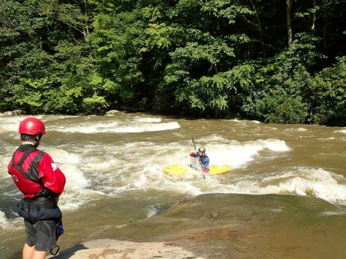
24,753
Total Features
21,352
Rapids
855
Waterfalls
927
Playspots
1,513
Hazards
106
Portages

Click a category above to filter the map and list

Loading...

Map Legend

Rapids
Waterfalls
Playspots
Hazards
Portages
Rivers

Wisconsin 28 features

Marked rapids #2

Marked rapids #2

Yellow (Chippewa trib) - A) Yellow River Road to CTH.M (9.7 miles)
Rapid N/A

Marked rapids #3

Yellow (Chippewa trib) - A) Yellow River Road to CTH.M (9.7 miles)
Rapid N/A

Marked rapids #4

Yellow (Chippewa trib) - A) Yellow River Road to CTH.M (9.7 miles)
Rapid N/A
Marked rapids #5

Marked rapids #5

Yellow (Chippewa trib) - A) Yellow River Road to CTH.M (9.7 miles)
Rapid N/A
Marked rapids #6

Marked rapids #6

Yellow (Chippewa trib) - A) Yellow River Road to CTH.M (9.7 miles)
Rapid N/A
Marked rapids #7

Marked rapids #7

Yellow (Chippewa trib) - A) Yellow River Road to CTH.M (9.7 miles)
Rapid N/A
Polley Lane

Polley Lane

Yellow (Chippewa trib) - C) CTH.B in Gilman to CTH.H (Mattes Bridge) (up to 8.83 miles)
Rapid N/A

Powerlines

Yellow (Chippewa trib) - C) CTH.B in Gilman to CTH.H (Mattes Bridge) (up to 8.83 miles)
Rapid N/A
Put In

Put In

Yellow (Chippewa trib) - B) Below Miller Dam to CTH.B in Gilman (7.75 miles)
Rapid N/A
Put In

Put In

Yellow (Chippewa trib) - D) Cadott (PnP)
Rapid N/A

Put-in on N.Fk.Yellow (Drainage is 46.5 sq.mi.)

Yellow (Chippewa trib) - A) Yellow River Road to CTH.M (9.7 miles)
Rapid N/A
River Road

River Road

Yellow (Chippewa trib) - C) CTH.B in Gilman to CTH.H (Mattes Bridge) (up to 8.83 miles)
Rapid N/A

Road 1403

Yellow (Chippewa trib) - B) Below Miller Dam to CTH.B in Gilman (7.75 miles)
Rapid N/A
Take Out

Take Out

Yellow (Chippewa trib) - B) Below Miller Dam to CTH.B in Gilman (7.75 miles)
Rapid N/A
Take Out

Take Out

Yellow (Chippewa trib) - D) Cadott (PnP)
Rapid N/A
Take Out

Take Out

Yellow (Chippewa trib) - C) CTH.B in Gilman to CTH.H (Mattes Bridge) (up to 8.83 miles)
Rapid N/A
Take Out

Take Out

Yellow (Chippewa trib) - A) Yellow River Road to CTH.M (9.7 miles)
Rapid N/A
CTH.C

CTH.C

Yellow (Wisconsin R. trib) - CTH.N to CTH.A (Little Bull Falls) (up to 7 miles)
Rapid N/A
Dells

Dells

Yellow (Wisconsin R. trib) - CTH.N to CTH.A (Little Bull Falls) (up to 7 miles)
Rapid N/A
Jenny Falls

Jenny Falls

Yellow (Wisconsin R. trib) - CTH.N to CTH.A (Little Bull Falls) (up to 7 miles)
Rapid N/A
Little Bull Falls

Little Bull Falls

Yellow (Wisconsin R. trib) - CTH.N to CTH.A (Little Bull Falls) (up to 7 miles)
Rapid N/A
Lower North Wood County Park Dam

Lower North Wood County Park Dam

Yellow (Wisconsin R. trib) - CTH.N to CTH.A (Little Bull Falls) (up to 7 miles)
Hazard N/A
North Wood County Park (Northern Boundary)

North Wood County Park (Northern Boundary)

Yellow (Wisconsin R. trib) - CTH.N to CTH.A (Little Bull Falls) (up to 7 miles)
Rapid N/A
Park Road

Park Road

Yellow (Wisconsin R. trib) - CTH.N to CTH.A (Little Bull Falls) (up to 7 miles)
Hazard N/A
Put In

Put In

Yellow (Wisconsin R. trib) - CTH.N to CTH.A (Little Bull Falls) (up to 7 miles)
Rapid N/A
Take Out

Take Out

Yellow (Wisconsin R. trib) - CTH.N to CTH.A (Little Bull Falls) (up to 7 miles)
Rapid N/A
Upper North Wood County Park Dam

Upper North Wood County Park Dam

Yellow (Wisconsin R. trib) - CTH.N to CTH.A (Little Bull Falls) (up to 7 miles)
Hazard N/A

Upstream Entrance Drop

Yellow (Wisconsin R. trib) - CTH.N to CTH.A (Little Bull Falls) (up to 7 miles)
Rapid N/A

West Virginia 20 features

Put In

Put In

Abram Creek - US 50 Bridge to the confluence of the North Branch of the Potomac River
Rapid N/A
Take Out

Take Out

Abram Creek - US 50 Bridge to the confluence of the North Branch of the Potomac River
Rapid N/A
Put In

Put In

Anglins Creek - CR 17/2 bridge to confluence of Meadow River
Rapid N/A
Take Out

Take Out

Anglins Creek - CR 17/2 bridge to confluence of Meadow River
Rapid N/A
Put In

Put In

Anthony Creek - 1. Neola to the Blue Bend Recreation Area
Rapid N/A
Put In

Put In

Anthony Creek - 2. Blue Bend Recreation Area to the confluence of the Greenbrier River at Anthony
Rapid N/A
Take Out

Take Out

Anthony Creek - 2. Blue Bend Recreation Area to the confluence of the Greenbrier River at Anthony
Rapid N/A
Take Out

Take Out

Anthony Creek - 1. Neola to the Blue Bend Recreation Area
Rapid N/A
Put In

Put In

Arbuckle Creek - Oak Hill to New
Rapid N/A
Take Out

Take Out

Arbuckle Creek - Oak Hill to New
Rapid N/A
Put In

Put In

Armstrong Creek - Powellton to Kimberly
Rapid N/A
Take Out

Take Out

Armstrong Creek - Powellton to Kimberly
Rapid N/A
Put In

Put In

Armstrong Creek, Powellton Fork - McDunn to Powellton
Rapid N/A
Take Out

Take Out

Armstrong Creek, Powellton Fork - McDunn to Powellton
Rapid N/A
Put In

Put In

Back Creek (Potomac trib.) - 5. WV 9 to McCoy's Ferry
Rapid N/A
Put-in  - Swinging Bridge Rd.

Put-in - Swinging Bridge Rd.

Back Creek (Potomac trib.) - 4. Swinging Bridge Rd. to WV 9
Rapid N/A
Take Out

Take Out

Back Creek (Potomac trib.) - 5. WV 9 to McCoy's Ferry
Rapid N/A
Take-out - WV Rt. 9 near Hedgesville

Take-out - WV Rt. 9 near Hedgesville

Back Creek (Potomac trib.) - 4. Swinging Bridge Rd. to WV 9
Rapid N/A
Put In

Put In

Beaver Creek (Blackwater trib.) - Old WV 93 about 7 road miles above WV 93/Corridor H bridge above Davis to WV 93/Corridor H bridge above Davis
Rapid N/A
Take Out

Take Out

Beaver Creek (Blackwater trib.) - Old WV 93 about 7 road miles above WV 93/Corridor H bridge above Davis to WV 93/Corridor H bridge above Davis
Rapid N/A
« Prev1...489490491492493...516Next »