Take-out
MO
Take Out
Lower Rock Creek - Barren Hollow (south of Highway D) to Highway E (3 miles) (MO)
Gauge Conditions
Runnable: 4.5 – 12.0 FT
Help us out! Add a comment about runnable levels!
Data from American Whitewater & USGS
Photo
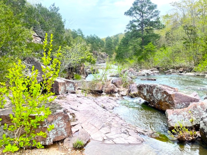
Photo courtesy of American Whitewater
Description
Take Out rapid marks the end of this section, characterized by a narrow constriction that concentrates flow and creates potential for pinning hazards near the river's right bank. Paddlers should be prepared for potential submerged rocks and a quickening current as the river approaches the Highway E takeout, maintaining a line that avoids the right bank obstruction.
Location
Other Rapids on This Run (1)
View Full Run
Barren Hollow (south of Highway D) to Highway E (3 miles)
Lower Rock Creek
IV
3.2 mi
Current Conditions
5-Day Forecast
Whitewater data from
American Whitewater
American Whitewater