Gauge Conditions
Runnable: 3,000.0 – 8,000.0 CFS
Can be run much higher by class V boaters
Data from American Whitewater & USGS
Photo
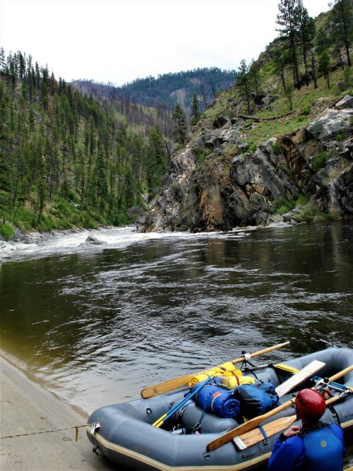
Photo courtesy of American Whitewater
Description
Take Out rapid marks the end of the South Fork Siletz run, located near the confluence with the main stem. Limited beta exists for this specific rapid, suggesting it may be less frequently run or documented compared to other sections of the river. Paddlers should scout thoroughly and be prepared for potential unseen hazards or changing conditions given the limited information available.
Location
Other Rapids on This Run (1)

View Full Run
Valsetz Dam Site to Confluence
Siletz, South Fork
III-IV
4.4 mi
Current Conditions
5-Day Forecast
Whitewater data from
American Whitewater
American Whitewater