How's Your
River
×
Explore
Explore Map
Water Bodies
Gauges
Access Sites
Tidal Stations
Whitewater
Pricing
Login
Sign Up
Hazard Warning:
Hazard information may be user-submitted and unverified. Conditions change frequently. Always scout rapids and obstacles yourself.
Whitewater
Maine
Sandy - 1) Smalls Falls
Top Drop
Waterfall
ME
Class V
Top Drop
Sandy - 1) Smalls Falls (ME)
Monitor this Rapid
Water Body
This Run
Map
Other Rapids
Gauge
Weather
Directions
Gauge Conditions
Sandy River near Madrid, Maine
Downstream
Primary
Runnable: 140.0 – 600.0 CFS
Data from
American Whitewater
&
USGS
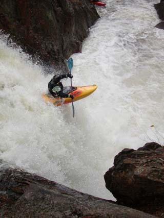
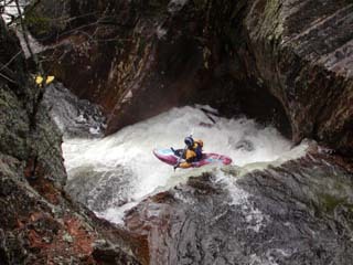
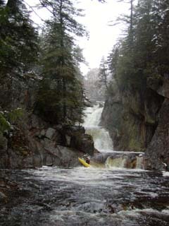
Photo
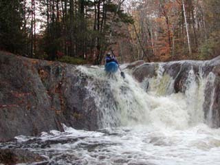
Photo courtesy of
American Whitewater
Description
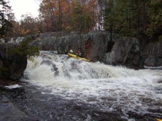
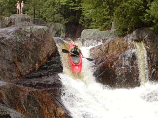
This is the hardest drop at Smalls. Paddlers often put in below this drop, especially when the water is low. Higher water opens up a great boof on the right.
Location
Radar
Counties
Cell
Verizon
AT&T
T-Mobile
Dark
Satellite
Terrain
Other Rapids on This Run (7)
Rapid
N/A
Put In
0.0 mi
Waterfall
IV+
Slideways (2nd drop)
0.0 mi
Waterfall
V
Down & Out (3rd drop)
0.0 mi
Waterfall
V
Biggie Smalls (4th drop)
0.0 mi
Waterfall
V
5th drop
0.1 mi
Waterfall
IV+
Last Drop
0.1 mi
Rapid
N/A
Take Out
0.1 mi
Type
Waterfall
Difficulty
Class V
Mile Marker
0.0 mi
Directions
Navigate
View Full Run
1) Smalls Falls
Sandy
V
0.1 mi
Current Conditions
5-Day Forecast
Whitewater data from
American Whitewater
Top Drop