01. Keno Dam to Pioneer Park West or Moonshine Falls
Linked via: Unknown Synced 6mo ago
Gauge Conditions
Data from American Whitewater & USGS
Run Map
Run Time Estimate
Select put-in and take-out to estimate time.
Unlock Advanced Trip Planning
See wind-adjusted speed maps, forecast planning, and detailed time estimates.
Sign in to generate an AI timing estimate for this run.
Whitewater timing varies with scouting, portages, and group pace. Use as a planning baseline.
Description
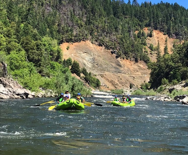
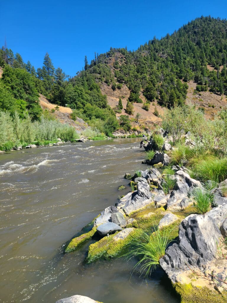
The Keno Run on the Klamath River offers Class II/III whitewater, diverse high desert forest scenery, and excellent opportunities for fishing and bird watching. The upper five miles of the run are mostly remote, except for the Keno Dam and a transmission line crossing. Below this, the river now flows freely where the J.C. Boyle Reservoir once inundated the river. Paddlers can take out at Pioneer Park West (just below Highway 66) or extend the trip by almost two miles to the just below the site of the former J.C. Boyle Dam, which includes one Class III and one Class IV- rapid.
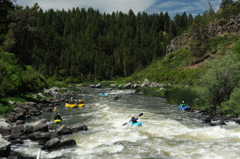
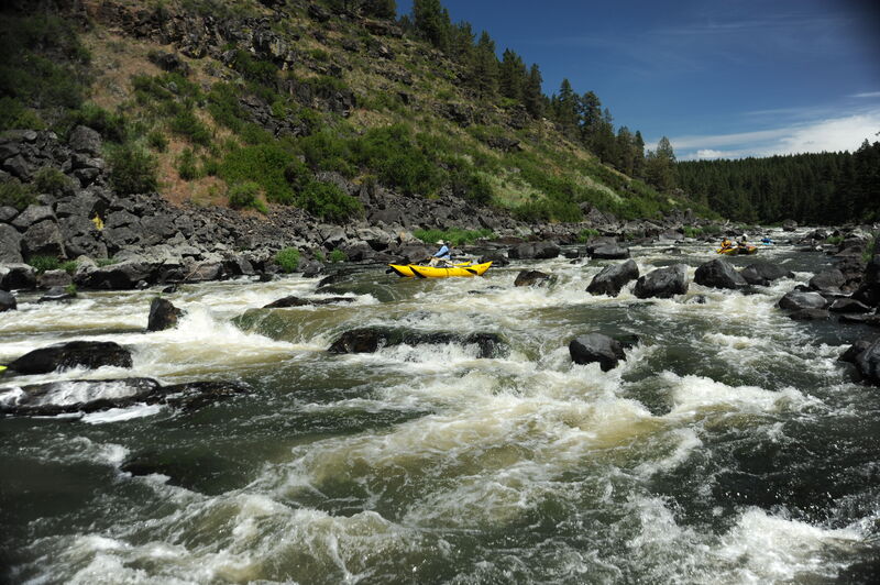
Keno Canyon Section: Keno Dam to Former Reservoir Footprint
The run begins at the base of Keno Dam, accessible year-round on river right via Old Wagon Road. This road is heavily rutted and requires a high-clearance vehicle. PacifiCorp’s four downstream dams were removed in 2024 but Keno Dam remains and is now under the management of the U.S. Bureau of Reclamation.
For about five miles, the river features continuous whitewater with notable rapids in a distinct but shallow canyon. Rapids include the Keno Wave and Meatball, a more challenging rapid near the end of this section.
Former J.C. Boyle Reservoir Section: Upstream of Pioneer Park West
The breach of J.C. Boyle Dam on January 16, 2024, quickly drained the reservoir and extended the free-flowing reach of the Keno Run. After Meatball, the river flows thorugh the former reservoir footprint, becoming low-gradient for two miles before reaching Pioneer Park West. This access point, located just downstream of Highway 66 on river right, will reopen as a river access facility in spring 2025. Until then, paddlers can take out at the Highway 66 bridge within the right-of-way. Continuing past Pioneer Park West to the Moonshine Falls River Access 1.5 miles downstream, increases the challenge of the run by adding one Class III and one Class IV- rapid, Moonshine Falls, which may not be easily navigable by rafts at lower flows. Unless seeking this adventure, it is best to take out at Pioneer Park West.
Pioneer Park West is open year-round, but the access road is not maintained in winter and may be impassable or temporarily closed due to weather. Nature ultimately dictates access—please use good judgment and avoid attempting the access road drive in unsafe conditions. When snow makes Pioneer Park unreachable, boaters typically use the HIghway 66 bridge right-of-way to access the river; be aware of traffic hazards if doing so.
Former J.C. Boyle Reservoir Section: Pioneer Park West to Moonshine Falls
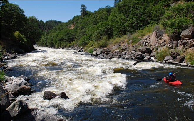
The river below Pioneer Park West is gentle for a mile, with occasional riffles leading to the former J.C. Boyle Dam site. The dam site is marked by a perfectly graded slope on river left that will gradually re-vegetate. A sharp right bend signals the fast approach to Upper Moonshine Falls (III), a significant and constantly evolving rapid worth scouting from river left. Downstream, Moonshine Falls (IV-) is a narrow, technical rapid on a leftward bend. At low flows, rafts may have difficulty navigating the rapid and there are rocks and brush that provide pin potential for all crafts.
The Moonshine Falls River Access, located on river right below the falls and timber bridge, opened to the public on August 1, 2025. It features a steep stairway with a raft slide the drops directly into the water (better suited for getting rafts into the river than for exiting the river), parking, restrooms, and other amenities. American Whitewater successfully advocated for this access as part of the dam removal project. It is expected to primarily serve as the put-in for the Big Bend Run (IV+).
Logistics
*Put-in Access (Keno Dam)*
Currently, the only put-in access at Keno Dam is on river right via Old Wagon Road, which is rough and requires a high-clearance vehicle.
Historically, paddlers accessed Keno Dam on river left via the Keno Recreation Area (Keno Camp), which was managed by PacifiCorp. However, this area is now closed with no plans to reopen. The access road is gated near Highway 66, but paddlers can hike in with kayaks. Future management of the site remains unclear following the transfer of Keno Dam to the Bureau of Reclamation in 2024. American Whitewater is advocating that the recreation area be reopened to the public.
*Take-out Options*
1. Pioneer Park West (Highway 66): The most common take-out point, located just below the Highway 66 bridge on river right. It is open as a day-use site, 7 am to 7 pm. Continuing past here adds two Class IV- rapids to the run.
2. Moonshine Falls River Access: Beginning August 1, 2025, boaters can take out below the timber bridge after Moonshine Falls. This access include stairs to the river, a raft slide, parking, restrooms, and other amenities. It is accessed via a dirt road off Highway 66, about 1.6 miles west of the Klamath River bridge. It is open as a day-use site, 7 am to 7 pm.

Difficulty
Class III
Length
8.8 mi
Gradient
50 ft/mi
Rapids
6
Access Points
Difficulty Classes
I Easy
II Novice
III Intermediate
IV Advanced
V Expert/Extreme
VI Unrunnable
Current Conditions
5-Day Forecast
Whitewater data from
American Whitewater
American Whitewater