05. Access 1 to K’utárawáx·u (Grizzly Hill) Access
Linked via: Unknown Synced 6mo ago
Gauge Conditions
Runnable: 600.0 – 5,000.0 CFS
Estimated range of boatable flow
Data from American Whitewater & USGS
Run Map
Description
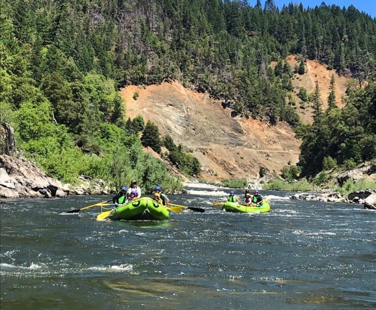
The six-mile K’íka·c’é·ki Valley Run features easy whitewater, continuous current, and a meandering channel, making it suitable for less experienced boaters or those seeking a relaxed whitewater trip. The river is incised into the valley floor, and floating it provides a fascinating look into a landscape that was submerged for over a century by Copco Reservoir. K’íka·c’é·ki is the Shasta language place name for the greater landscape of this area, pronounced phonetically as K’-EE-kah-ts’EH-kee.
K’íka·c’é·ki Valley
The six-mile K’íka·c’é·ki Valley Run is the gentlest section of the undammed Upper Klamath River—thanks, ironically, to a natural dam formed by lava flows between 140,000 and 10,000 years ago in the present day location of K’íka·c’é·ki Canyon. This lava dam created a five-mile-long lake that eventually filled with gravel and clay eroded from the Cascade Range upstream. The river eventually cut through the lava dam, draining the lake (sometimes referred to as Clammittee Lake) and leaving behind a flat valley floor which the river incised with a meandering channel. This fertile valley supported vibrant Indigenous communities and, later, settler farms. Downstream, the river has now cut through lava to form the vertical-walled K’íka·c’é·ki Canyon.
Human Damming of Klamath River
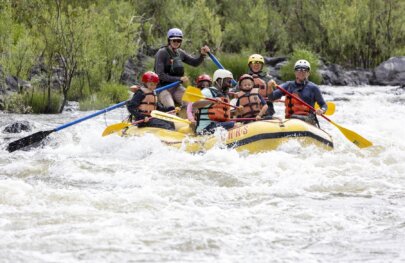
The narrows of K’íka·c’é·ki Canyon were the Klamath's most obvious hydropower dam site, but it wouldn't prove easy to construct a dam in the canyon. After six years of challenging construction and financial turbulence, the California Oregon Power Company completed of Copco 1 Dam in late 1917. The dam displaced Shasta Indian families, flooded cultural sites, and drown settlers' ranches and orchards. For over a century, Copco Reservoir covered this beautiful valley, replacing its fertile landscape with stagnant waters that fostered toxic algae blooms. These blooms forced summer swimming closures and led to health warnings on the Klamath as far as 190 miles downstream--all the way to the Pacific Ocean.
On January 23, 2024, Copco 1 Dam was breached with 800 pounds of explosives, allowing the river to flow freely for the first time since 1912 when its construction began. The dam was fully removed by September 2024, and salmon migrated upstream past the site in October, some going as far as Spencer Creek in Oregon, upstream of all four of the Klamath's now-removed hydropower dams.
A Valley Restored
The draining of Copco Reservoir revealed a unique, meandering stretch of the Klamath River with continuous current, easy rapids, and a scenic floodplain—a perfect day trip for less experienced boaters or those seeking a leisurely float. The river is incised into the valley floor, winding around diatomaceous bluffs and alluvial banks. Grassy slopes rise up the valley's flanks to meet a rim of basalt cliffs. As vegetation returns to the valley floor with the assistance of a massive restortion effort, wildlife will flourish across 1,000 acres of newly restored bottomlands, a type of landscape that is rarely preserved as open space. Ironically, the flooding of this reach of the Klamath in 1918 protected it from being straightened and channelized as most meandering rivers in California were in the 1900s.
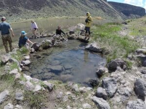
In August 2025, the K’utárawáx·u (Grizzly Hill) Access opened, providing an essential take-out above K’íka·c’é·ki Canyon for those wishing to avoid the Class IV rapids downstream. American Whitewater helped secure $3.5 million to fund this and other access projects on the undammed Klamath.
Rapids in this Run (3)

Hazards & Portages (1)
Caution: The following locations may require scouting or portaging. Always check current conditions.
Difficulty
Class II
Length
6.4 mi
Rapids
3
1 Hazard
Access Points
Difficulty Classes
I Easy
II Novice
III Intermediate
IV Advanced
V Expert/Extreme
VI Unrunnable
Current Conditions
5-Day Forecast
Whitewater data from
American Whitewater
American Whitewater