1 - Index (Sunset Falls) to Split Rock
Linked via: Nhdplus discovery 90% confidence Synced 6mo ago
Gauge Conditions
Runnable: 700.0 – 20,000.0 CFS
Data from American Whitewater & USGS
Run Map
Run Time Estimate
Select put-in and take-out to estimate time.
Unlock Advanced Trip Planning
See wind-adjusted speed maps, forecast planning, and detailed time estimates.
Sign in to generate an AI timing estimate for this run.
Whitewater timing varies with scouting, portages, and group pace. Use as a planning baseline.
Description
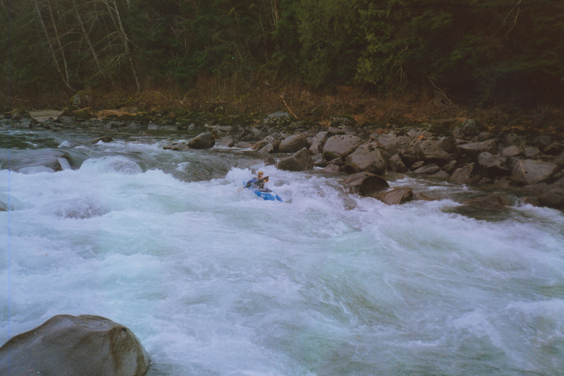
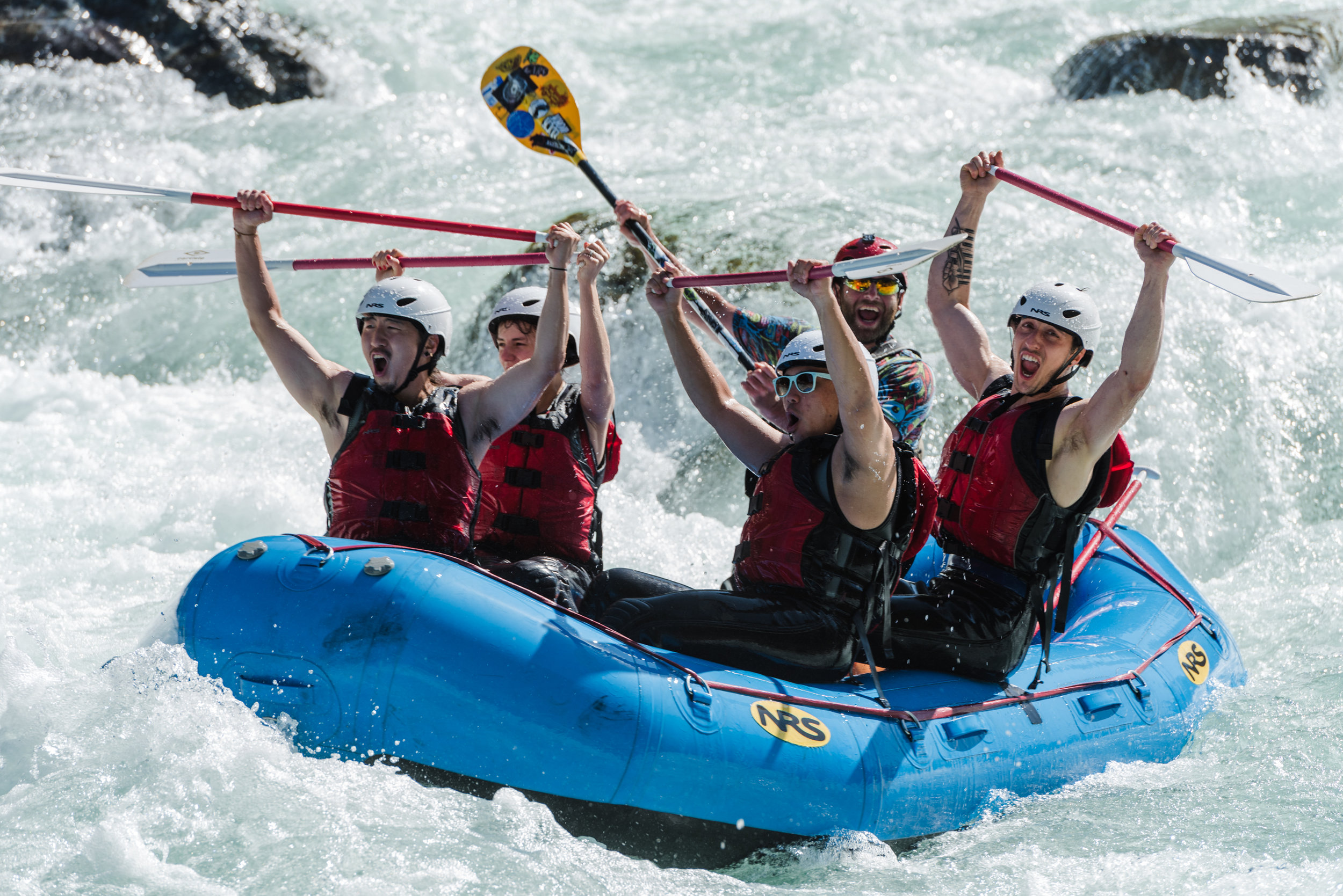
Known simply as 'The Sky', the Sunset run on the Skykomish is where experienced boaters can go for their weekly whitewater fix and still be home by dinner. Only an hour from Seattle, or closer for those who live in Highway 2 corridor, the run offers excellent whitewater throughout the year and plenty of fun play spots. In a good water year it can be paddled all twelve months of the year. You may be grinding your way down on the coldest winter days or after several days with no rain in the summer, but you are just about always guaranteed to have a good time.
Historically, kayakers began their trips from the base of the dramatic Sunset Falls with a seal launch from the rocks (before access was closed by WDFW in 2000). Currently, boaters will put in at Cable Drop located on the South Fork and administered by the Forest Service, at the Highway 2 Bridge at the confluence of the North Fork and South Fork Skykomish, or in the town of Index when there is sufficient flow on the North Fork. From Sunset Falls access, which is currently not generally used, the first rapid on the river is a short series of ledges ending with one of the favorite surfing waves on the run. Pull out on river right to line up for First Wave.
The next rapid is a straightforward boulder garden ending with a sometimes meaty hole just to the left of center. You can hop in for a wild ride, but at most levels it's not for the timid. The river passes through another boulder garden before reaching Cable Drop.
Powerlines overhead and a horizon line mark the entrance to Cable Drop Rapid (otherwise known as Powerline). It's a great intermediate rapid at moderate flows. Good lines can be found down river left or river right. At most levels you can find some good surfing in this rapid and this has been the site of the SkyFest freestyle through a rapid competition in the past. Continuing down on river left you pass through a boulder garden with a nice ender spot at some levels, and then on under the Highway 2 bridge to the confluence with the North Fork of the Skykomish.
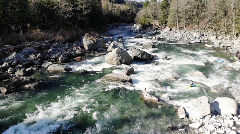
The river winds through another couple rapids before turning back towards the road near the outlet of Anderson Creek. Here on river left one can find Anderson Hole for some fun surfing. Boulder Drop lurks just downstream (within sight of Anderson Hole) and is easily recognized by the large mid-channel boulders.
Those just getting their feet wet with class III should portage Boulder Drop (the easiest portage route is on river left along the shoulder off the road). Although it may look deceptively easy at lower water levels, the series of moves required to negotiate the rapid is not trivial. This rapid is identified in the American Whitewater safety code as a IV+ standard at 5,000 cfs. Those who have solid class III experience and are ready to start class IV normally start running Boulder Drop at levels of around 2000 cfs or less after a careful scout from river right and with back-up from experienced paddlers. There are two basic routes used to run Boulder Drop. Both start by entering the rapid on river right through one of a couple possible chutes and then eddying out at the first big eddy on river right. Paddlers are then faced with the Picket Fence, a series of boulders that are lined up across the width of the river. The major routes through the Picket Fence are Airplane Turn or Ned's Needle. The Airplane Turn requires a hard ferry to river left behind a large boulder, while Ned's Needle requires a precise line up for the narrow slot. The reversal at the base of Ned's Needle can create problems if you don't clear the base of the drop with a good boof and at lower levels the Dragon's Back appears on the left side of the chute leading away from the Needle. At higher levels a third option becomes available in the form of a sneak route on river right. The final section of the rapid includes a series of large waves and holes run just left of the ominous House Rock. A good eddy line for squirt moves forms in the pool below Boulder Drop. The whole rapid can be viewed from the road between mile marker 34 and the Anderson Creek bridge.
After passing through a couple more rapids you come to Lunch Hole. The main current heads towards a rock wall along the left bank. Lunch Hole sits along the left bank and has been known to grab unsuspecting paddlers. It can be easily avoided on the right or for those wanting a more intimate look you can catch the small eddy on river left above it and ride the narrow tongue alongside it.
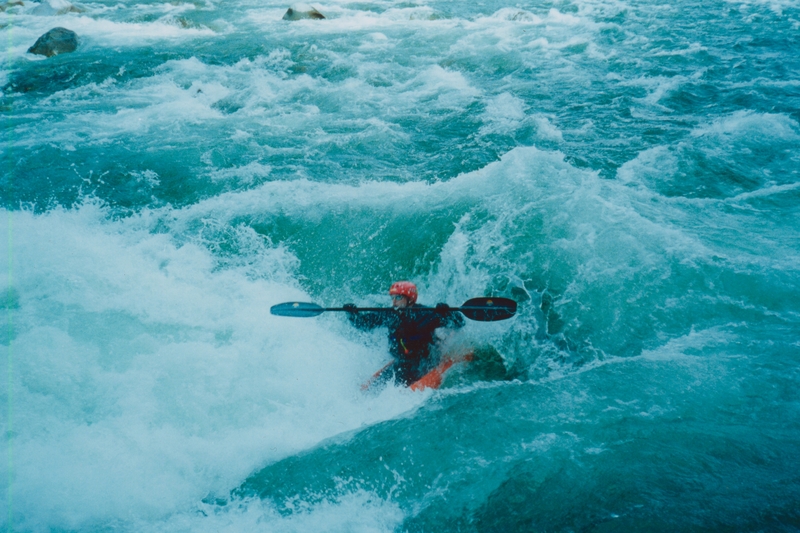
The next fun spot on the river is Last Wave at Split Rock. Kayakers line up in the large eddy behind a big boulder on river left to take turns surfing this beautiful wave. Some take out along the road near Split Rock while others continue on downstream around the corner to the railroad bridge takeout on river left or on down to Big Eddy. The Big Eddy run begins at the railroad bridge.
Logistics:
PUT-IN: For kayakers the best put-in is at the base of Sunset Falls on the South Fork of the Skykomish (elevation 500'). Access to the traditional put-in is 1 mile east of the Mt. Index Cafe off Highway 2 (mile 36.5). At this point there is a pullout on the south side of the highway and a road that leads down towards the river (marked with a 'road closed' sign). Follow the road down to a parking area just before a bridge over a small creek. Hike your boat down the hill under the railroad tracks to the base of Sunset Falls. (NOTE: Access to this put-in has been closed by WDFW. Restoring access is a long-term priority of American Whitewater). Currently, the best alternative access point is on Forest Service land on river left above Cable Drop Rapid (1.9 river miles downstream from Sunset Falls). At Highway 2 mile 35.1 (just west of bridge across the Skykomish) take FR 6020 0.4 miles to a parking area near a big powerline tower. A trail from the corner of the parking area leads down to the river at a point just upstream of Cable Drop Rapid. Don't attempt to use private land (clearly marked) near the base of Sunset Falls on river left. Additional access points include Forest Service land at the Highway 2 bridge at mile 35.1 (river left), and on the North Fork at either the bridge in the town of Index (river right) or Forest Service land (Llama Ledges) less than a mile south of Index (river right).
TAKEOUT: The railroad bridge over the Skykomish at Highway 2 mile 32.5 (elevation 295'). There is a parking area on the north side of Highway 2 with enough space for a half dozen cars (more if you get creative). There have been occasional problems with break-ins to shuttle vehicles. In recent years the more popular take-out has been Split Rock (Highway 2 mile 32.9) as it is closer to the highway. This access is private land but Outdoor Adventure Center manages the site and provides insurance to cover use of the site as a boating access; boaters need to fill out a liability waiver with Outdoor Adventure Center in Index. Some have used the fishing access downstream at (Highway 2 mile 30.4). Many continue down river from here to the Big Eddy take out a few miles downstream, adding a bit of Class II-III to the run.
Rapids in this Run (9)
![Cable Drop Access [Forest Service]](https://howsyourriver.s3.amazonaws.com/images/rapids/885209.jpg)
Waterfalls (1)
![Sunset Falls - Put-in [closed to public]](https://howsyourriver.s3.amazonaws.com/images/rapids/888670.jpg)
Difficulty
Class III+(IV)
Length
4.4 mi
Gradient
45 ft/mi
Rapids
9
Access Points
Difficulty Classes
I Easy
II Novice
III Intermediate
IV Advanced
V Expert/Extreme
VI Unrunnable
Current Conditions
5-Day Forecast
Whitewater data from
American Whitewater
American Whitewater