1) Kennebec Gorge: Harris Station Dam to Carry Brook
Linked via: Proximity 89% confidence Synced 6mo ago
Gauge Conditions
Runnable: 350.0 – 13,000.0 CFS
Good play levels
Data from American Whitewater & USGS
Run Map
Run Time Estimate
Select put-in and take-out to estimate time.
Unlock Advanced Trip Planning
See wind-adjusted speed maps, forecast planning, and detailed time estimates.
Sign in to generate an AI timing estimate for this run.
Whitewater timing varies with scouting, portages, and group pace. Use as a planning baseline.
Description
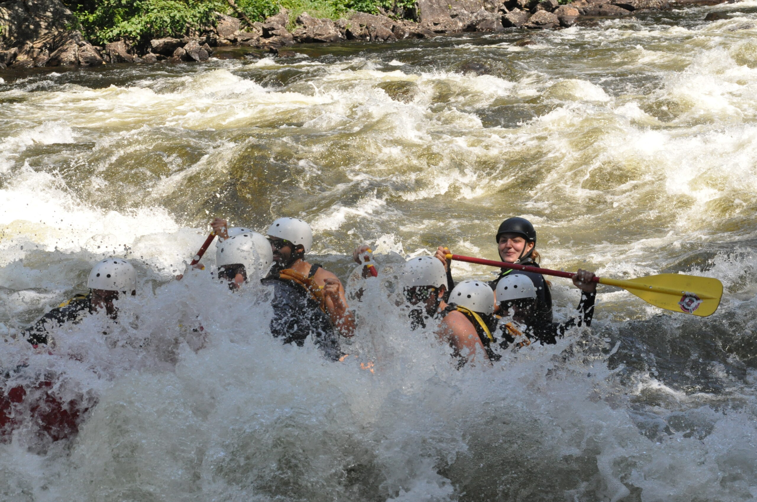
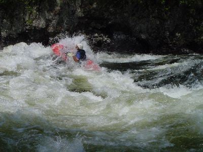
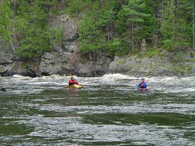
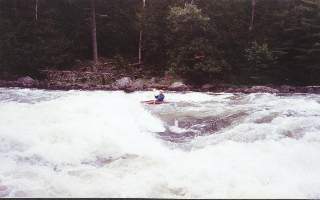
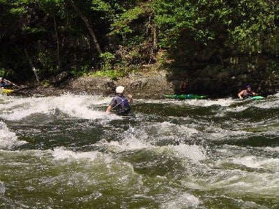
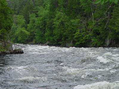
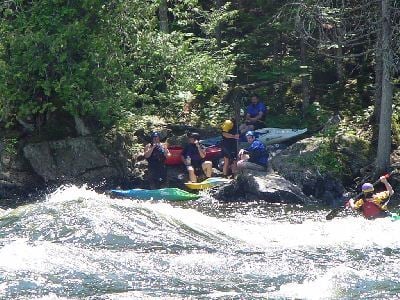
Once you enter the gorge below Harris station, you are commited to the run. The gorge has sheer walls with class IV big water running for approximately 2 miles. The main concern is big waves, crosscurrents, and some large holes. The shoreline is shale that tends to break up into sharp jagged edges. The Alleyway continues up to Cathedral eddy were there is a good wavetrain. After Cathedral eddy the Kennebec widens and the shear gorge walls dissappear. Z-turn rapid lies 1/4 mile downstream. This is an easy class II playspot with surfing waves and an ender/sidesurfing hole. Another 1/3 of a mile below Z-turn is the biggest drop on the Kennebec. Run left for a dip into Magic Hole. At levels above 3500cfs Magic Hole can be punched but be ready to roll. Below 3500cfs Magic gets sticky and trashy. Take the 'Highway' which runs just left of center of the river. Do not run river right at any level below 8500 cfs. Maytag hole can hold rafts for days. This is the most significant horizon line on the run, so if you are not sure of where you are and you come to a horizon line, you are at Magic falls. Maytag is below Magic, on the center right. The takeout is another 1-1/2 miles downstream at Carry brook. There is a steep stairway on the left. Trips can continue down to the Forks (9 miles) but the river becomes more sluggish the further downstream you go. The following information is from AW Director Tom Christopher, quoted in various message boards: 1. The 300 cfs minimum flow will not be in place until FPL receives their operating license from FERC, hopefully in about a year. It is an excellent Class II-III run, fine for open boats and not pushy, with 2, perhaps 3, easy Class IV drops that can be easily portaged. It will provide a wonderful opportunity for folks with a lower skills level to enjoy the remote beauty of the Kennebec Gorge. 2. The normal 4800 cfs release is a classic Class IV run with big water waves and crosscurrent crashing off of the Gorge walls, a few serious holes, and multiple opportunities for long nasty swims especially below 'Big Mama' (8 ft. waves) and into the 'Alleyway'. If you do not have a combat roll or have limited Class IV experience, it is probably not a good idea to run at this level. 3. At 2400 cfs all of the above is significantly magnified. There are more holes with consequences, much stickier and nasty. The river become more technical at this level and now becomes a more difficult Class IV+ river that will require a good solid skills level for the trip to be run safely.
Directions to the Forks
Take I-95 North to Maine Exit 36 (Route 201) in Fairfield or Skowhegan. Go north on 201 to The Forks (about 60 miles north on 201 from I-95). This will get you to West Forks Maine. You will start seeing outfitters about 5 miles before the Moxie Falls road turnoff to the putin.
Directions to the put in from the Forks
1) Begin at Webbs/Berrys on US-201 and go Southeast for 0.4 miles (0.4 cumulative) 2) Turn left on Moxie Rd,Moxie Falls Rd and go East for 5 miles (5.6 cumulative). Location marked by a 'W' on the map. 3) Turn left on Indian Pond Dam Rd and go North for 8 miles (13.5 cumulative) Location marked by a 'X' on the map. 4) Check in at the gate house then proceed through the gate .2 miles (13.7 cumulative). Location marked by a 'Z' on the map.
Directions to the take out from the put in
1) Begin at the put in (Harris station) head south on Indian pond dam road 4.0 miles(4.0 cumulative) 2) Turn right at a dirt road intersection with a small shed size building on the right. Location marked by a 'Y' on the map. 3) Approximately 1.5 miles of good to poor dirt road to take out (5.5 cumulative)
### Technical info
Put in elevation........844'Take out elevation......706'Total drop..............138'Average drop/mile.......40'Distance................3.5 miles River width average.....50'River geology...........Slate ledge River water quality.....Good, clarity good.Scenery.................Excellent, isolated steep walled gorge Wildlife................Deer, moose, loons, eagles.
Kennebec Turbine Test Days 2021 release schedule: https://brookfieldprod.blob.core.windows.net/files/63740800886-Kennebec%202021%20River%20Recreation%20Schedule%20Final.pdf
Kennebec river mile by mile guide: https://gorafting.com/united-states/maine/kennebec/
Rapids in this Run (4)
Playspots (3)
Difficulty
Class III-IV
Length
3.4 mi
Gradient
40 ft/mi
max 55
Rapids
4
Access Points
Difficulty Classes
I Easy
II Novice
III Intermediate
IV Advanced
V Expert/Extreme
VI Unrunnable
Current Conditions
5-Day Forecast
Whitewater data from
American Whitewater
American Whitewater