2. Mile 5.5 bridge to Two Rivers Picnic Area Scenic
Linked via: Proximity 99% confidence Synced 6mo ago
Gauge Conditions
Runnable: ? – ? CFS
Approximate reading: This gauge is 1.8 miles away on Collawash. Use as a general reference only.
Data from American Whitewater & USGS
Run Map
Put-in
Take-out
Rapids/Hazards
Scenic
Recreational
Run Time Estimate
Select put-in and take-out to estimate time.
Unlock Advanced Trip Planning
See wind-adjusted speed maps, forecast planning, and detailed time estimates.
Sign in to generate an AI timing estimate for this run.
Whitewater timing varies with scouting, portages, and group pace. Use as a planning baseline.
Description
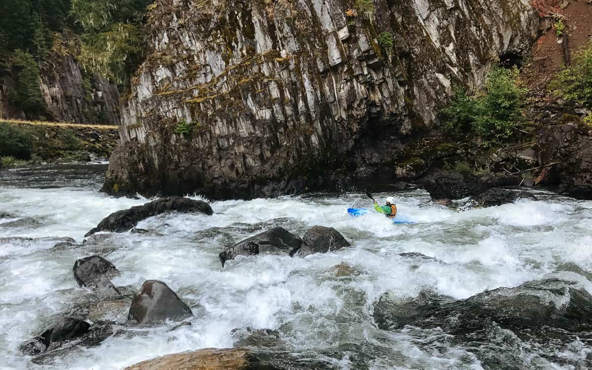
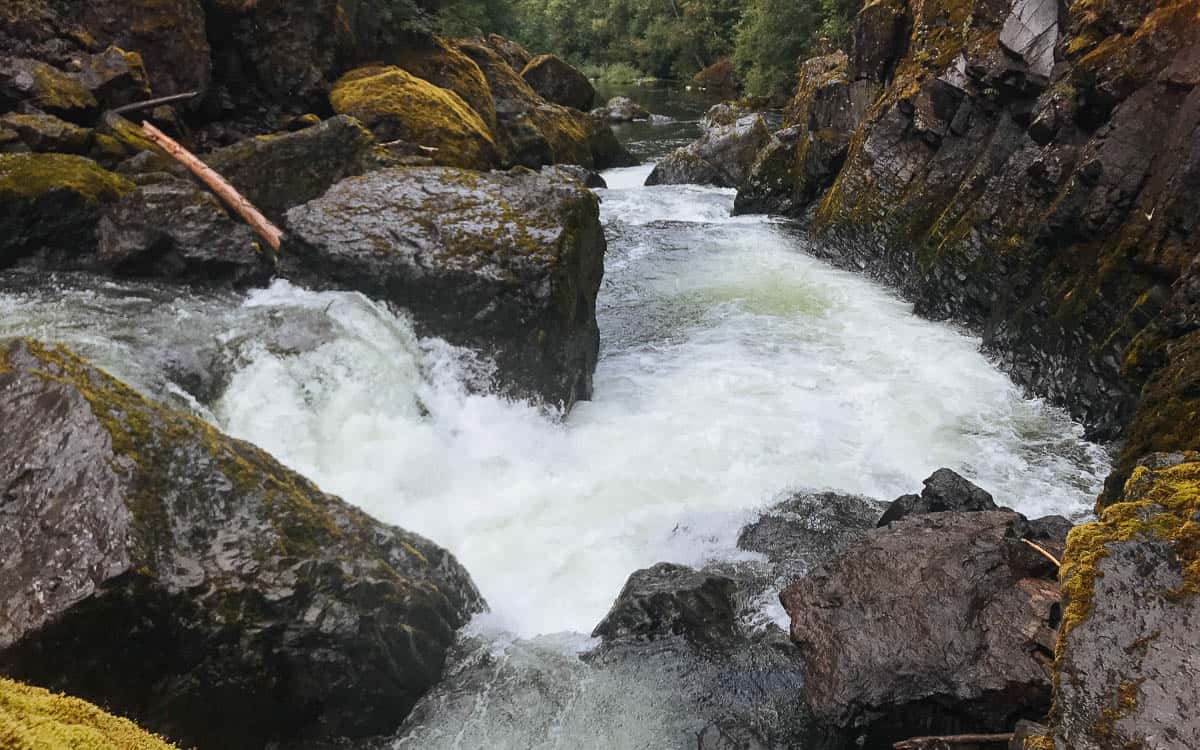
This section of the Collawash is a step down from the section right above it but still presents some challenges. The first 2 miles contains a couple class 3 rapids, one fun Class 4 rapid (Boulderdash) and a probable portage around Chute to Kill. An alternate put-in is at the large pool at Little Fan Creek Campsite.
Below Little Fan the river changes to Class 3 with short sections of flat or smaller rapids in between. The rapids pick up at Up Against the Wall which can be scouted from the road. Below this there is a beautiful section of fun waves with some stunning scenery. A last fun rapid is just around the corner from the bridge towards the end of the run. The easiest take-out is at some small eddies adjacent to the Two Rivers Day Use Site on the right just before the confluence with the Clackamas River.
Check out the description, with excellent pictures, in Jason Rackley's Oregon Kayaking. Rackley divides the Collowash into three sections: the Upper, Middle, and Lower. His Middle constitutes the first two miles of this run, from the Mile 5.5 Bridge to the Hot Springs Fork bridge.
Rapids in this Run (1)
Waterfalls (1)
Difficulty
Class III-IV(V)
Length
6.4 mi
Gradient
60 ft/mi
Rapids
1
Access Points
Difficulty Classes
I Easy
II Novice
III Intermediate
IV Advanced
V Expert/Extreme
VI Unrunnable
Current Conditions
5-Day Forecast
Whitewater data from
American Whitewater
American Whitewater