2. New Boston
Linked via: Nhdplus discovery 90% confidence Synced 6mo ago
Gauge Conditions
Runnable: 4.0 – 7.0 FT
The fall release level is around 3.8 feet which is very low. If the low end was marked higher then the AW listing would indicate that the river was too low.
Data from American Whitewater & USGS
Run Map
Description
The Farmington is often run during the autumn drawdown of Otis Reservoir.
ChuckB, on the Northeast Paddlers' Massage Board, says:
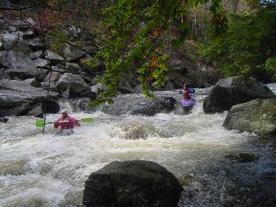
"The middle section is probably the one most commonly run and is rated conservatively as class III-IV. It is actually pretty steep, averaging about 75 ft/mi drop, but the low volume keeps the pace down so it isn't that difficult. It is very rocky and technical, but the moves aren't hard to make because the current is fairly easy, at least at lower levels. There are, I think, three spots that are a little harder than the rest which probably contributed to the IV rating. It's probably overrated, but this section is probably tough for canoes as there is not much maneuvering room. The common takeout for the middle section is at the American Legion field downstream of the New Boston bridge. There may be a fee involved but I can't remember.
"Each of the sections ( Bear's Den Section, New Boston Section, and Upper New Boston) is a couple/few miles long and any one or two or three of them can be run together. Those three harder spots are pretty cool, especially one that has a four foot drop 'cause you can watch your probe disappear for a moment before reappearing behind the horizon line (unless you _are_ the probe). This is a great river to work on your eddy hopping and boat scouting skills. Keep an eye out for strainers as the narrowness of the river could easily make a strainer impassable. There is not much in they way of play on this river, but idiots like me still try as evidenced by the scratches on my helmet and the gouges in my boat. The release level is really boney so pray for some rain to supplement it."
The Farmington releases come down out of Otis Reservoir. If you're looking for a bit of steep Class-V fun, check out Fall River.
Check out the river description at the Farmington River Watershed Association website.
Directions from the center of New Boston, about 1/4 of a mile north of the takeout for this section: For the takeout travel 1/4 mile south on MA Rte. 8. The put in is approximately 3 miles north of town on MA Rte. 8 by a steel bridge.
For a more detailed local map, click on the "Directions" tab.
Additional Info regarding changes since Hurricane Irene:
Riverken and I ran it today from Reservoir Road to the Legion. The Reservoir Road bridge is under construction and won't be done for awhile so you have to take Rte 23 to Rte 8 in Otis as a detour to get there. Its not marked well at Katie's Country Store where we usually turn on to Reservoir Road.
The gage was just under 5 feet when we put on which is a rocking fluid level and then it fell nearly a foot while we were on the river. IMO its now too scratchy to run.
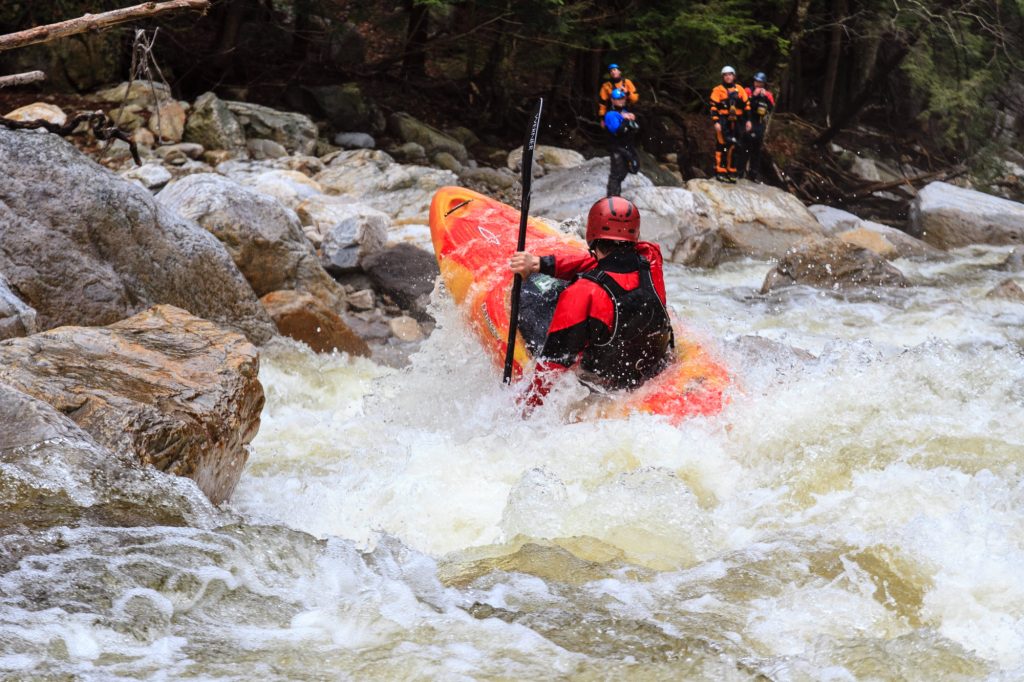
The river has undergone some significant changes Post Irene. Most notably the Gorge at and above Decoration Rock and then Corkscrew.
The Gorge at and above Decoration rock is a very different rapid now. We did not even recognize it at first. Big rocks have moved. The right side drop at Decoration Rock is now blocked by a large edged rock below where the drop was which has eliminated the right side as the line of choice. The runnable line is now left of Decoration Rock and its not quite as thrilling as the old line.
Corkscrew has gotten a bit gnarlier. The major turn in the regular route to the right of the sharp rock that sticks up below the first and center pourover ledge ( you know the one ) is more difficult because there is a lot more flow pouring over the center ledge causing a bigger flow differential line which twists and rams a boat directly into and over another sharp rock and a hole below it which you will get stuck in because there is nowhere to go below that except to ram into the ledge. Riverken and I both decided this rapid is really screwed now, too nasty to run the regular route so we wimped out and did the left side sneak route which is still OK.
There were two other open boaters on the river with us at Corkscrew ( a father & son from NY named Stu and Martin ) that Ken knew from the Dryway. Dad was in an Outrage and son was in a Caption...both excellent open boaters with less fear than me. They both attempted the regular route and both met with the exact same fate that I described above. They were both good enough to move around on the hole after ramming the ledge and get themselves out without swimming but it wasn't pretty and the boats took a beating.
Recommend scouting the Gorge and the regular route through Corkscrew before trying them. It was a fun run overall, really a blast at 5 feet but too scratchy at the end of the day. Thats one technical run. Mucho rocks to push over and around. You really have to be on your game.
_Info courtesy of Conrad Nuthman_
Rapids in this Run (3)
Difficulty
Class III
Length
2.9 mi
Gradient
75 ft/mi
max 95
Rapids
3
Access Points
Difficulty Classes
I Easy
II Novice
III Intermediate
IV Advanced
V Expert/Extreme
VI Unrunnable
Current Conditions
5-Day Forecast
Whitewater data from
American Whitewater
American Whitewater