2. Nozzle Section
Linked via: Proximity 99% confidence Synced 6mo ago
Gauge Conditions
Runnable: 400.0 – 2,000.0 CFS
Data from American Whitewater & USGS
Run Map
Run Time Estimate
Select put-in and take-out to estimate time.
Unlock Advanced Trip Planning
See wind-adjusted speed maps, forecast planning, and detailed time estimates.
Sign in to generate an AI timing estimate for this run.
Whitewater timing varies with scouting, portages, and group pace. Use as a planning baseline.
Description
This is a fun, creek style float and is quite different from the main Payette. It is an excellent option for developing paddlers to branch out from the Main Payette for a new experience. The water is not as pushy as the larger Payette sections and the scenery is undeniably gorgeous.
WHEN TO RUN: The run is best done in the spring, while run-off provides higher flows (~800 - 1,500 cfs). Best in Late April - Early July. The Middle Fork relies totally on snow-pack and run-off, resulting crystal-clear but frigid waters.
HOW TO GET THERE: From Boise take state hwy 55 north about 32 miles to Banks. Turn left on the Banks-Lowman Hwy. Follow this for about 8 miles and turn left at the sign for Crouch. Follow this (Middle Fork Road) for about 11 miles to a bridge that crosses the Payette MF and park just past the bridge on your right side, just across from Hardscrabble Campground. Or you can putin a bit further upstream, at the bottom of 'the Steeps' drops; its roadside so you can pick a spot that looks good.
SHUTTLE: Leave a shuttle across from Tie Creek Campground or, for a slightly longer run, drive down Lightning Creek Road (a right off Middle Fork Road) about 1/2 mile and leave it near the Bridge.
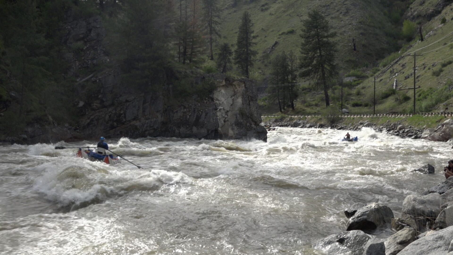
THE FLOAT: There are several class II rapids and two class III rapids about 2 miles downriver. There are some great sliding pour-overs. I would not run this much lower than 400cfs. An alternative take-out is Tie Creek Campground, or a quarter mile upstream of there at a primitive camp with a dirt boat ramp. Watch for the occasional logs.
The iconic Nozzle rapid is a class 3 slide and drop (similar to Howard's Plunge on the Cabarton). You can scout it from the road on your way up, but finding the correct pull out usually takes a few tries. Enter on river left and let the torrent carry you down like a roller coaster. There are calm pools above and below to prepare or recover.
Note: upstream of this section, (between sections 1 and 2, between Rattlesnake and Hardscrabble campgrounds) are two very steep roadside sections, 'The Steeps', without a run description, called 5+ by locals, with lots of wood and strainers.
WHAT ELSE IS IN THE AREA: LOTS!
-Payette Middle Fork Gorge and Boiling Springs runs.
-The Payette South Fork (Canyon, Swirly Canyon and Staircase runs)
-Payette North Fork ( Cabarton's class III and Smiths Ferry-Banks class V sections),
-Payette Upper Main and Lower Main.
-Also the Gutter for 'park-n-play'.
Rapids in this Run (3)
Difficulty
Class II-III
Length
2.7 mi
Rapids
3
Access Points
Difficulty Classes
I Easy
II Novice
III Intermediate
IV Advanced
V Expert/Extreme
VI Unrunnable
Current Conditions
5-Day Forecast
Whitewater data from
American Whitewater
American Whitewater