3. Dam to Brown's Fall Road
Linked via: Nhdplus discovery 90% confidence Synced 6mo ago
Gauge Conditions
Runnable: 900.0 – 2,200.0 CFS
Estimated
Data from American Whitewater & USGS
Run Map
Description
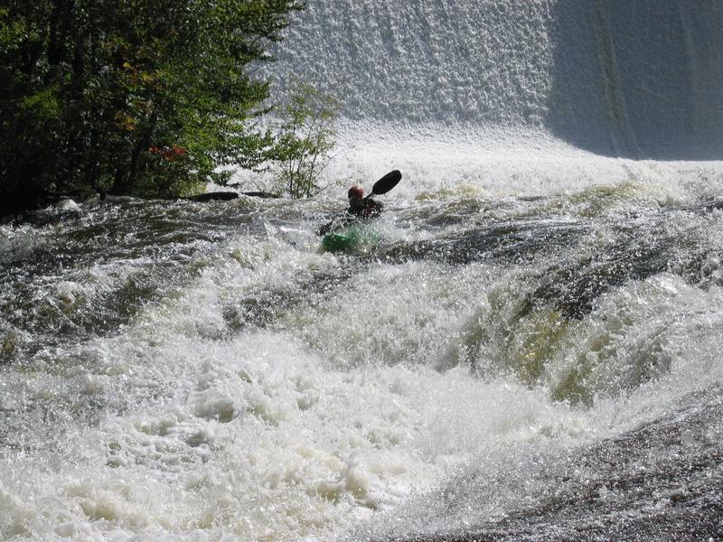
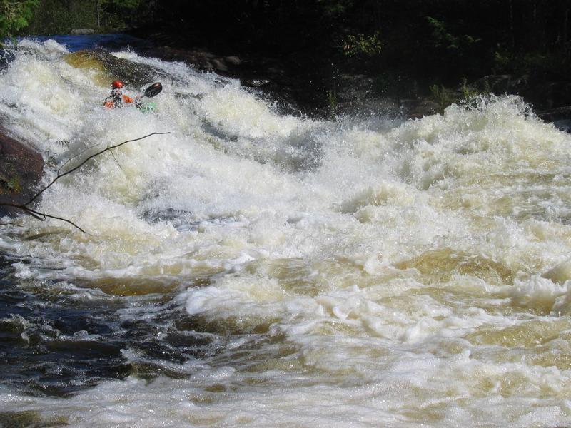
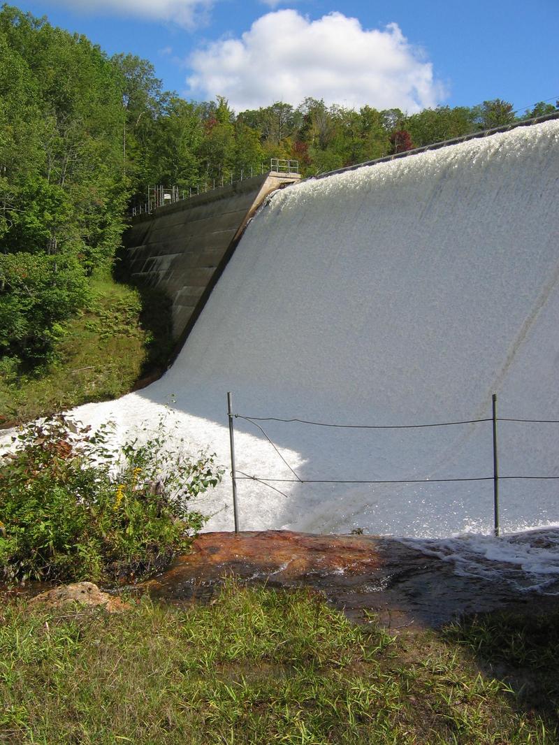
The Brown's Bridge section of the East Branch of the Oswegatchie (that's a mouthful) is a short but fun run that is located near the town of Fine on the West side of the Adirondack Park. Because of its short length it is an excellent choice if you would like to combine several runs into one day. The rapids (especially the 2nd) are not the typical pool drop that are found in many of the other area's rivers. There is no gauge that I know of for this run so you have to stop and check it out to find out if it is running. The take-out is east of Fine on a road called Brown Falls Rd (off RT 3). Turn northish on Brown Falls Rd, take out is at the bridge. To get to the put-in you can either walk or drive up a dirt road until you get to a large dam. The road has a gate on it but is sometimes open. I am not sure if it is a private road. There is some boogie water below Brown's Bridge but there is not another takeout for quite a while. There are only 4 major rapids on the run so make sure you combine this run with another branch of the Oswegatchie or one of the many branches of the Grass which are in the area.
Other area runs: South Branch of the Grass, Middle Oswegatchie, Middle Grass, Lampson Falls section of the Grass, East Oswegatchie, West Oswegatchie.
I made up the names of the rapids. If you know the name of any of these rapids let me know and I will change them on the AW page. Thanks
Governour - Cranberry Lake Area Reaches:
Black Creek Boland Creek
Indian (Oswegatchi Tributary) Island Branch
Jenny Creek Little
Oswegatchi (Owbow to Elmdale) Oswegatchi East Branch Sect. 1
Oswegatchi East Branch Sect. 2 Oswegatchi East Branch Sect. 3
Oswegatchi East Branch Sect. 4Oswegatchi Middle Branch Sect. 1
Oswegatchi Middle Branch Sect. 2 Oswegatchi Middle Branch Sect. 4 (Sluice Falls)
Oswegatchi West Branch (Bisha to Jerden) Oswegatchi West Branch (Fullerville to Oswegatchi)
Sawyer Creek
Canton - Cranberry Lake Area Reaches
Boland Creek Elm Creek
Grass (1. Lampsons Falls to Downerville) Grass (2. Downerville to Russell)
Grass (3. Morley to Massena)Grass (4.Woods Bridge Road to Route 47)
Grass, Middle BranchGrass, North Branch
Grass, Upper South BranchGrass, Lower South Branch (Twin Falls)
Oswegatchie, E. Branch (2.)Oswegatchie, E. Branch (3.)
Oswegatchie, W. BranchPlumb Brook
Google Map of New York Whitewater
New York Whitewater Paddlers Facebook Group
Rapids in this Run (4)

Hazards & Portages (1)
Caution: The following locations may require scouting or portaging. Always check current conditions.
Difficulty
Class IV-V
Length
1.4 mi
Rapids
4
1 Portage
Access Points
Difficulty Classes
I Easy
II Novice
III Intermediate
IV Advanced
V Expert/Extreme
VI Unrunnable
Current Conditions
5-Day Forecast
Whitewater data from
American Whitewater
American Whitewater