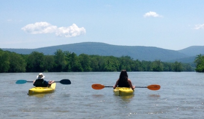
3. Millville, WV to Harpers Ferry (Potoma Wayside, VA or Weverton, MD)
Linked via: Proximity 67% confidence Synced 6mo ago
Gauge Conditions
Data from American Whitewater & USGS
Run Map
Run Time Estimate
Select put-in and take-out to estimate time.
Unlock Advanced Trip Planning
See wind-adjusted speed maps, forecast planning, and detailed time estimates.
Sign in to generate an AI timing estimate for this run.
Whitewater timing varies with scouting, portages, and group pace. Use as a planning baseline.
Description
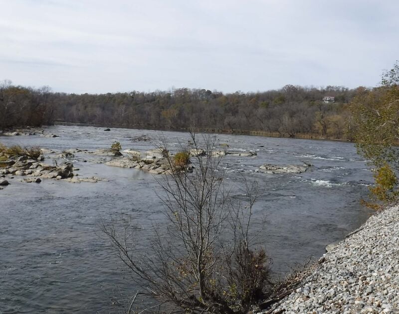
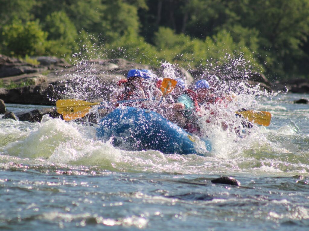
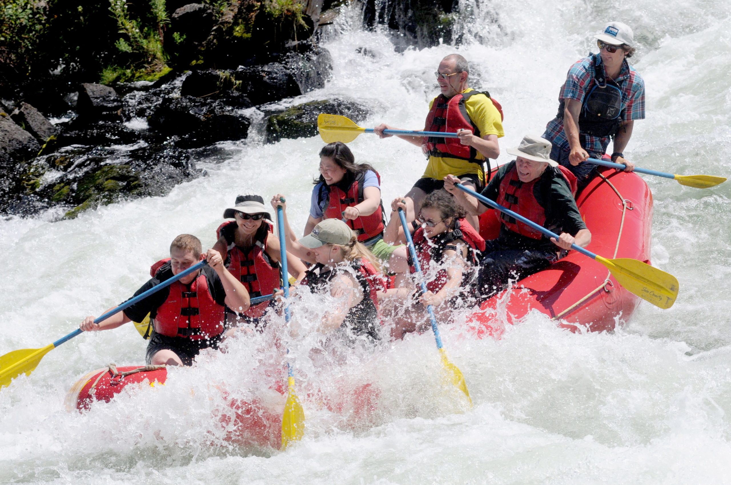
The Shenandoah Staircase is a classic run that has an appeal to a wide variety of paddlers. Lower water creates a superb training ground for the beginner paddler to hone their skills. Medium water creates several small and fun playspots to delight the playboater. High water brings out the big water enthusiasts and the extreme rodeo stars. When the water is rockin, the playboating in this area is spectacular!
The standard run is from Millville, WV to just below Harpers Ferry, WV. Playboaters interested in a park & play run will be interested in the 'Bridge to bridge' run. This would be the 1.7 mile run from the (WV) 340 bridge over the Shenandoah to the (MD) 340 bridge over the Potomac.
The Staircase can be run a bit lower below the WV 340 Bridge over the Shenandoah than from Millville.
This is the site of the annual Tim Gavin Downriver Race.
Directions:
From Frederick Maryland take Hwy 340 West to Harpers Ferry.
The Potoma Wayside take-out is on river right just upstream from the bridge.
Parking is limited (three spaces).
To get to the put in, continue South on 340 about 1.5 miles. After you pass the stoplight at the Harpers Ferry Park entrance, look for the next stoplight. At this stoplight, turn left on Millville Road. Follow the road about 2 miles down thru Millville, WV until you see water. Some of the rafting companies own land on the banks, expect to pay $20.00 per car on summer weekends ($10.00 to $5.00 weekdays) to park at the River & Trails Put-in. Or continue on about a mile further to the public parking at the power transformers.
Some guidebooks recommend taking out on river left near the 340 Potomac bridge near Sandy Hook, Maryland. The CSX Railroad has closed and now enforces a no crossing rule for the railroad at Sandy Hook. Potoma Wayside (heavy traffic and minimal parking) and the Harpers Ferry Adventure Center (fee charged) on the Virginia (the West Virginia/Virginia line is just above these take-outs) side of the river; and Weverton (an additional mile of mostly flatwater paddle and long carry on confusing trail) and Brunswick (very long flatwater paddle), both on the Maryland side, are the only remaining takeouts.
Harpers Ferry National Historical Park
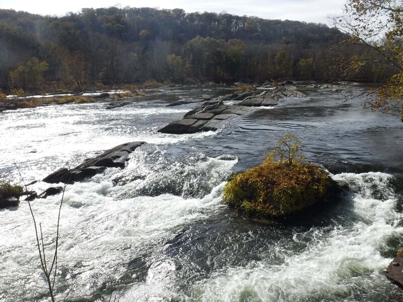
Playspot List & Levels _(List compiled by Bobby Miller/Mason Dixon Canoe Cruisers \[with some additions from other sources\])_ : 'Bull Falls' Slot 1
Boof Move 2-4'\[Millville gage\].
Slot 2 - straight through at all levels - the hole at the bottom easily punched on right side - more of a stopper to the left.
Slot 3 - classic standard line - set right angle and keep paddling - power through.
'Rodeo Drive' 3.5-4.5' (best 4.0') \[Millville gage\]
'Smackdown Hotel' 5-7.5' (no best level, stickiest at 6-6.5')\[Millville gage\]
Slot 4 - not considered runnable because there's no real feature, but pins are likely - no reward, much pinning risk.
Slot 5 - 4.5 and above\[Millville gage\] . Located at the right side of the main ledge. Usually considered a high water sneak when Slot 3 is deemed too high.
Far Right Creek Channel 5.0 or higher\[Millville gage\]\- above the 'Bull Falls' ledge is an entrance on the right side of the river to a high water side channel that sneaks around the 'Bull Falls' ledge on the right. It has a number of Class III creek slides and can be fun. Two important considerations: 1.) this channel collects wood - expect it. 2.) You'll miss 'Bull Falls', Bull's Tail, and 'Lunch Rock Follies' as it joins the main channel below them. 'Bulls Tail' 2.5'-as high as it gets (best around 6') \[Millville gage\] 'Spike Dam'
Spike Dam waves (River Right) 2-4' \[Millville gage\] - Small wave on left side of right channel right at spikes. 'Waves at Rock' (River Right - one or more waves off a rock a little below 'Spike Dam' 2-4'\[Millville gage\] .
Left 'Canal' waves (River Left) - stay left until see canal lock, turn right into small channel 2-3' \[Millville gage\] .
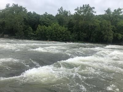
'Staircase'
Staircase Waves 2'-as high as it gets\[Millville gage\] - wave after wave of front surfing, side surfing and play. 'Dragon’s Tongue' 2-4' \[Millville gage\] - Towards the end of the Staircase rapid, just downstream of the Upper (WV) US 340 bridge. 'Hesitation Ledge'
'The Ruins' (Far River Left) 2.7'-high water \[Millville gage\] - (better the higher the river gets). As the ledges spread out on the river left side of 'Hesitation Ledge' they form a series of nice slides and surf waves along the ruins on the left shore.
'Carter's Crescent' (River Rightish - just to left of some shrubbery) 2-4'\[Millville gage\] - catch eddy river left between the ledges, peel out, take the second drop and keep moving left in a crescent.
' Hesitation Ledge' Waves(River Center) 1.7'-high water \[Millville gage\] 'Roller Coaster' 'Baby Swimmers' (center channel, second ledge at 'Roller Coaster') 3.5-4.5' (best at 4') \[Millville gage\]
'Roller Coaster' Waves 1.7-4'\[Millville gage\] 'Ring Hole' 4.5-5'\[Millville gage\] 'Mini Skook' 1.7-3'\[Millville gage\]
Below confluence with Potomac
'Wake Up Call' (river left in first rapid after confluence) 2.5-5' \[Point of Rocks gage\] - wave/hole good for front surfing, spins and cartwheels.
'Maui Wave' (river center) 7 feet to high water \[Point of Rocks gage\], perfect at 9-10' \- wave good for front surfing and spins.
'Mavericks' (river right) 12 feet to high water \[Point of Rocks gage\], reaches incredible status at 14' and above - dynamic wave good for all kinds of wave moves.
'Squirtland Ledge' or 'Sunset Blast' (second rapid river center) 6-10 feet \[Point of Rocks gage\], perfect at 7.5-8.5' \- wide hole good for spins, blasts and cartwheels.
'Mad Dog Wave' (river left) 2-4 feet \[Point of Rocks gage\] - small smooth wave good for front surfing.
'White Horse' (river left) as low as the water goes to 10 feet \[Point of Rocks gage\] - mix of squirt eddies and breaking wave holes that are fun for surfing and cartwheels at higher flows, the eddy line at the top is a favorite for squirt boaters at low flows.\
'Rush Hole' (just right of ' White Horse') 9-12 feet \[Point of Rocks gage\] - fun large hole for spinning.
'Cogler’s Hole' (next channel right of Whitehorse) 3-6 feet \[Point of Rocks gage\], best between 4-5 feet - breaking wave/hole good for spins, cartwheels and loops.
'Dash's Hole' or 'Bobby's Hole' (river center at top of '100 Yard Dash') 3.5-5.5' \[Point of Rocks gage\], best at 4 feet - fun left hand cartwheel pourover, can give out endless lefties at the right water level.
'Tumble Dry' (river right below 'Bass Rock') 6-11 feet \[Point of Rocks gage\], best at 8-9' \- wide hole good for spins, cartwheels and loops.
'Spin Wash' \- (right right near the bank parallel to 'Tumble Dry'), 7-11 feet \[Point of Rocks gage\], best at 9-10' \- powerful hole that is good for spins, cartwheels and big loops.
(It can happen that you can put on at a nice friendly intermediate level at Millville, run the Shenandoah, and when you get to 'Roller Coaster' rapid, you find that it and all the Lower Shenandoah river features below it have mysteriously vanished, replaced by a flatwater pool. The mystery will be solved when you get to the Potomac. Surprise! Sudden Big Water. It is wise to check both the Millville and the Potomac River gages in planning for this run.)
See Also:
_Classic Virginia Rivers,_ Ed Grove (1992 ed), p. 162.
_Virginia Whitewater_, Roger Corbett (2000 ed.), p. 125.
_Exploring Virginia's Waterways_, Ed Gertler (2022 ed.), p. 77.
Rapids in this Run (9)
Rapid
I
Small Riffle
 Rapid
II
Rapid
II
"Entrance"
Rapid
II
"Bulls Tail"
Rapid
II
"Lunch Rock Follies"
 Rapid
II+
Rapid
II+
"Hesitation Ledge"
Rapid
II
"Roller Coaster"
Rapid
Lower Shenandoah Playspots below "Roller Coaster" and before Potomac confluence.
Rapid
Surfing Waves below Shenandoah/Potomac Confluence
Rapid
II
"Mad Dog"
Playspots (3)
Hazards & Portages (2)
Caution: The following locations may require scouting or portaging. Always check current conditions.
Difficulty
Class II-III
Length
6.1 mi
Gradient
7 ft/mi
Rapids
9
2 Hazards
Access Points
Shuttle Info
_Description kindly provided by a volunteer under the condition of anonymity._
Takeout:- park on the shoulder of the road across the street from the Exxon on Hwy 340 in Virginia (along the Potomac). 37245 Jefferson Pike, Purcellville, VA for an exact address of the Exxon.
Bear Left on US-340 - go 3.25.1 mi.
Turn Left on MILLVILLE RD(Country Road # 27) - go 1.52.4 mi.
Pass through the town of Millville, WV.
Continue on Country Road #27; cross the train tracks.
On the left side of the road just past the train tracks there is a rafting company putin. It costs $3 / car + $2 / boat to park there. You can continue on up the road and park on the shoulder of the road for free.
An alternative takeout is to park on Sandy Hook Rd on the Maryland side, but parking is difficult there and the shuttle is longer.
I saw some people who did a park-and-play by parking at the Harpers Ferry National Historical Park and hitting some waves there.
http://www.nps.gov/archive/hafe/home.htm
Difficulty Classes
I Easy
II Novice
III Intermediate
IV Advanced
V Expert/Extreme
VI Unrunnable
Current Conditions
5-Day Forecast
Whitewater data from
American Whitewater
American Whitewater