3 - Secesh Confluence with South Fork to Salmon River
Linked via: Proximity 96% confidence Synced 6mo ago
Gauge Conditions
Runnable: 1.0 – 7.0 FT
Data from American Whitewater & USGS
Run Map
Run Time Estimate
Select put-in and take-out to estimate time.
Unlock Advanced Trip Planning
See wind-adjusted speed maps, forecast planning, and detailed time estimates.
Sign in to generate an AI timing estimate for this run.
Whitewater timing varies with scouting, portages, and group pace. Use as a planning baseline.
Description
Summary
Following the pioneering descent in 1971, Cal Giddings reported in the American Whitewater journal that “we feel we have uncovered a superb wilderness kayaking river.” The South Fork has stood the test of time as a great 2-3 day self-support trip in central Idaho. The put in is at the confluence where the Secesh River joins the South Fork Salmon River and the road ends. The trip can be combined with runs on the South Fork Salmon River, East Fork South Fork Salmon River, or Secesh River that all have access points along the forest road network in the basin.
This is a challenging, remote wilderness run. It is strongly advised to not attempt this unless you know exactly what you're doing.
_A permit is required for the float out on the Main Salmon, but there is presently no lottery. You cannot camp on the Main Salmon part of the run. Get your permit before heading from McCall from the Paytte Forest office, with more info here._
Overall Description
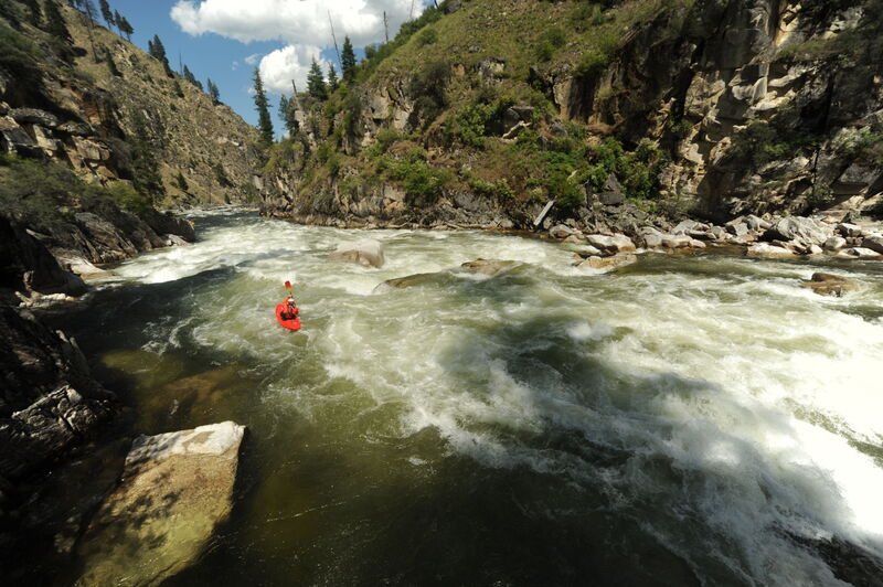
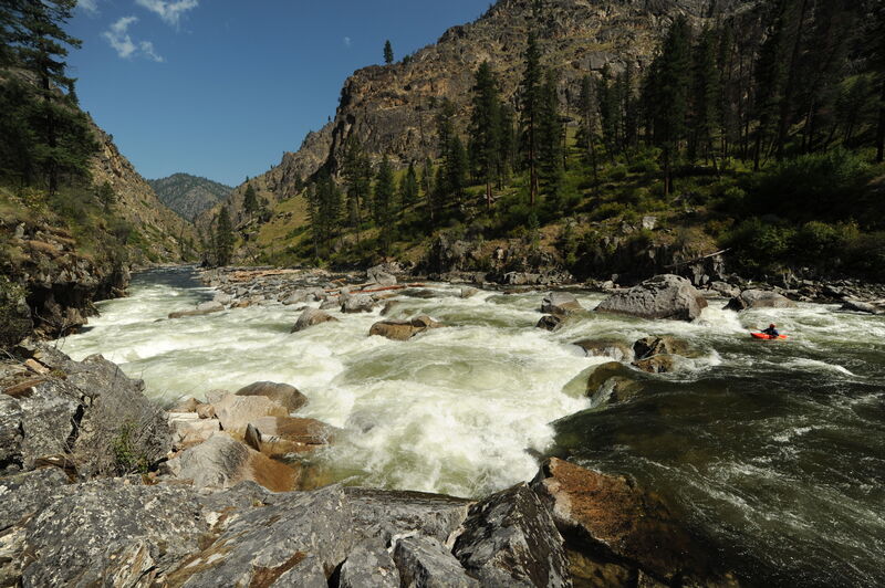
The river changes with flow. During spring snowmelt the South Fork dishes out some of the biggest water around and is a committing Class V expedition. Expect huge waves and holes, many of which are unavoidable, stacked throughout the run. Medium flows provide an experience somewhere in the middle, with several spots that still readily push into Class IV+ or more. Due to the remoteness, it is not a place for someone who swims or misses lines on any regular basis. It is remote and rescue extremely difficult.
Rafting descents of the South Fork are challenging and relatively rare although catarafts are an increasingly common sight. The river is largely the domain of self-support kayakers.
One Boise boater has opined, 'My two cents: you gotta feel super good on the SF Payette - sticking moves and lines before you consider the SFS.' It is definitely a notch up in difficulty, and a big notch up in remoteness, from the runs on the South Fork Payette - especially at high water.
The scenery on this run is spectacular. While much of the river flows through an Inventoried Roadless Area, ranches and small developments are scattered through the river corridor particularly in the vicinity of the one significant road crossing. Camping is great but sparse. To protect this incredible resource, paddlers must follow the rules on the permit page, and make every effort to follow leave-no-trace practices in the river corridor: park responsibly, camp on durable surfaces, and use fire pans and portable toilet systems so no ash or human waste is left behind.
More detailed description
The run begins at the confluence where the Secesh joins the South Fork, with good dispersed camping just downstream of the confluence of the South Fork Salmon, East Fork South Fork Salmon, and Secesh Rivers. While remnants of an old road continue downstream from the put-in along river left for a few miles, this portion of the road beyond the Secesh River confluence has since been closed. Over the first 9 miles the river builds from class III to class IV. As you pass a waterfall entering the river on the left you are at the top of the rapid just above Devil Creek Rapid. Enjoy this rapid and then grab an eddy on the left for the scout. Devil Creek Rapid represents the first big test and has a couple of options depending on flow but avoiding the hole at the bottom on river left is key.
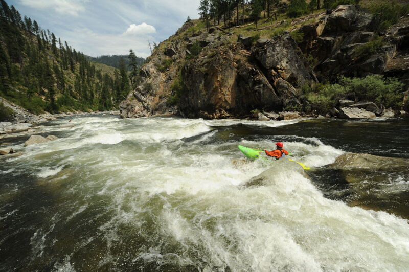
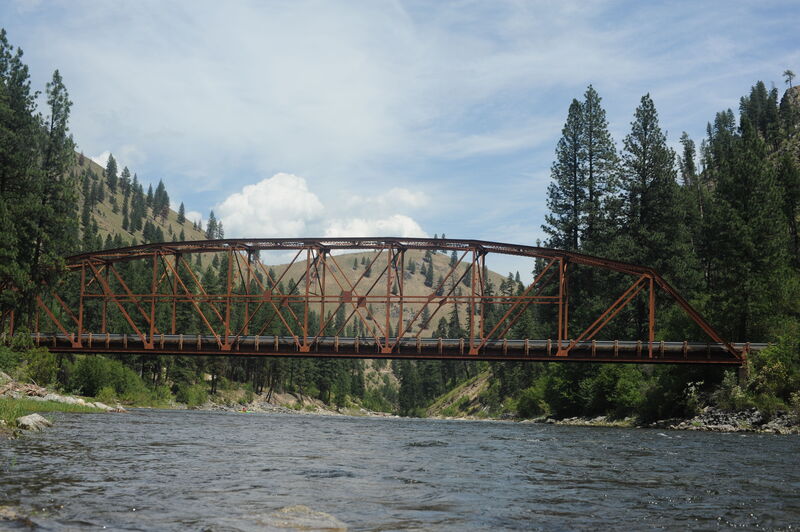
Just over 4 miles downstream of Devil Creek, where the river follows a bend around to the left, one can find a nice bench on river left with good camping and sites that can accommodate a few separate groups. It’s another mile downstream to Surprise and then Elk Creek Rapid that are part of a sequence of 3 rapids, with some big holes, that deserve a scout. It’s a short float from this point down to the South Fork Guard Station and a bridge across the river that is accessible off the Warren Wagon Road. This first half of the run from the Secesh down to the South Fork Guard Station has has over half a dozen major rapids, including the signature drops of Devil Creek, Surprise, and Elk Creek. At medium flows the rapids are generally 100-200 yard long boulder gardens with a total drop of 10-25’.
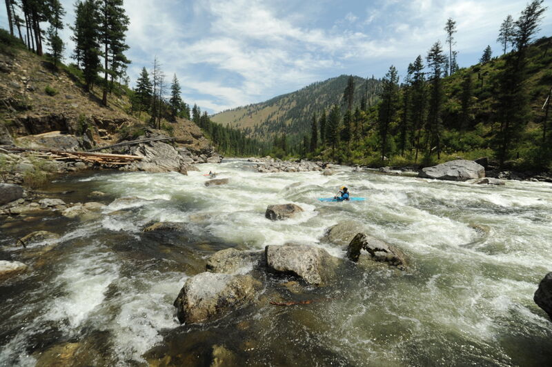
As you pass the South Fork Guard Station and float under the bridge, you will encounter more moderate whitewater and pass a couple miles of private cabins on river left. The river then enters a short canyon with some good whitewater before you arrive at the ranch at the confluence with Smith Creek on river left that is the last point along this middle segment of the river accessible from the Warren Wagon Road. At medium flows you will encounter plenty of great read-and-run class IV rapids continuing on down to Porphyry Creek where a trail bridge crosses the river 10 miles from the confluence with the Salmon River.
Over the next 6 miles downstream of Porphyry Creek the river drops 400 feet, with nine major rapids culminating in Fall Creek Rapid. This is a great section of whitewater through a scenic canyon. The rapids are noticeably bigger and more powerful as the river grows in size with the contribution of tributary streams along the way. The final test is Fall Creek Rapid, a rapid that is preceded by some great class IV that takes you right up to the horizon line. This final big drop is most easily scouted on the left but portaged on the right. The line involves navigating among large boulders and between, or through, the holes to the pool that awaits at the bottom.
As the canyon opens up over the next mile, a nice bench on river left has some good campsites. If you are planning to spend another night on the river before floating out on the Salmon River, good sites are available upstream of the pack bridge at Station Creek and the Badley Ranch on river left.
Following a trip down the South Fork Salmon River, it’s another 20 miles down the Main Salmon River to reach the standard take-out at Vinegar Creek. You must obtain a permit to float out on the Salmon River from the Payette National Forest, but they are free and easy to get (no lottery required). Visit the permit page for more details.
Logistics:
There are a few options for a put-in. You can drive the Warm Lake Road from Cascade (the turn is at Highway 55 mile 116.1). It's 24 miles on Warm Lake Road to the turn for the South Fork Road (FR 474) at Warm Lake Road mile 55.9 (on the way you will pass Trail Creek Hot Spring at Warm Lake Road 60.5, 0.1 mile up the hill west of the FR 409 junction). The South Fork Road (FR 474) parallels the river on river right along the upper reaches of the South Fork Salmon, providing the option to take advantage of alternate put-in locations. You can just follow the road down to the Secesh confluence put-in which is approximately 60 miles total driving from Cascade along a paved forest road.
You can also head to Yellow Pine (55 miles from Cascade over paved and dirt roads) and start your run on Johnson Creek (at the airport if considering a plane shuttle) or the East Fork South Fork.
Another option to access the put-in is to drive the Lick Creek Road which is a beautiful 35 mile drive (unpaved and may be snowed in early season) from McCall that follows the lower reaches of the Secesh River for the last few miles.
For the take-out, most groups camp on the South Fork their last night and float out 20 miles on the Main Salmon to take outs at Vinegar Creek or Carey Creek accessible by road. Another option is to arrange a flight back to McCall or Yellow Pine from one of the private airstrips near the confluence of the South Fork Salmon River with the Main Salmon River. Inquire locally at the airport in McCall for charter options and details on the best airstrip to use. A Cessna 206 can typically fit two kayaks and two paddlers. Boats under 9' will be an easier fit.
Difficulty
Class IV-V
Length
36.0 mi
Rapids
6
Access Points
Difficulty Classes
I Easy
II Novice
III Intermediate
IV Advanced
V Expert/Extreme
VI Unrunnable
Permit Required
Obtained in person at the McCall Ranger District in McCall, Idaho;
OR
You can print out the permit at the link below, fill it in, sign it, and mail it to the McCall Ranger District, C/O Front Desk, 102 W. Lake St., McCall, ID 83638 or scan and email the contact on the USFS permit page: https://www.fs.usda.gov/detail/payette/passes-permits/?cid=fsm9_030962
Permit: https://www.fs.usda.gov/Internet/FSE_DOCUMENTS/fseprd526083.pdf
The district will then mail you back your tag(s) with your permit number(s) that gets attached to your boat, allowing you to exit to either Cache Bar on the Main Salmon for those floating Big Creek; or Vinegar Creek or Carey Creek on the Main Salmon for those floating out of the SFSR.
Please allow approximately 7 days for your permit request to be processed. If you have ANY questions, feel free to call the McCall Ranger District at (208)634-0400.
that permits can be picked up at the McCall Forest Service Office
Get Permit
Current Conditions
5-Day Forecast
Whitewater data from
American Whitewater
American Whitewater