3. Three Lynx Power Station to North Fork Reservoir
Linked via: Proximity 99% confidence Synced 6mo ago
Gauge Conditions
Runnable: 600.0 – 10,000.0 CFS
Low water, but still worthwhile.
Data from American Whitewater & USGS
Run Map
Run Time Estimate
Select put-in and take-out to estimate time.
Unlock Advanced Trip Planning
See wind-adjusted speed maps, forecast planning, and detailed time estimates.
Sign in to generate an AI timing estimate for this run.
Whitewater timing varies with scouting, portages, and group pace. Use as a planning baseline.
Description
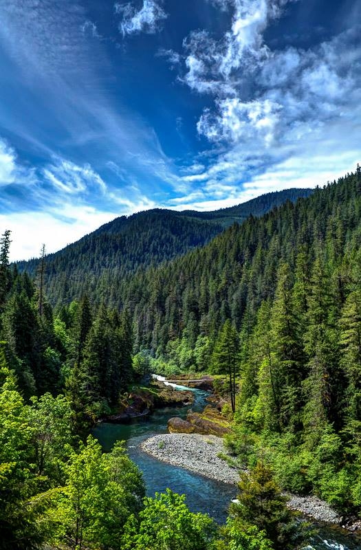
The Clackamas River is a classic whitewater run of the Pacific Northwest with great class III whitewater and reliable flows.
In December 2010 Portland General Electric (PGE) was issued a new license for operation of the hydropower project on the river and American Whitewater was a formal participant in that process, advocating for river and fisheries restoration, improved public access to the river, enhanced and expanded gage information, and a study of a playboating feature to mitigate for lost opportunities and impacts of the project.
When paddlers refer to the Upper Clackamas they mean the river section upstream of North Fork Resevoir. The run from Sandstone Bridge (more often called Three Lynx) down to the old Memaloose Weigh Station comprises the entire 13.5 mile run. Most paddlers do shorter sections, especially when the water drops under 1200-1500cfs.
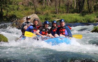
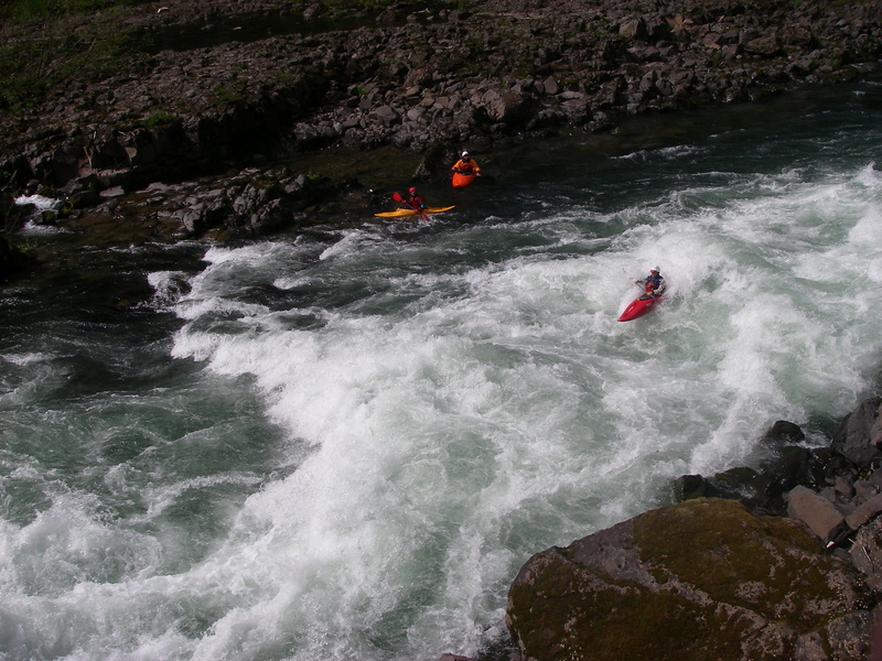
The two most popular sections are known to locals as the Confidence Run (class II, from below Toiletbowl or Moore Creek to Memaloose or Big Cliff) and the Carnage Run (class III, from Hole in the Wall to Moore Creek).
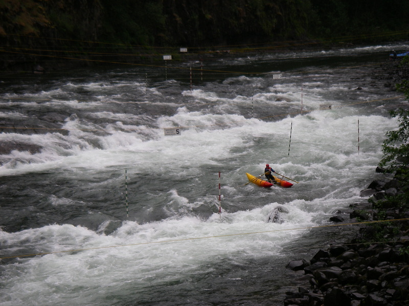
The annual Upper Clackamas Whitewater Festival takes place in May every year. The festival site is in a large river left parking area adjacent to Carter Bridge. The most exciting viewpoint for the majority of events is at Carter Rapid, just upstream from the bridge.
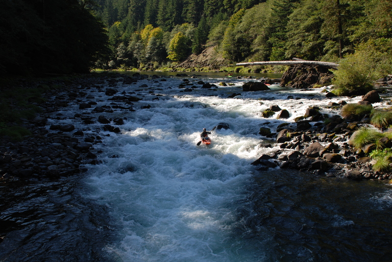
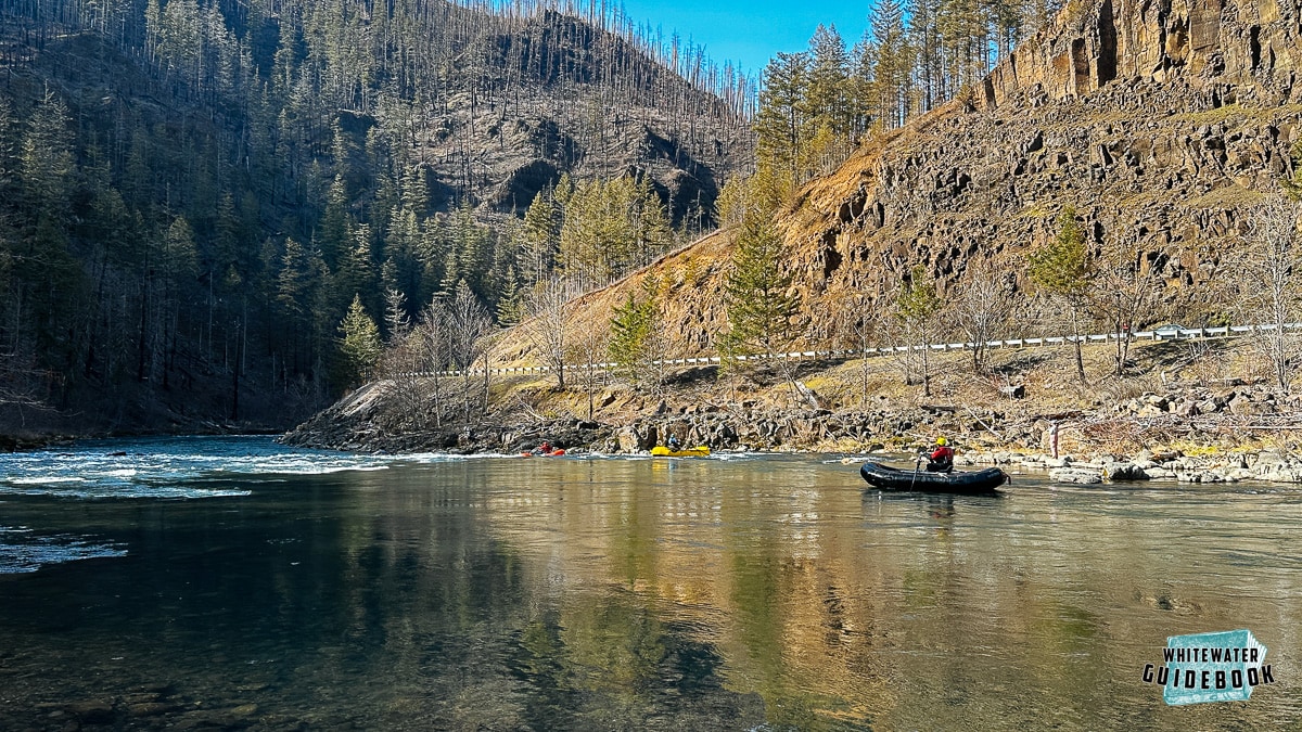
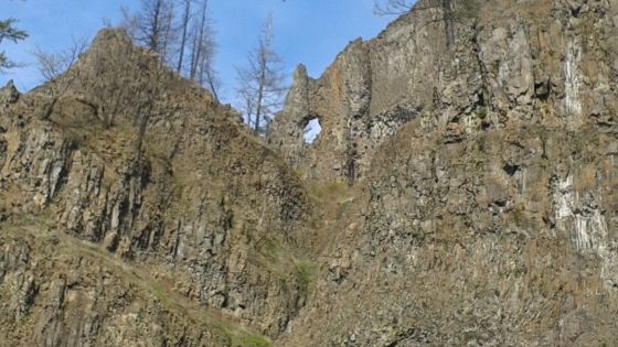
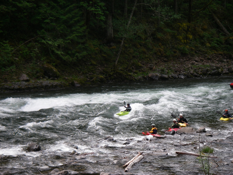
The character of the run is pool-drop class III rapids which can develop class IV hydraulics as the river rises during intense winter storms or strong snowmelt. Consistent flows are available year-round with rain in the winter, snowmelt in the spring and year-round springs that keep flows boatable all summer and fall. The river drops low in the summer, but many enjoy the technical boating and a wonderful escape into the National Forest just an hour from downtown Portland. Highway 224 follows most of the river which makes scouting easy, but the road disappears from view once you are on the water. Even after the changes wrought by wildfire in 2020, the landscape is beautiful with cliffs and ridges more visible now, and greenery coming back more each summer. As of summer 2024 many of the Forest Service Campgrounds are still closed due to the 2020 Labor Day fire, but many are expected to open in 2027.
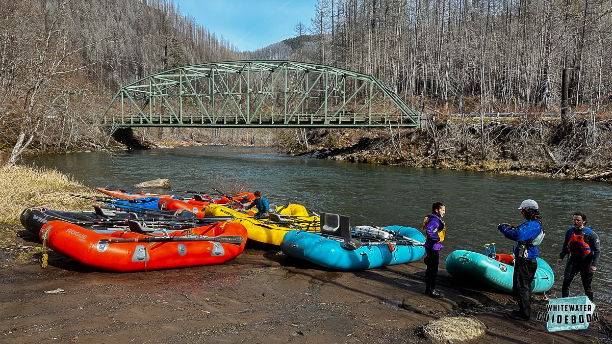
The full run starts out at the Sandstone Boat Access Site which is on river left upstream of the Three Lynx Powerhouse and a bridge. Typically the powerhouse adds another shot of water to the river, but Powerhouse Rapid is a significant two-part rapid above that inflow. Powerhouse gets very shallow for rafts and catarafts below 1000cfs.
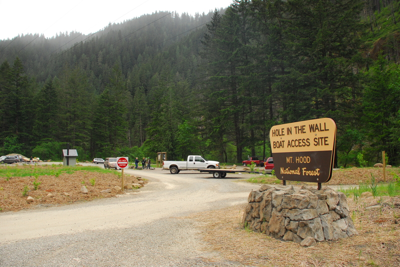
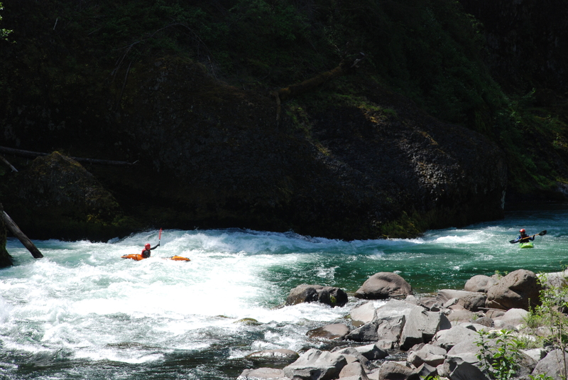
After the powerhouse the river continues on with more fun class II and III. Soon you reach the Narrows where the river is squeezed within a mini basalt gorge. Downstream of the Narrows is the Maze and Roaring River Rapids. Roaring River gets shallow and challenging at low water and has an undercut wall at the bottom on the left. Just downstream of Roaring River is Hole in the Wall Access, a good alternate put-in for a shorter run particularly at the lower range of flows. Just downstream of Hole in the Wall Access is Hole-in-the-Wall Rapid where the river slams up against the bedrock wall on river left. There have been incidents here as boaters became trapped in the recirculating current up against the wall, so be sure to stay right. The road is above this rapid on river right and it's worth taking a look on the way to the put-in if you have any questions regarding the preferred line.
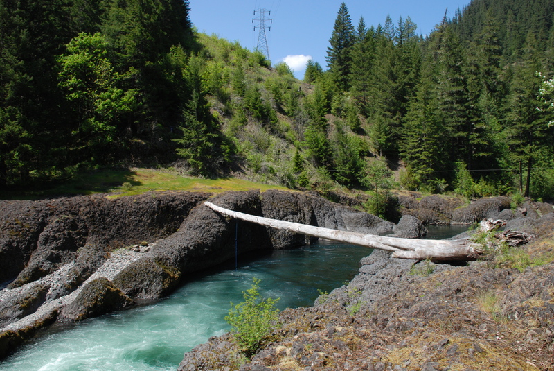
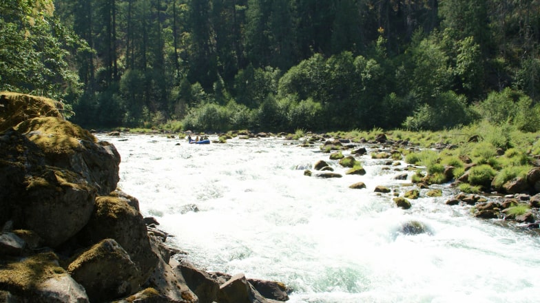
About a mile below Hole in the Wall Rapid is another bridge and the Fish Creek boat slide on river left. This is another alternate access point. After a couple class II rapids you will come to one of the biggest rapids on the run, Carter Bridge Rapid. This rapid is upstream of the Carter Bridge and it also the site of annual races held as part of the Upper Clackamas Whitewater Festival.
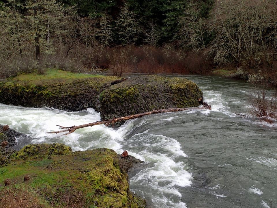
After Carter Bridge the river leaves the road for a short section which includes Slingshot. After this section the river pools up at Big Eddy. Just below Big Eddy is Rock 'n Roll and then comes Toilet Bowl which is the last of the significant drops on the run and one of the few not easily visible from the road.
Just around the next left turn below Toilet Bowl is Bob's Hole. Line up on river left for a chance to surf this feature. Bob's Hole is at one of those sites along the river that is subject to change with floods and each year can be a little different. It changed significantly in the 1996 floods and will likely change again. Many kayakers enjoy the playboating at Bob's Hole and it has been a park and play spot but most continue on downstream to Moore Creek Access which is a good take-out option. Boaters can also put-in here and continue through an easier class II float of a couple miles down to the old Memaloose Weigh Station or Big Cliff.
Logistics
The Clackamas is reached by taking Highway 224 east out of Portland continuing east from Estacada over a rise, then up the river. There are a number of options for easy roadside access on this section of the Upper Clackamas. Although you can scramble down at any of a number of places along the river, the primary access points are listed below by their location relative to Highway 224 mile markers:
- Mile 31.0: PGE's Promontory Park which is on the reservoir but has been used for river festivals in the past. It's an option for flatwater SUP adventures in summer.
- Mile 33: Big Cliff is the name for a large pullout on the outside of a bend that provides adequate access for small boats but is not great for rafts. This is a possible takeout for the 'Confidence Run'.
- Mile 33.5: Memaloose Weigh Station provides good access and can accomodate rafts. It is the last raft access before the reservoir. This is the usual takeout for the 'Confidence Run'. Please be cautious of fast traffic on the highway as the parking is on the far side.
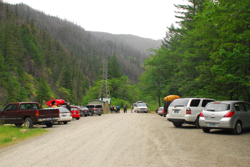
- Mile 35.3: Moore Creek Access was opened in 2015 and is managed by PGE for river runners. It provides the best raft access and is a standard take-out and meeting point. This is a possible put-in for the 'Confidence Run', and the usual takeout for the 'Carnage Run'.
- Mile 36.7: Bob's Hole is not an access site anymore. Historically it was a park-and-play site but parking in this area has been closed due to unstable hillslopes and chance of rock fall.
- Mile 37.0 Below Toiletbowl is a pullout with a primitive short trail providing access below the last big rapid (Toiletbowl). This is the highest possible put-in for the 'Confidence Run' and requires that paddlers have the skills to navigate Bob's Hole.
- Mile 37.4: Big Eddy is a possible take-out above the Toilet Bowl with a good trail to the river. The site provides easy access for kayaks and you can make it work for a raft. Rock and Roll rapid is immediately below this access point.
- Mile 38.8: Carter Bridge provides access for rafts or kayaks on the downstream river left side of the bridge and below Carter Bridge Rapid. The bank is steep and rocky. This is the site of the Clackamas River Festival.
- Mile 39.2: Fish Creek access is marginally usable for boats that you can shoulder in 2024. Reached by turning off the highway at mile 39.2 and parking on river right before crossing the bridge, it is possible to reach the river with kayaks/canoes by climbing down on river right on the downstream side of the bridge. The old boatramp burned in a wildfire and has not been replaced. There have been problems with vehicle break-ins at this site over the years.
- Mile 41.0: Hole in the Wall Access is nicely developed and easy access for rafts or smaller craft. This is a good put-in for when flows are lower or playboating is the objective. This is the usual put-in for the 'Carnage Run'. It opened in 2016 and is managed by PGE for river runners.
- Mile 45.7: Sandstone Boat Access Site is easy access on river left upstream of the Three Lynx powerhouse. It's considered the start of this section and offers good river access for all craft. It was improved in late 2016 by PGE and includes a moderate amount of parking on a side road near the Indian Henry Trailhead.
Additional Information
See the Upper Clackamas page on Rackley's Oregon Kayaking site.
Rapids in this Run (16)
 Rapid
III
Rapid
III
Powerhouse Rapid
 Rapid
III
Rapid
III
The Narrows
 Rapid
III
Rapid
III
Roaring River Rapid
 Rapid
Rapid
Hole in the Wall Access
 Rapid
III
Rapid
III
Hole in the Wall Rapid
 Rapid
Rapid
Fish Creek Access
 Rapid
II
Rapid
II
Fish Creek Rapid
 Rapid
II
Rapid
II
Armstrong
 Rapid
III
Rapid
III
Carter Bridge Rapid
 Rapid
II
Rapid
II
Slingshot
 Rapid
III
Rapid
III
Rock 'n Roll
 Rapid
III
Rapid
III
Toilet Bowl
 Rapid
Rapid
Below Toilet Bowl or MP37
 Rapid
III
Rapid
III
Bob's Hole
 Rapid
Rapid
Moore Creek Access
 Rapid
Rapid
Memalose Log Station
Difficulty
Class III-IV
Length
14.0 mi
Rapids
16
Access Points
Difficulty Classes
I Easy
II Novice
III Intermediate
IV Advanced
V Expert/Extreme
VI Unrunnable
Current Conditions
5-Day Forecast
Whitewater data from
American Whitewater
American Whitewater