4. Barnum, WV to Bloomington, MD
Linked via: Proximity 100% confidence Synced 6mo ago
Gauge Conditions
Data from American Whitewater & USGS
Run Map
Run Time Estimate
Select put-in and take-out to estimate time.
Unlock Advanced Trip Planning
See wind-adjusted speed maps, forecast planning, and detailed time estimates.
Sign in to generate an AI timing estimate for this run.
Whitewater timing varies with scouting, portages, and group pace. Use as a planning baseline.
Description
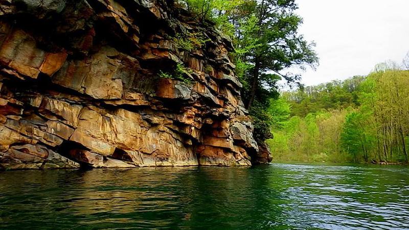
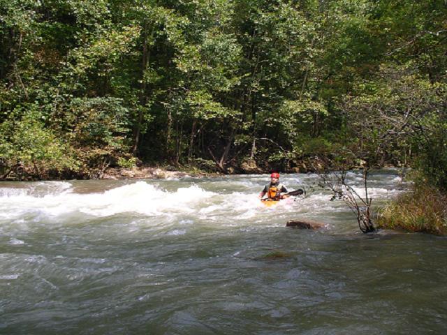
This section of the North Branch Potomac has fairly continuous whitewater consisting of primarily open Class II-III rapids with waves and holes. The water is cold, however, because it is usually drawn from deep in the reservoir. Be prepared for 50-55 degree water anytime of year. Short pools break up the rapids. Releases are posted here.
The rapids start right below the put-in. A little more than half-way down is the most difficult rapid: 'Robin's Nest. After 'Robin's Nest' the rapids become generally progressively easier down to the town of Bloomington, MD and the take-out, on river left. A detailed description of the rapids follows below.
Camping Opportunities in Area:
Barnum Camping (Mineral Co. WV): https://www.mineralwv.org/parks-and-recreation-barnum/
Savage River State Forest Camping (MDDNR): https://dnr.maryland.gov/forests/Pages/publiclands/SavageRiver/Camping.aspx
New Germany State Forest Camping (MDDNR): https://dnr.maryland.gov/publiclands/Pages/western/NewGermany/Cabins-and-Campsites.aspx
U.S. Army Corps. Craig Campground: https://www.nab.usace.army.mil/Missions/Dams-Recreation/Jennings-Randolph-Lake/Camping/
Take Out: There is now an official public take-out at Bloomington, at the wastewater treatment plant, river left, just upstream of the arch railroad bridge. From I-68, take the MD 36 - Frostburg/Westernport exit and go South on MD 36 through Midland and Lonaconing to Westernport (notice that in Midland and Lonaconing the speed limit drops to 25 mph) (Another option - somewhat longer/more stoplights but it goes by Keyser WV supermarkets - is to take US 220 South from Cumberland to McCoole, MD, then take MD 135 West to Westernport). Once in Westernport, take MD 135 West through Luke to Bloomington. Approaching Bloomington, the road will make a sharp left turn at a woodyard and rock wall and cross the Savage River. Drive west and uphill from the Savage River on Rte 135, over the railroad to the first left (Hamill Ave). Across from the school, take the next left (Owens Ave) downhill to the access. Once again, we emphasize model behavior (slow driving, no public nudity), as we will be creating traffic in a residential neighborhood.
As for using the original take-out at the mouth of the Savage: that is still OK, too. Just remember: the popular parking lot at the take-out, in front of the two-story brick building, is on private property. Please take care not to block the driveway (even just to unload for a minute), change clothes in the open, or do anything else to offend the tolerant owner, or the caretaker who lives out back in the trailer (where we have no business being). Poor behavior by some in 1997 almost cost us the use of the lot. So be on your best behavior and watch over the other guy too. (From Ed Gertler) There are a number of places to eat in nearby McCoole, MD or Keyser, WV. and after being closed for a long time, the 'Have-A-Lot' (the little restaurant in Bloomington) has been reopened (as of April, 2018) as a sandwich/ice cream take-out.
Put in from Bloomington, MD Take-out: Begining in 2023, the charge for access to the Barnum Whitewater Area will increase from $2.00 to $5.00 per day on release weekends. Directions to the Barnum Whitewater Area (BWA) from Bloomington, MD Take-out. Take Owens Road up the hill to Hamill Ave (Drive slowly through this residential area). Turn Right onto Hamill. Take Hamill to MD 135. Turn right onto MD 135. Take MD 135 down across the Savage. After the road makes a hard right turn at a rock wall, look for a bridge to the right across the N.Br. Potomac. Turn right onto the bridge (WV 46). Take WV 46 up the hill. At the top, WV 46 turns right onto the shuttle road (still WV 46). Follow the shuttle road (WV 46) for 3.5 miles, which includes a double switchback towards the end of the 3.5 miles. At the end of the 3.5 miles a road comes in from the left: Ignore it and stay to the right onto the main road (WV 46). Follow WV 46 another 1.3 miles down and up a hill and past a couple of churches. Look for Barnum Road on the right. Turn right onto Barnum Road and follow it down to the put-in at the bottom of the hill.
Directions to Keyser, WV (& Put-In \[BWA\]) from Interstate 81/Virginia
From I-81 Winchester Exit Interstate 81 at VA 37 north of Winchester, VA. From VA 37, take US 522 north to VA 127 west, which becomes WV 127 at the WV state line. At the Forks of the Cacapon, WV 127 ends where WV 29 comes in from the right - stay straight onto WV29 south. At Slanesville, WV, turn right onto WV 3 (Slanesville/Springfield Pike) and follow it to Springfield, WV. At Springfield, WV, go straight onto WV 28 to Fort Ashby, WV. At Fort Ashby, turn left onto WV 46 to Keyser, WV.
(Ed Evangelidi claims that from Keyser, it is faster to cross the Potomac River at this point and take MD 135 through Westernport and Bloomington and turn left onto the usual shuttle road than to take 220 south to 50 west to 46 north to Barnum road; which means that you might as well run by the Bloomington take-out and set shuttle. But, if you want to go directly from Keyser to the Barnum put-in -- keep reading.)
First Caviat: This route is not for RVs or other long vehicles that would have a problem with short steep switchbacks or drivers that dislike the same. To the put-in from Keyser, WV take WV 46 to West Piedmont Ave (depending upon how you get there, probably a right turn). Turn left onto 'D' street, then right on Fort Ave, then left onto Parkview Drive, which becomes Hoover Hollow Rd. Follow Hoover Hollow Road up the mountain (sharp switchbacks) and after you cross the ridge, just before you get to a lake on the left, a side road comes in from the right (ignore) which changes the name of the main road to Pinnacle Rd. Continue straight onto Pinnacle Road which curves around the lake to the left (the total distance of Hoover Hollow/Pinnacle Road is 5.9 miles). Once you've completely passed the lake start looking for a right turn onto Kantor Cutoff Road. Kantor Cutoff Road (2.0 miles) will take you down to WV Rt 46 east. Turn right onto Rt 46 and in less than a quarter mile, Barnum Road will appear to the left. Turn left on Barnum Road and follow it down the hill to a grassy parking area at the Barnum Whitewater Area --Approximately 2 1/2 miles. Second Caviat: Be aware that GPS tracking devices will get you into trouble in Keyser, WV -- whoever did the work assumed a connection between US 220 south of Keyser and Hoover Hollow/Pinnacle road that does not exist.
Rapids in this Run (16)
Rapid
II
"Woodsmoke" [Boulder Garden 1]
Rapid
II+
"Rocks & Rhododendron" [Boulder Garden 2]
Rapid
II+
"Easy Out" [Boulder Garden 3]
Rapid
II
Lead in to "The Slides" [Boulder Garden 4]
Rapid
II+
"The Slides"
Rapid
II
"Folly Run"
 Rapid
II
Rapid
II
"Blue Hole"
Rapid
II+
"Lunch Stop"
Rapid
II
"Rick's Ride"
Rapid
II
"Warnick"
 Rapid
III
Rapid
III
"Robins Nest"
Rapid
II
"Top of the World"
Rapid
II
"Rock Face"
Rapid
II
"Piney Swamp Run"
Rapid
First Railroad Bridge
Rapid
II
"Bloomington"
Difficulty
Class II-III
Length
6.2 mi
Gradient
30 ft/mi
Rapids
16
Access Points
Difficulty Classes
I Easy
II Novice
III Intermediate
IV Advanced
V Expert/Extreme
VI Unrunnable
Current Conditions
5-Day Forecast
Whitewater data from
American Whitewater
American Whitewater