4. Lumsden Campground (Merals Pool) to Wards Ferry Bridge Wild
Linked via: Proximity 99% confidence Synced 6mo ago
Gauge Conditions
Runnable: ? – ? CFS
Approximate reading: This gauge is 11.7 miles away on Tuolumne. Use as a general reference only.
Data from American Whitewater & USGS
CDEC Flow Data California
Data from California Data Exchange Center (CDEC)
Run Map
Put-in
Take-out
Rapids/Hazards
Wild
Scenic
Recreational
Run Time Estimate
Select put-in and take-out to estimate time.
Unlock Advanced Trip Planning
See wind-adjusted speed maps, forecast planning, and detailed time estimates.
Sign in to generate an AI timing estimate for this run.
Whitewater timing varies with scouting, portages, and group pace. Use as a planning baseline.
Description
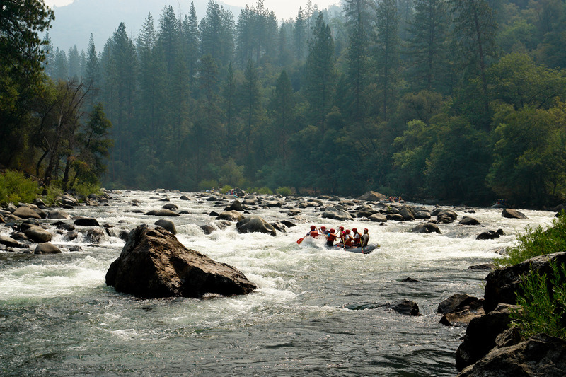
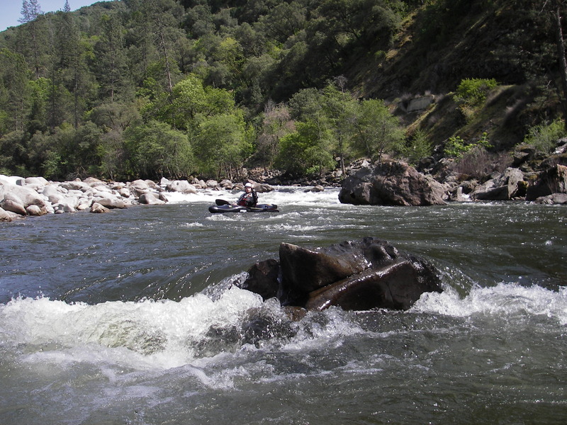
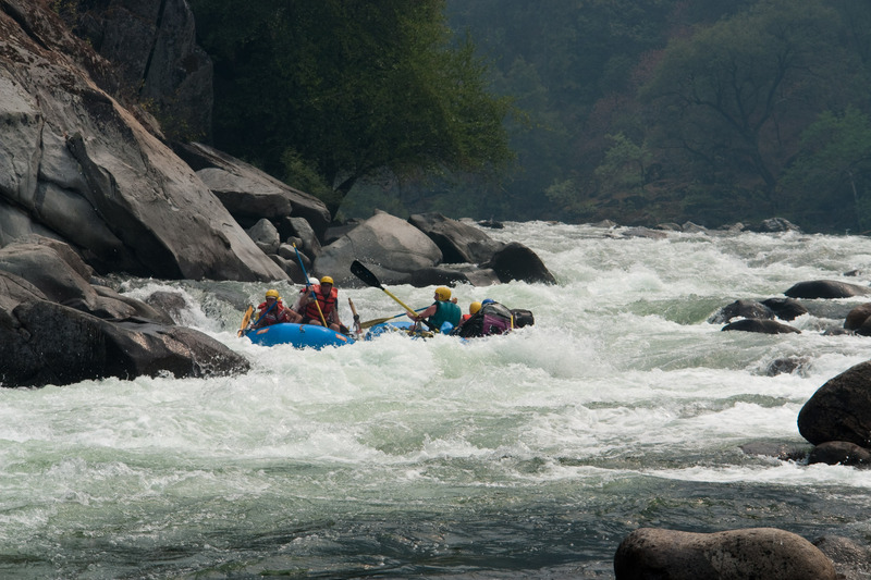
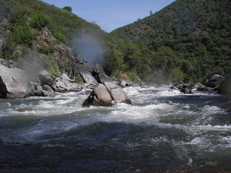
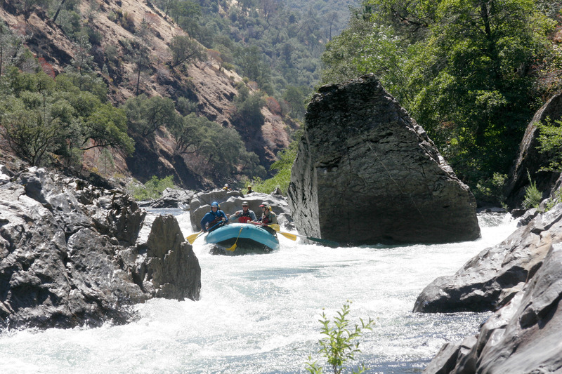
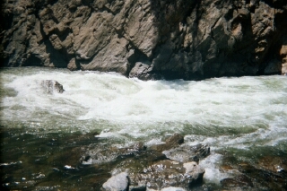
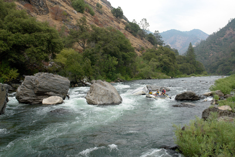
The Main Tuolumne River is a California classic, with nice scenery, exciting class 4 rapids, good side hikes and interesting historical sites. While the river can be done as a day trip, many take the time to enjoy the classic 18 mile stretch from Meral’s Pool to Ward’s Ferry above Don Pedro Reservoir as 2-3 day trip. Dependable flows are provided by Holm Powerhouse up on Cherry Creek. Hetch Hetchy Water and Power has developed a good relationship with the whitewater community and has agreements to provide dependable daytime flows through the summer to the extent possible.
Permits are Required from May 1 to October 15 of each year. Permits must be obtained from the Stanislaus National Forest, Groveland Ranger District, Tuolumne River. Day trip permits are usually easy to obtain in person and are free. Overnight permits can be reserved starting on January 1st. Weekday overnight permits can be easy to obtain also. Permits are free but there is a fee to reserve permits ahead of time. The reservation fee is $15 per 1st 10 people, and $2 per person over 10 people.
The Groveland Ranger District office is on Highway 120, about a third of a mile east of Ferreti Road, the turnoff to Meral's Pool. Call (209) 962-7825.
Video highlighting popular rapids and scenery. Shot in late April 2014 (after 2013 Rim Fire) by Matt Henry, All-Outdoors Whitewater Rafting
Getting There: Groveland is on Highway 120, the northern route into Yosemite National Park. From Modesto or Manteca on Freeway 99, it is a little more than an hours drive up 120 to Groveland.
Driving from the south up highway 99, turn north at Merced up J59 through Snelling to La Grange. Take highway 132 to Coulterville. In Coulterville, turn north onto 49 and continue to highway 120 at the bottom of the Priest Grade. Alternatively, turn onto Greeley Hill Road in Coulterville, then turn left after a few miles onto the Priest Coulterville road. This narrow road meets highway 120 at the top of the Priest Grade.
Put in: From Goveland, drive east on highway 120 about 8 miles to Ferretti road at Casa Loma. Turn left and drive 1 mile to the junction with the Lumsden Road (Forest Route 1N10) Meral's Pool is 5 miles down this narrow, twisty, rough, slow, dirt road. Allow about 20 minutes driving time from Highway 120 down to Meral's Pool. Lumsden Road is generally closed in the winter time. Call the ranger district to see when this road opens in the spring. There are several free campsites along the river in the vicinity of the put in. They have pit toilets but no potable water.
When Lumsden road is closed, kayakers can hike down the SF Tuolumne road. It is a two or three mile hike but all down hill with some nice scenary. Talk to the rangers at the Forest Service station for directions and conditions. The turn off for the road/trail is about .4 miles past the Buck Meadow Lodge.
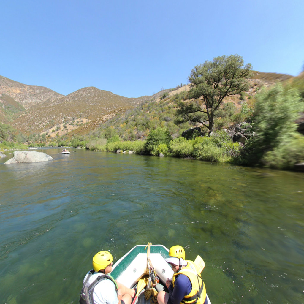
Take out: Wards Ferry Road bridge crosses the upper end of New Don Pedro reservoir. Boaters will usually have to paddle a mile or two of flatwater on the lake. If the reservoir is low there can be nice rapids almost to the bridge. There is a trail on the upstream river right side of the bridge. Parking is limited, so cars get spread out on the shoulder along the road. Don't leave any valuables in the car. Break ins sometimes happen. Allow about 20 minutes driving time each way from the river to Highway 120.
Alternate Take out: A commercial towing service will tow rafters down the reservoir to Moccassin Point Marina, where derigging and unloading is much easier. Contact: Dave 209-962-4965\] direct, or contact Tuolumne River shuttle service, \[Darrell \] 209-559-4605 to reserve a time for hook up and pull out.
Other information sources:
Cassady & Calhoun, Holbek & Stanley, Martin
Whitewater Guidebook
Tuolumne River - National Forest page
Tuolumne-River.com guide page
Paddle to the Sea; 2009 (blog)
Tuolumne River Shuttles (209-732-6165)
Geology:
Cenozoic evolution of the Tuolumne
http://www.terrywrightgeology.com/tguiderevision07.1.doc is an msWord doc of Terry Wright's wonderful book, 'Rocks and Rapids of the Tuolumne River; A guide to the Natural and Human History'.
Rapids in this Run (18)
Rapid
South Fork Road trailhead
 Rapid
IV
Rapid
IV
Rock Garden
 Rapid
IV
Rapid
IV
Nemesis
 Rapid
IV
Rapid
IV
Sunderland's Chute
 Rapid
IV
Rapid
IV
Hackamack's Hole
 Rapid
IV
Rapid
IV
Ram's Head
 Rapid
IV
Rapid
IV
Stern
 Rapid
V
Rapid
V
Clavey Falls
 Rapid
V
Rapid
V
Clavey Hole
Rapid
IV
Gray's Grindstone
 Rapid
III
Rapid
III
Thread the Needle
Rapid
IV
Cabin
Rapid
IV
Hells Kitchen
Rapid
North Fork of the Tuolumne
Rapid
IV
Pinball
Rapid
Elevation 750 Feet - Deer Creek
Rapid
Elevation 700 feet
Rapid
Elevation 650 feet
Difficulty
Class IV
Length
18.1 mi
Gradient
40 ft/mi
Rapids
18
Access Points
Shuttle Info
The map below shows a long way around route to the put in (as of 2011).
**Put in:** From Goveland, drive east on highway 120 about 8 miles to Ferretti road at Casa Loma. Turn left and drive 1 mile to the junction with the Lumsden Road (Forest Route 1N10) Meral's Pool is 5 miles down Lumsden road. Allow about 20 minutes driving time from Highway 120 down to Meral's Pool. Lumsden Road is dirt, often rough, and is generally closed in the winter time. Call the ranger district to see when this road opens in the spring.
When Lumsden road is closed, kayakers can hike down the SF Tuolumne road. From Casa Loma (Ferreti Road) continue east on 120 for 3.8 miles, then turn onto a dirt road on the left. The gate is within a few hundred yards. You may have to hunt around to find the proper route. This road is visible in spots in aerial photos and shows up as a trail on the topo view. It is a two or three mile hike.
**Take out:** Wards Ferry Road bridge crosses the upper end of New Don Pedro reservoir. From Groveland take either Wards Ferry Road if coming from the west, or Deer Flat Road if coming from the east. The two roads merge after a couple miles. Wards Ferry Road is paved, but narrow and winding. Allow about 20 minutes driving time each way from the river to Highway 120.
Difficulty Classes
I Easy
II Novice
III Intermediate
IV Advanced
V Expert/Extreme
VI Unrunnable
Permit Required
Permit applications are accepted after January 1 for the following season: May 1 through October 15. While permits for day trips or weekday overnight trips are generally available in-person, advance reservation for weekend overnight trips is recommended.
Get Permit
Current Conditions
5-Day Forecast
Whitewater data from
American Whitewater
American Whitewater