Gauge Conditions
Runnable: ? – ? CFS
Approximate reading: This gauge is 20.9 miles away on Merced. Use as a general reference only.
Data from American Whitewater & USGS
CDEC Flow Data California
Data from California Data Exchange Center (CDEC)
Run Map
Description
This section of the Merced is usually done as a continuation of the upstream 5) Redbud to Briceburg section. However, if continuing all the way to Bagby, the logistics get very different. Instead of a fine highway along the whole length, there is only a dusty gravel road for part of the ways below Briceburg. There is a long and big Quarter Mile Rapid, followed immediately by a big portage at North Fork Falls. Then there are easy rapids leading into flat water paddling on Lake McClure. Shuttle requires driving up highway 140 into Mariposa, then down highway 49 to Bagby Recreation Area on Lake McLure.
BRICEBURG TO RAILROAD FLAT, the end of road access from upstream
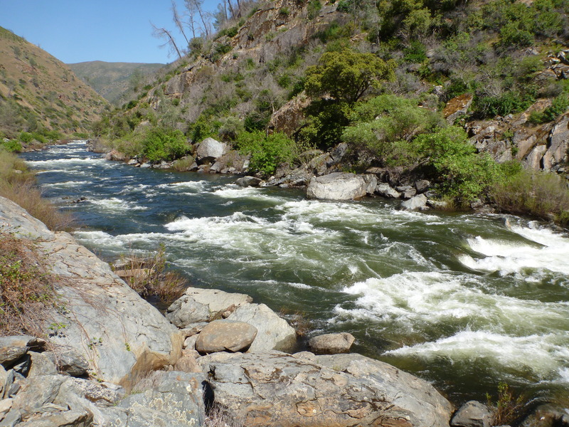
This section is very different from the Merced River upstream of this point. It still has continuous road access, but on a dirt road along the river right side. The banks are steeper with more short rocky faces, the channel is narrower, and the rapids more pool-and-drop style than the long continuous boulder fields upstream. It stays more enjoyably paddle-able at the lowest flows.
The first mile and a half or so are relatively flat, with only a couple of constrictions and/or turns forming easy (class 2+/-?) rapids. Around this point, you can see some large metal plates in the right(road) bank; on the road, there may be some large metal plates visible depending upon how much dirt is around. This is the siphon/pump station that provides the town of Mariposa with its municipal water supply, and also the site and reason for the flow gauge "below Briceburg." There is a good beach here at low/moderate flows.
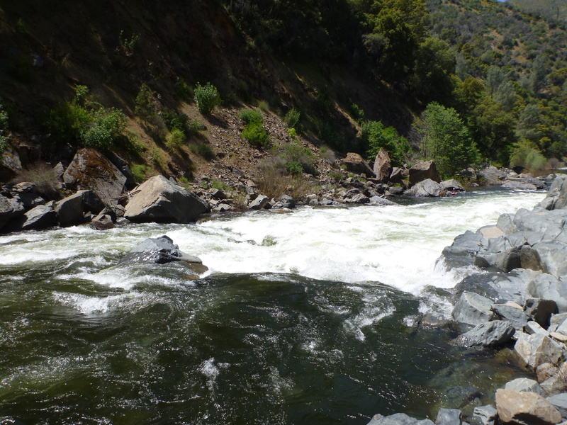
Below this point, the river starts to accelerate until it reaches a couple of class 3 rapids close to McCabe Flat. If not careful, the first of two class 4 rapids, "Split Rock", can sneak up on the unwary. At low/moderate flows, this shouldn't be a problem as the route is pretty much straight down the middle in the tongue. At moderate/higher flows, some scary holes can form, and this rapid becomes essentially one with the next rapid, a somewhat harder (at most flows) rapid called "Corner Pocket" for very good reason.
_Warning - at moderate to high flows, Split Rock and Corner Pocket can run together into one large and scary complex rapid. Scouting thouroughly before deciding to run this is strongly recommended, given the rocky nature of the rapids and the eddy trap at the bottom._
Corner Pocket can be scouted and portaged at the campground on river right, McCabe Flat. It is a rocky angular pore-over several feet tall, at the bottom of a rocky lead-in. If one enters or gets pushed too far to the left, you end up in the Corner Pocket at the bottom, river left. The first time I saw this feature, I watched six kayaks follow into this like lemmings. All six ended up swimming out, with the boats tumbling in the pocket for later retrieval. The current below the pore-over splits, and the left flow goes up against a flat wall that forms a very strong recirculating eddy. Bank access on this side is not as easy as it could be, and like everything else along this reach, infested with poison oak.
Below this point, flat paddling is occasionally broken up by short class 2-3 rapids of no real notability. After 2 1/2 more miles, take out at the end of the driveable road at Railroad Flat campsite.
RAILROAD FLAT TO HWY 49 AT BAGBY
There is no road access from this point to the take out at Bagby, where the river crosses under a bridge on Hwy 49 north of Mariposa. The old railroad bed turns into a foot and mountain bike trail along the river right side. Take out at Bagby has changed hands in the past couple of years, may have been purchased by state or fed. park mgt. ageny. The precise status is unknown (other than it is available and can be used) at this time to the author; I intend to make another run down this way in the near future, and will then be able to pass on the most current info.
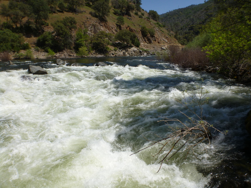
The first mile or two below Railroad Flat is enjoyable and acenic, if not particularly challenging. The prime feature of this section is a rapid called "Quarter Mile." Actualy feeling more like a half mile, it is a tighter channel with continuous pool and drop features that can be boat scouted along the way, eddy hopped and dropped with continuous amusement at low to moderate flows. At higher flows, this could prove to be a significant and ugly trap.
300 yards past the end of Quarter Mile is an impassible Class 6 called North Fork Falls, where the North Fork of the Merced joins the Main Merced. There are several very large flat and blocky boulders that much of the river flows UNDERNEATH! If there is even the slightest chance of missing this mandatory portage, don't!
At North Fork Falls, there is a pipe skid rig up the right side for rafter use. This is a short portage if one continues down lessening Class 2/3 rapids, and ending at the upper end of Lake McClure if the lake is full, and continuing to Bagby if the lake is low. The alternative for kayakers is to portage the 3(?) miles back up to Railroad Flat. Quarter Mile rapid is fun enough that I have endured this portage more than once and not for the last time.
National Wild & Scenic River
The Merced is part of the National Wild & Scenic Rivers system. The included sections are from the headwaters of the main fork all the way to elevation 867 feet which is the high water mark of Lake McLure. The entire South Fork Merced is also included. Merced Irrigation District is currently promoting congressional action to remove a portion of the Merced River from the National Wild & Scenic system so that they may enlarge their reservoir.
See House Bill H.R. 869
Other Information Sources
Cacreeks.com
BLM Merced page.
Merced River Watershed Portal
Cassady & Calhoun, Holbek & Stanley, Martin, Penny
Bagby Recreation Area
Merced Irrigation District
CDEC: McClure Reservoir data
Rapids in this Run (8)
Hazards & Portages (2)
Caution: The following locations may require scouting or portaging. Always check current conditions.
Difficulty
Class IV
Length
13.8 mi
Gradient
20 ft/mi
Rapids
8
2 Hazards
Access Points
Difficulty Classes
I Easy
II Novice
III Intermediate
IV Advanced
V Expert/Extreme
VI Unrunnable
Current Conditions
5-Day Forecast
Whitewater data from
American Whitewater
American Whitewater