742 to Barthell (5.4 miles)
Linked via: Proximity 87% confidence Synced 3mo ago
Gauge Conditions
Runnable: 3,000.0 – 9,000.0 CFS
Likely too low. (Visual inspection is required.)
Data from American Whitewater & USGS
Run Map
Description
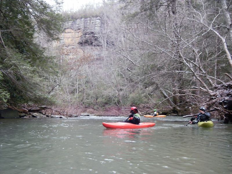
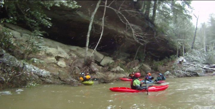
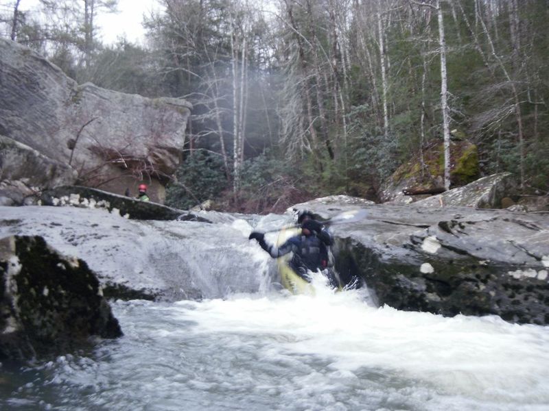
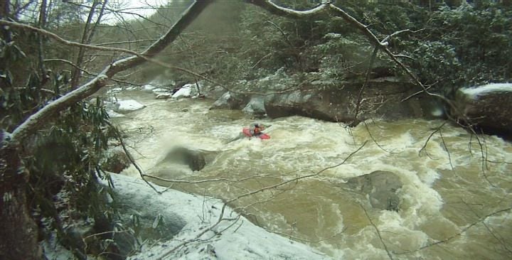
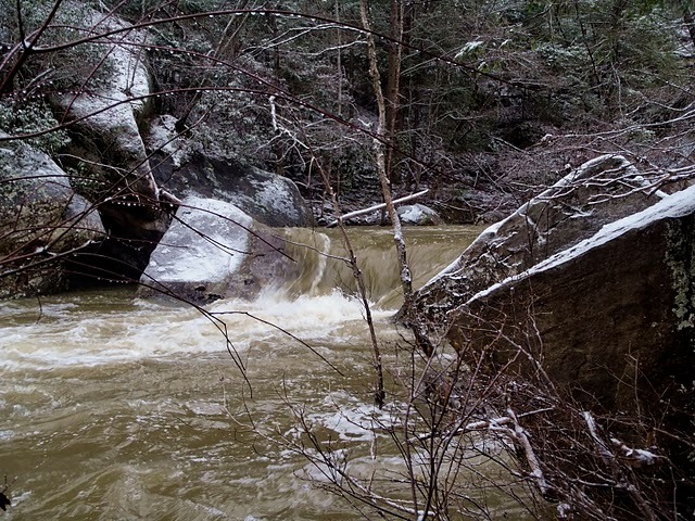
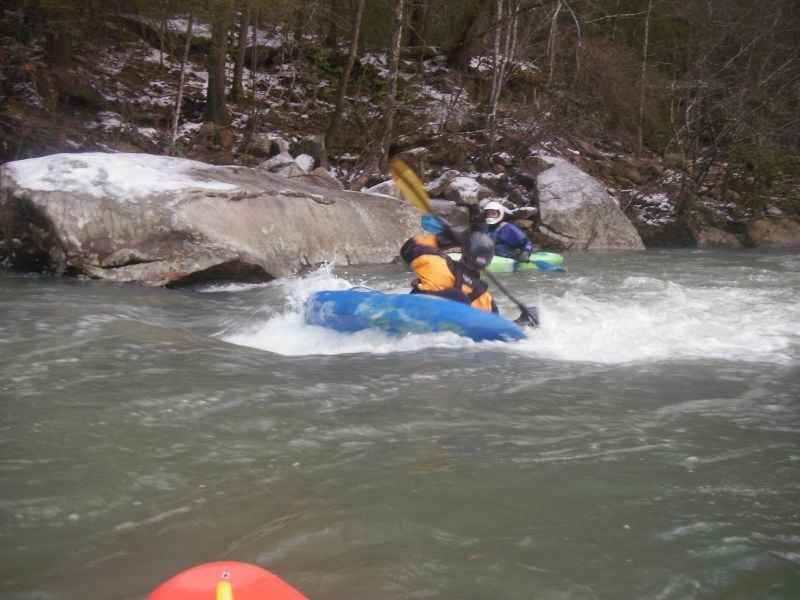
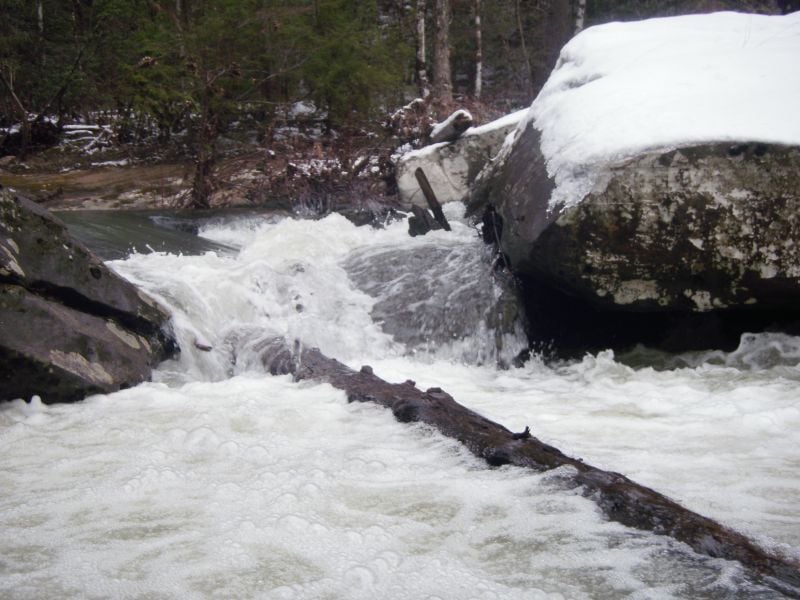
The upper paunch isn't exactly a destination run, but it does have a few nice rapids, some good boogie water and pleasant scenery. Typical to the area, it has several undercuts and sieves in the streambed, one of which is normally a portage. The class IV on this run is brief and not terribly difficult, but there are a few spots to watch out for. Most of this stretch is heavily forested and there are many nice cliffs. Toward the end of the run the O&W Scenic Railway parallels the creek as you float through the Barthell Mining Museum. Shortly below Barthell there will be a nice rapid with surfing waves and cables that go across the river. Take out just past the cables on the left and walk up to the road.
Look for around 1” of rain. Maybe less when the ground is wet. The drainage area is about 40 sq.mi., so it holds for a few days after big rain. There is a paddlers gauge on the downstream face of the river left bridge pier. Something over 12” is a low level, with 22” being a nice busy medium level. Not sure what the upper limit is. Watch out for the hole at Squeaker at high water.
Directions:
Follow 742 out of Stearns toward Blue Heron in the BSF National Park. A few miles out of town the road will wind down a hill and cross the Roaring Paunch Creek at a concrete bridge. This is the put-in and the location of the gauge. To find the take-out, continue on 742 another 4.5 miles into the park and then down the hill. At the bottom of the grade you will see a road that turns right to the Barthell mining museum, park at this intersection. Parking is limited at the put-in and the take-out but there are many parking spaces on the side of the road past the take-out.
Rapids in this Run (4)
Waterfalls (1)
Playspots (1)
Hazards & Portages (1)
Caution: The following locations may require scouting or portaging. Always check current conditions.
Difficulty
Class IV
Length
5.9 mi
Gradient
35 ft/mi
max 66
Rapids
4
1 Hazard
Access Points
Difficulty Classes
I Easy
II Novice
III Intermediate
IV Advanced
V Expert/Extreme
VI Unrunnable
Current Conditions
5-Day Forecast
Whitewater data from
American Whitewater
American Whitewater