Above Nash to Confluence with Tye R.
Linked via: Nhdplus created 95% confidence Synced 6mo ago
Gauge Conditions
Runnable: 900.0 – 5,000.0 CFS
Upper limit for best boatability uncertain. Please help your fellow boaters with a comment or report.
Data from American Whitewater & USGS
Run Map
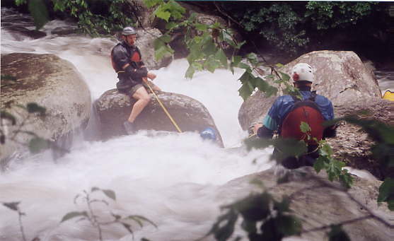
Description
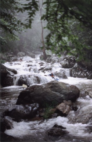
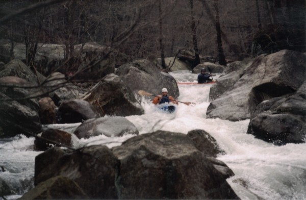
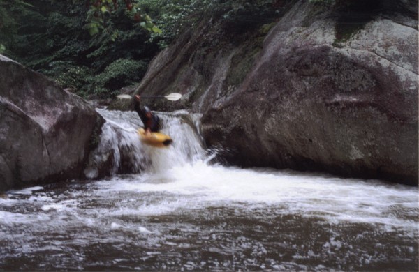
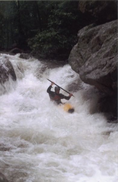
The North Fork of the Tye drops a total of 560' over 2.8 miles, for an average of exactly 200 feet-per-mile. Everything is runnable, unless blocked by a strainer. The streambed geology is generally made up of large, smoothed granite boulders. This geology is conducive to technical boulder garderns with plenty of boofing potential. The quality and feel of the NFT is a little different from what you'd expect to find in Virginia. It is my pet theory that the North Fork is so special because of a unique confluence of events that affected this area over 50 years ago. In August, 1969 the 'remnants' of Hurricane Camille came back to life over western Nelson County, VA. World-record levels of rainfall fell overnight, causing flooding on a biblical scale in the Tye and Piney River watersheads. Between 27 and 35+ inches of rain fell in just a few hours. One percent of Nelson County's population was lost in the flood. The Tye River reached flows of \_\_\_\_cfs, its carnage made even worse by massive landslides of rock, dirt, and timber that roared off the mountainsides and turned the flow into a surging soup of rock and timber. It's flow was so great that when the Tye River met the James River it temporarily caused the James to flow back upstream toward Lynchburg. It is my belief that the North Fork Tye we see today is the way it is now because of the massive scouring effect the 1969 flooding. Otherwise we'd have a more closed-in, canopied, and rock-jumbled streambed here; more like the typical 'trout streams' we see farther north and south of here along the Blue Ridge. A similar transition happened during my own lifetime during the 1995 flooding in Albemarle County; affecting the North Fork Moormans, as an example. Whatever the reason, the North Fork Tye offers a true gem of an experience for qualified Virginia paddlers. It's quality makes it the go-to creeking destination for local class V boaters; and also perhaps the most classic of Virginia's class V runs. One last word of advice though: _'It's harder than it looks from the road.'_
Rapids in this Run (5)
Hazards & Portages (2)
Caution: The following locations may require scouting or portaging. Always check current conditions.
Difficulty
Class V
Length
3.0 mi
Gradient
200 ft/mi
Rapids
5
1 Hazard
1 Portage
Access Points
Difficulty Classes
I Easy
II Novice
III Intermediate
IV Advanced
V Expert/Extreme
VI Unrunnable
Current Conditions
5-Day Forecast
Whitewater data from
American Whitewater
American Whitewater