Below Falls to weir at Morris Avenue
Linked via: Proximity 95% confidence Synced 6mo ago
Gauge Conditions
Runnable: 150.0 – 4,000.0 CFS
Data from American Whitewater & USGS
Run Map
Description
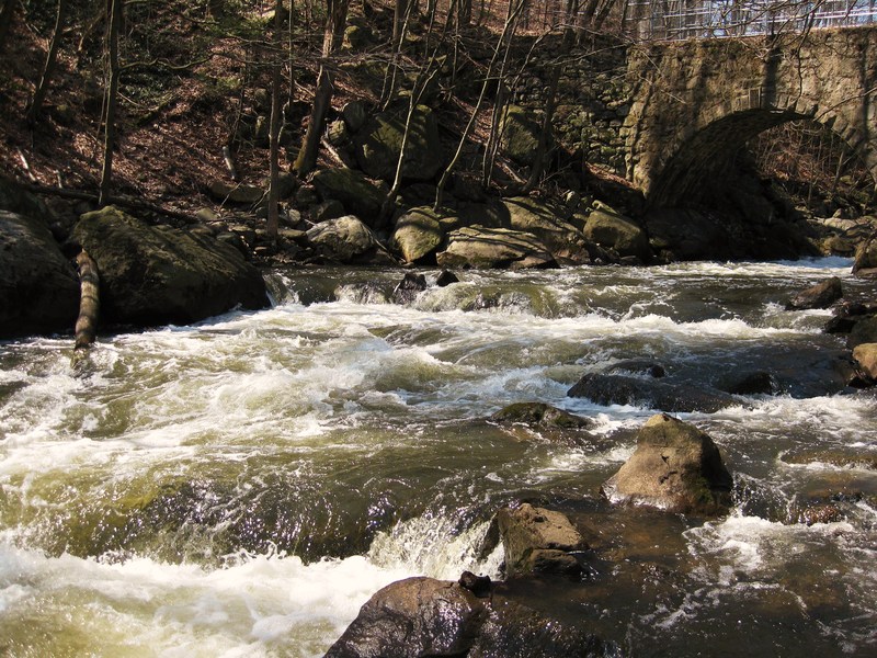
- With all of the black basalt and birch trees, the upper section is pretty in the fall. You can park at the police firing range (just an empty lot with a hill at one end), carry about 120 yds up, paddle about 400 yds of river, and carry about 40 yds up to your car or do it again.
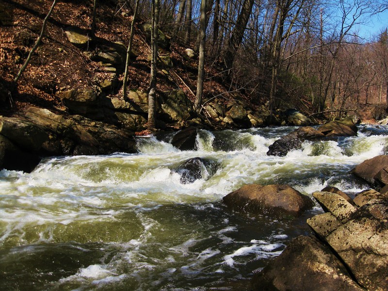
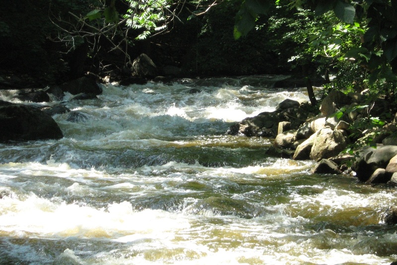
- The section from the firing range to the gauge is shallow and wide. At low to medium levels it is bony class 2 water. When the water get's higher it is a flat flush up to the gauging station weir.
- If you want to run the second half of the river (from the gauge to the Reservoir) and avoid legal entanglements, you need to take out on river left at the mouth of the res. and carry back up the nice flat trail as far upstream as you can and then ferry across to river right and carry up the rest of the way (going under 287). You can paddle down the rest of the river to the reservoir, but... DO NOT PADDLE ON THE RESERVOIR! If you do you will most likely be arrested and or fined for trespassing.
Lately there have been some "issues" relating to access on the upper section of the river (from the falls to the gauge). Go to http//www.njwhitewater.info and click on the Boonton link for lots more information about the situation.
Here's a summary.
In the winter of 2006-07, seemingly in response to a rescue incident which occurred in July of 2006, the town council of Boonton made it clear that they didn't feel Boonton Gorge was an appropriate place for paddling and that they would be working to create legislation which would prevent paddling on the Rockaway River through Boonton Gorge. Since then, little has changed. The town has not proposed, nor accepted any ordinances which would prevent paddling, but the police have continued to ask people to leave sometimes.
If you run into police or other officials who tell you that you can't paddle and/or warn you of fines for paddling,
1. Be polite, don't argue, do what they tell you to do.
2. While you're packing up, ask them for more info (1. What ordinances or laws prevent paddling in the Rockaway River through Boonton. 2. What ordinances or laws define the fines to be charged in the event of someone violating any ordinances regarding paddling in the Rockaway River through Boonton)
3. After the police officer answers (or doesn't answer) your questions, go to the police station and ask for details at the desk. The police station is about 1/2 a mile from the river. (here's a map) If you've already been told you can't paddle, you've got some time to go and help everyone out by getting some info. It will only take a few minutes.Be calm and polite. Describe what happened and ask again 1. What ordinances or laws prevent paddling in the Rockaway River through Boonton. 2. What ordinances or laws define the fines to be charged in the event of someone violating any ordinances regarding paddling in the Rockaway River through Boonton. Please write down the name of everyone you talk to and what they said to you (as exactly as you can)
Please email Stephen Strange with any info you gather.
Rapids in this Run (5)
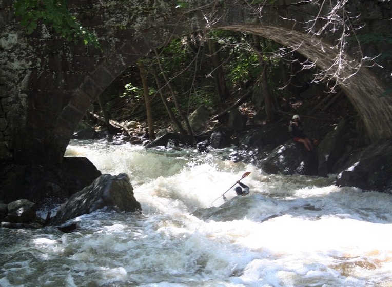
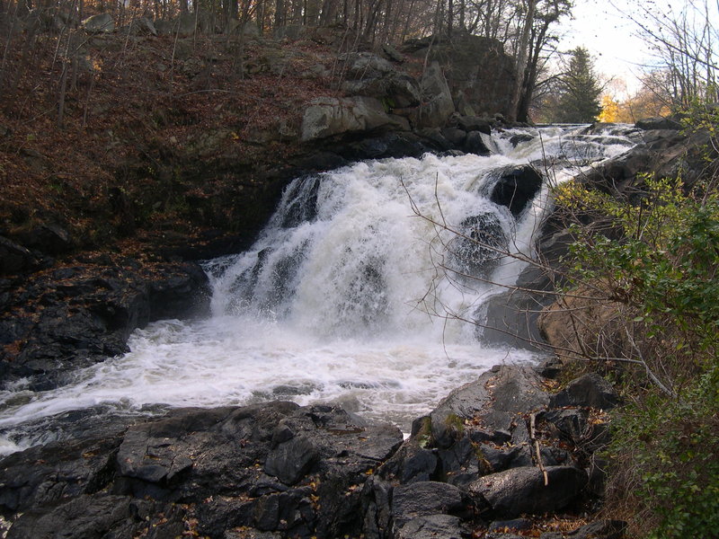
Waterfalls (1)
Playspots (1)
Hazards & Portages (1)
Caution: The following locations may require scouting or portaging. Always check current conditions.
Difficulty
Class IV-V
Length
0.7 mi
Gradient
140 ft/mi
Rapids
5
1 Hazard
Access Points
Shuttle Info
To get to Boonton Gorge:
From the North- Go South on Rt. 287 until you get to exit 44 "Myrtle Ave. Boonton."
at the light, turn left onto Myrtle Ave.
drive about 1/2 mile until you get to Main Street.
turn right onto Main St.
about 400yds later, turn left down Plane St.
Skip to below
From the South- Go North on Rt. 287 until you get to exit 41 "Main St. Boonton" and get off.
The ramp loops you around to the right. Turn right off of the ramp
Then turn right onto Main St. and drive over Rt. 287.
after about 1/2 a mile turn left onto Plane St.
Skip to below
bear left twice and you'll end up at a gravel parking area next to the municipal lot.
From here you can carry up and run, or set shuttle over to the gauge (not really worth it unless you'll be running the lower section too).
To get to the gauge. Turn off of Main St. down the ramp to get onto 287 south (you won't be getting on 287, but the gauge and access point is on a little "driveway" which is only accessible from this ramp).
The NJ Transit commuter parking lot will be on your right. Put on your right turn signal as soon as you go past the entrance to the NJTransit lot.
After the NJ Transit parking lot, you'll go over the river.
**IMMEDIATELY** following the river, on the right, is the small parking area for the gauge.
Don't go down the ramp too fast, it's easy to miss the turn, and even easier to get rear-ended while turning.
If you get onto 287 South, you've missed it.
Difficulty Classes
I Easy
II Novice
III Intermediate
IV Advanced
V Expert/Extreme
VI Unrunnable
Current Conditions
5-Day Forecast
Whitewater data from
American Whitewater
American Whitewater