C) below Agate Falls (Hwy.28) to Hwy.45 (28.7 miles) Wild
Linked via: Nhdplus discovery 90% confidence Synced 6mo ago
Gauge Conditions
Runnable: ? – ? CFS
Approximate reading: This gauge is 8.6 miles away on Ontonagon. Use as a general reference only.
Data from American Whitewater & USGS
Run Map
Put-in
Take-out
Rapids/Hazards
Wild
Scenic
Recreational
Run Time Estimate
Select put-in and take-out to estimate time.
Unlock Advanced Trip Planning
See wind-adjusted speed maps, forecast planning, and detailed time estimates.
Sign in to generate an AI timing estimate for this run.
Whitewater timing varies with scouting, portages, and group pace. Use as a planning baseline.
Description
This is a long (25 miles!) reach, with NO bridges (road crossings) between put-in and take-out. (Therefore no _convenient_ way of shortening the run. There are a few roads or logging trails which come _close_, but none which cross the river.) This (of course) limits the number of paddlers who will tackle this stretch. The main feature (beyond looking at Agate Falls before you put in below it) would appear to be "Three Rapids Falls", somewhat after the midpoint of the reach. However, aerial views show very little at that location!
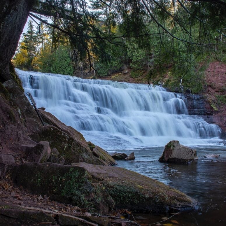
Put-in: Park at a wayside on Hwy.28. **\*\*\*Do NOT put in at the wayside.\*\*\* Carry downstream to put-in below Agate Falls.** This scenic, steep, stepped falls lands almost uniformly hard (on bedrock). Furthermore, the riverbed increasingly slopes and accelerates the water inexorably toward the lip of the falls. There would be precious little chance for a boater to avoid being swept over the falls (if in the river above it) at any reasonable boatable flow.
Take-out: Hwy.45 at "Military Bridge".
Rapids in this Run (26)
Rapid
USGS samping site
Rapid
Hwy.28 Wayside
Rapid
Log Jam
Rapid
II+
Wave/hole
 Rapid
Rapid
Confluence, Payne Creek
Rapid
Ledge/wave?
 Rapid
Rapid
Confluence, Tom Creek
Rapid
Log Jam 2 / Meto Creek
Rapid
Possible access/egress?
Rapid
Log Jam Concern #3
Rapid
Log Jam Concern #4
Rapid
Log Jam Concern #5
Rapid
Confluence Trout Creek
Rapid
Powerline Clearing
Rapid
Rapids
Rapid
Possible/apparent set of ledges/waves/holes
 Rapid
Rapid
Apparent rapids
 Rapid
Rapid
Confluence, Longtime Creek
Rapid
N.Paynesville Road
 Rapid
Rapid
Confluence, Cute Creek
 Rapid
Rapid
Confluence, Darling Creek
Rapid
North Country National Scenic Trail
 Rapid
Rapid
Waves/holes
 Rapid
Rapid
Confluence with Baltimore River
 Rapid
Rapid
Confluence, Spring Creek
 Rapid
Rapid
Confluence, East Branch
Waterfalls (1)
Hazards & Portages (1)
Caution: The following locations may require scouting or portaging. Always check current conditions.
Difficulty
Class I-III
Length
25.7 mi
Gradient
14 ft/mi
max 61
Rapids
26
1 Hazard
Access Points
Shuttle Info
Park at a wayside on Hwy.28. **\*\*\*Do NOT put in at the wayside.\*\*\* Carry downstream to put-in below Agate Falls.** This scenic, steep, stepped falls lands almost uniformly hard (on bedrock). Furthermore, the riverbed increasingly slopes and accelerates the water inexorably toward the lip of the falls. There would be precious little chance for a boater to avoid being swept over the falls (if in the river above it) at any reasonable boatable flow.
Difficulty Classes
I Easy
II Novice
III Intermediate
IV Advanced
V Expert/Extreme
VI Unrunnable
Current Conditions
5-Day Forecast
Whitewater data from
American Whitewater
American Whitewater