Cty.7 to falls above Hwy 61 (6.6 miles)
Linked via: Proximity 97% confidence Synced 6mo ago
Gauge Conditions
Runnable: ? – ? CFS
Approximate reading: This gauge is 27.5 miles away on Manitou. Use as a general reference only.
Data from American Whitewater & USGS
Run Map
Run Time Estimate
Select put-in and take-out to estimate time.
Unlock Advanced Trip Planning
See wind-adjusted speed maps, forecast planning, and detailed time estimates.
Sign in to generate an AI timing estimate for this run.
Whitewater timing varies with scouting, portages, and group pace. Use as a planning baseline.
Description
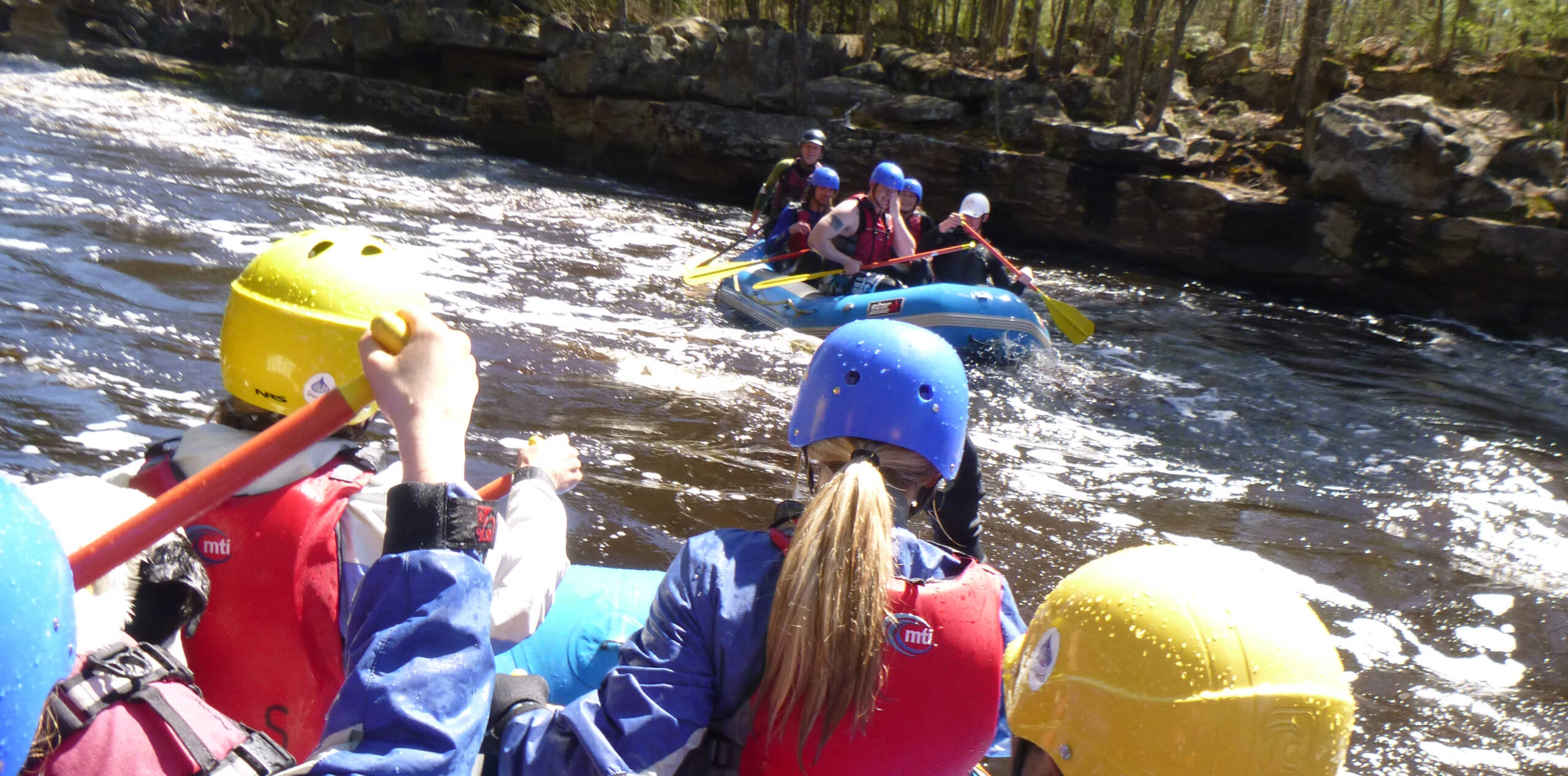
Overall the Manitou may not be overly difficult. However, it features (as one paddler calls them) "leaky eddies". Often you don't really have eddies but rather simply slower moving water. The Manitou features three portages (at least two of which are rather lengthy) so it may feel like you're carrying your boat as much as paddling it.
This run starts out with a flatwater paddle through an alder swamp. When the river bends left and you see a smoking horizon line, take out river right (before it's too late!) to portage around a long, mean, irregular, painful looking waterfall series.
Slide in below the falls, take some photos, then enjoy maybe a half mile of fun boat-scoutable, boulder-bed rapids. When the river bends left (and you may see a wooden staircase buried in the trees on the right) you'll want to take out river-right. The next drop is _Pinball_, a class IV+ drop. Scout/portage on river right. Boaters who choose to run Pinball will probably want to catch an eddy and get out immediately after to avoid being funneled into a Class VI canyon below. For those who choose to portage this whole combination, start climbing up and keep going until you hit the Superior Hiking Trail. It is a rather lengthy portage, so the trail-bridge spanning the river will be a welcome sight. You can put in just above the bridge to run Machine Gun Ledges.
After the bridge you've got more boulder-dodging, with the occasional small ledge. The next significant horizon line can be scouted either right or left. A fairly clean 5-10 foot falls can be run easily slightly left-of-center. After some more boulders and boat-scoutable ledges (2-3 feet, mostly) the river takes a sharp right turn with rock walls on each side. Catching a little eddy on the inside of the turn will allow you to scout the next drop, a slightly grungy waterfall, maybe 10-12 feet high. The best line is usually to ride the tongue about five feet off of the river right wall. After that it's more boulders and ledges, with a few smaller horizon lines that you may want to scout to check for snags or to be sure what line looks the best.
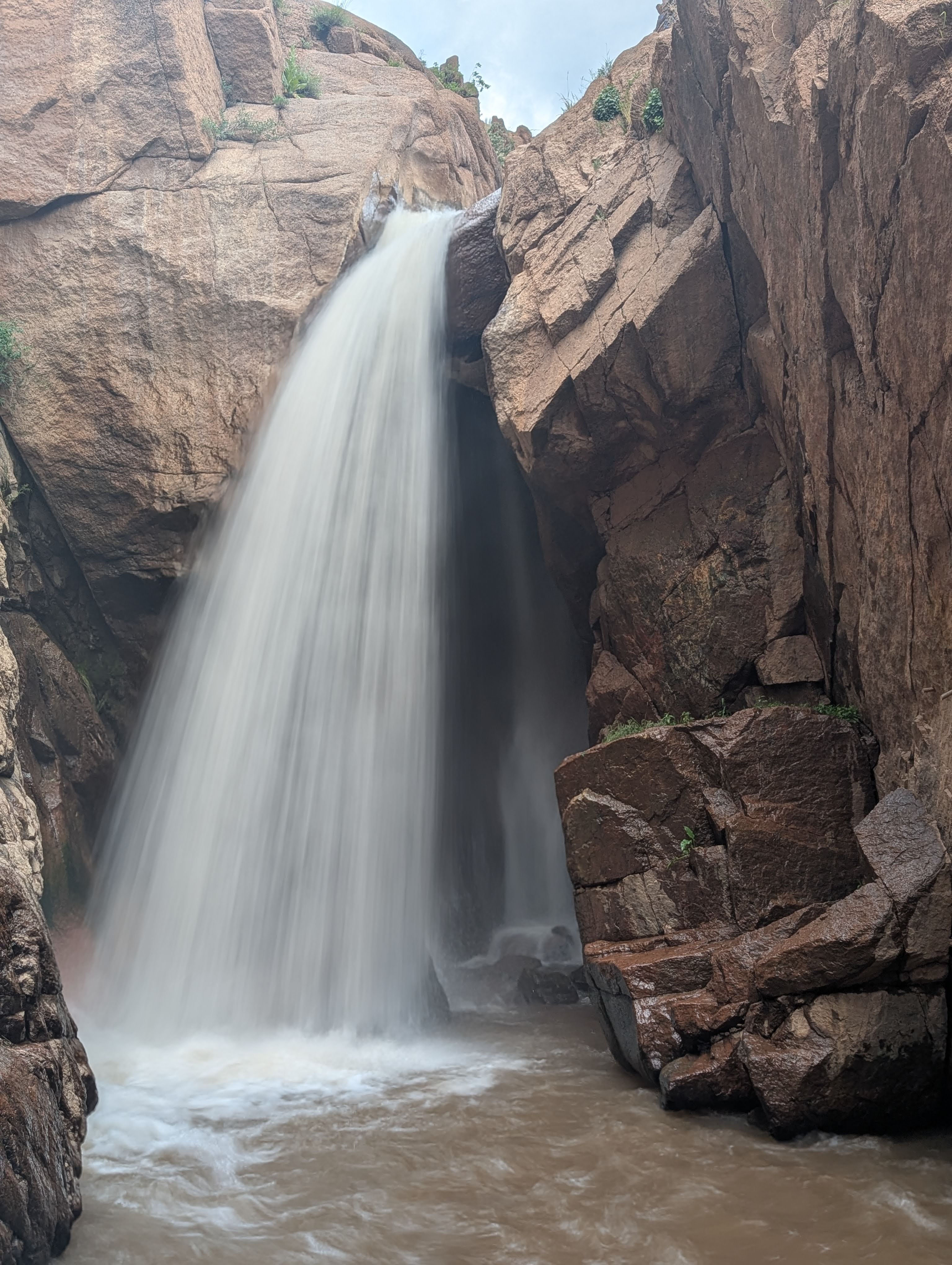
Just after the river takes a left, when you see powerlines downstream, take out river left. The next rapid looks runnable and fun, but things don't slow down and there is no reasonable egress from the river before you hit _"Rain falling up" falls_. This falls is one of the most beautiful, bizarre and impressive waterfalls/gorges you will ever see. As you are shouldering your boat on the hike out take the time to hike down and check out the falls, you won't be disappointed no matter how many times you may check it out. The rainbow over the gorge is a beautiful sight after a great day on the river. Hike a faint trail the rest of the way to Hwy.61.
(Our thanks to Jacob M. Vos (A.K.A., JetManJake) and Mark Mastalski for contributing to this fine description.)
Rapids in this Run (13)
Waterfalls (1)
Hazards & Portages (2)
Caution: The following locations may require scouting or portaging. Always check current conditions.

Difficulty
Class III-IV
Length
6.3 mi
Gradient
120 ft/mi
max 200
Rapids
13
2 Hazards
Access Points
Difficulty Classes
I Easy
II Novice
III Intermediate
IV Advanced
V Expert/Extreme
VI Unrunnable
Current Conditions
5-Day Forecast
Whitewater data from
American Whitewater
American Whitewater