Damascus to South Fork of the Holston River (U.S. 58)
Linked via: Nhdplus discovery 90% confidence Synced 6mo ago
Gauge Conditions
Runnable: 400.0 – 3,000.0 CFS
Maximum is a guess.
Data from American Whitewater & USGS
Run Map
Run Time Estimate
Select put-in and take-out to estimate time.
Unlock Advanced Trip Planning
See wind-adjusted speed maps, forecast planning, and detailed time estimates.
Sign in to generate an AI timing estimate for this run.
Whitewater timing varies with scouting, portages, and group pace. Use as a planning baseline.
Description
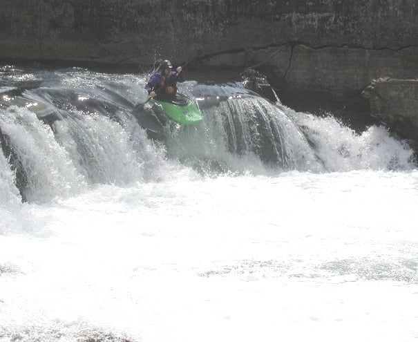
Laurel Creek is the section of water that runs through the town of Damascus, VA. It is most commonly referred to as the lower section of Whitetop Laurel or the Upper Section of South Fork Holston. The run actually starts at the confluence of Whitetop Laurel Creek and Beaverdam Creek and continues down to where the South Fork Holston enters on the right. Laurel Creek can be run anywhere from a scrapy 300 cfs to as high as you feel comfortable. At levels above 1000 cfs there are many great surf waves and playspots. About two thirds of the way down after a long flat pool you will see a horizon line signaling you are at an old mill dam. You can scout on river right as the left side is private property. The best routes are on the far left and right sides or you can scrape down the overflow channel on the right side. Its best to put in for this section at the Park in Damascus. You will see the parking area, just look for the red Caboose. There are numerous takeout points but most paddlers combine this section with the South Fork Holston.
Rapids in this Run (1)
Difficulty
Class II+(III)
Length
2.8 mi
Rapids
1
Access Points
Difficulty Classes
I Easy
II Novice
III Intermediate
IV Advanced
V Expert/Extreme
VI Unrunnable
Current Conditions
5-Day Forecast
Whitewater data from
American Whitewater
American Whitewater