Franconia Falls to Woodstock.
Linked via: Proximity 92% confidence Synced 6mo ago
Gauge Conditions
Runnable: 300.0 – 3,000.0 CFS
Data from American Whitewater & USGS
Run Map
Description
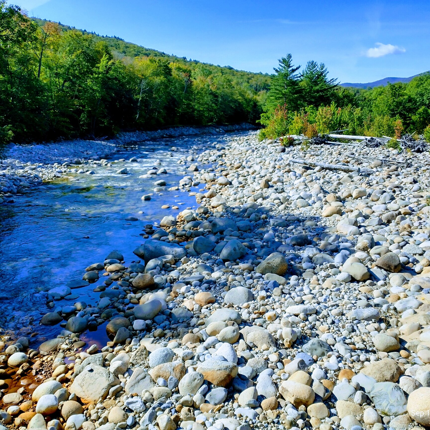
The East Branch of the Pemigewasset is a natural flow river best run in late April and May with the snowmelt from the high peaks of the White Mountains.
The river gets its start in the mountainous federally designated wilderness area upstream from the put-in. As a result the water is clean, clear, and usually cold when the river is running. Don't be fooled if the water looks too low; local river lore states that if it looks like there's enough water then it's probably too much!!!
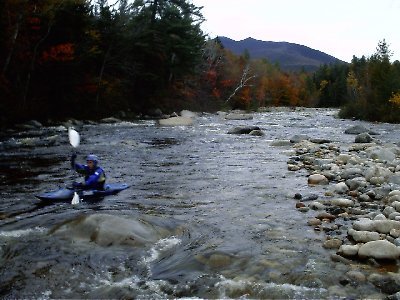
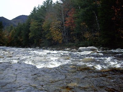
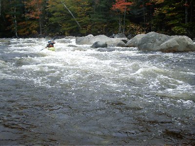
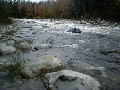
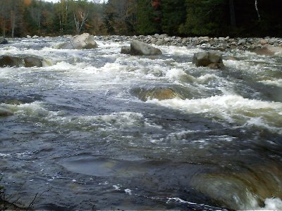
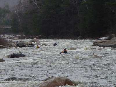
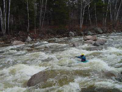
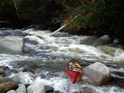
This river is a classic New England run. Continuous whitewater, a few more difficult rapids, and lots of technical moves required. Many boaters consider this river one of the best regularly run rivers in New England.
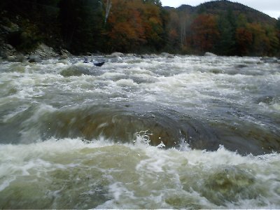
With the exception of a few bigger rapids on either side of Loon Mountain, the entire run is similar in character. (Although some purists claim that the upper section, reachable only by walking upstream is the best.) The river is relatively wide (85') for a New England river. It is strewn with car (and larger) sized boulders. These boulders create extreme turbulence during high water. The rapids are continuous and at high water all blend all together for a long class IV-V run. Any swim at high levels may result in the loss of one's boat as it is quickly swept many miles downstream. Be aware because of the nature of this river, boulders (even large ones) move and shift every spring changing the river character.
The Upper East Branch of the Pemigewasset run starts below Franconia Falls at the confluence of Franconia Brook and the North Fork of the Pemigewasset. To reach it you must walk/carry/drag your boat up the Wilderness Trail three miles along the river. The upper section is a bit more technical and unforgiving then the lower sections. Additionally the riverbed is more wide open, requiring a bit more water to paddle.
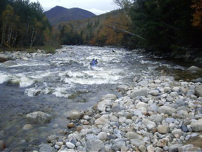
If a long walk just to paddle a beautiful river doesn't appeal to you, then start your run (as most do) on the middle section of the East Branch at the Lincoln Woods Parking Area (sometimes called the Wilderness Parking area.) This section benefits from the added water coming in from the Hancock Branch just below the put-in.
The lower East Branch (starting at Loon Mountain) holds its water a little longer than the upper (ie, it can be paddled at slightly lower levels). The river bed narrows somewhat allowing for less choice of passages. You will notice a lot more civilization in this section. Condos, ski area base lodges, and parking lots are found along much of the run; even a hidden sewage treatment lagoon located between the takeouts. Still, the river is pretty, seems secluded in most spots, and has a few nice swimming holes.
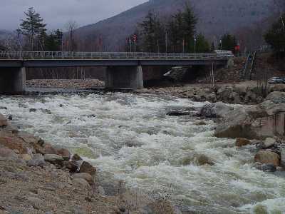
### Take-Out
The common take-out is at the Woodstock Fire Station / Family Park on Rt 3 about half-mile south of the traffic light at the junction of Rt 112 and Rt 3. On the river, be sure to take the RIGHT CHANNEL after the Rt 93 bridge crossings to access the take-out, otherwise you will travel downstream too far and start the Pemi-Woodstock section. Several other take-out spots are possible on river right after Loon Mountain Rapid if you are short on time, but it is worth planning ahead and running the entire 6 miles from the Lincoln Woods trailhead.
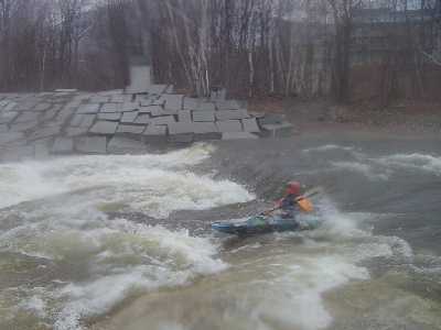
### Scouting the Rapids
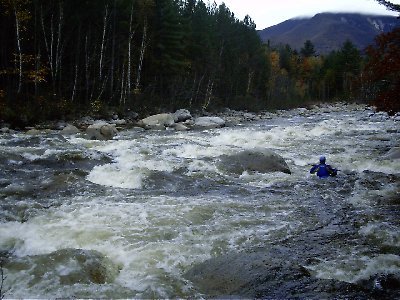
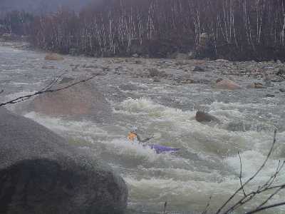
Loon Mountain Rapid is the only section where scouting is required. The rapids immediately above and below Loon Mountain require more caution for the boater new to the river, as does the fourth major drop in the upper section. The rest of the river can be easily boat-scouted. Indeed, given the large number of drops and the changing nature of the river each year, it is impossible for one to know what is coming and each run is always a new experience.
### Strainers, obstructions, and other hazards.
Strainers are inevitable and great caution must be used on blind corners and blind drops.
Culvert Rapid, a short distance above Loon Mountain has random sections of large 3-ft diameter steel pipe. Two pipe sections are lodge into rock sieves on river right and easily avoidable, but could cause trouble if shifted by flood water.
ARCHIVE COMMENT \*no evidence of this obstruction has been seen recently\*
At the bottom of Loon Mt. Rapid there is a large curved steel plate in the center of the right main channel of the river. The upstream end appears to be into the riverbed and the downstream end is up on a rock, so it just looks like a pour-over from upstream. From downstream you can see it is a large curved plate similar to the culvert plating in Culvert Rapid, but not a full section and not sticking up as much. It is located about 10 to 20 yards downstream of rapid section shown in the photo on the AW site description of Loon Mt. Rapid, at the last drop just before the left 'sneak' route rejoins the main flow.
### Fast rises/falls, flash flood potential
Note that the steep mountainous watershed causes the river to rise and fall rapidly. During periods of heavy rain the river can rise especially fast. This may catch old hands by surprise who expect a few hours of delay before any rain takes noticable effect.
An example is shown below (taken from the USGS Lincoln Gage). Note that in the space of only 15 minutes the flow increased by over 500 CFS; the increase over a two hour period was almost 2000 cfs, peaking at almost 3000 CFS before dropping back over the subsequent four hours. The Woodstock gage several miles downstream showed the same pattern of increase/decrease delayed by 20 minutes.
```
Date CFS Level2000.05.13 23:45:00 1190 2.852000.05.13 24:00:00 1160 2.82
Rapids in this Run (21)
 Rapid
Rapid
Typical River Character
 Rapid
IV
Rapid
IV
First Major Drop
 Rapid
IV
Rapid
IV
Second Major Drop
 Rapid
IV
Rapid
IV
Third Major Drop
 Rapid
IV+
Rapid
IV+
Fourth Major Drop
 Rapid
IV
Rapid
IV
Fifth Major Drop
 Rapid
III+
Rapid
III+
Sixth Major Drop
 Rapid
IV
Rapid
IV
Seventh Major Drop
 Rapid
IV
Rapid
IV
Hancock
Rapid
IV
Unnamed Rapid
Rapid
IV
Unnamed Rapid
 Rapid
IV
Rapid
IV
Potash
Rapid
IV
Culvert
Rapid
IV
Upper Loon Rapid
 Rapid
IV
Rapid
IV
Governor Adams
Rapid
IV
Unnamed Rapid
Rapid
IV
Unnamed Rapid
 Rapid
IV
Rapid
IV
Unnamed Rapid
Rapid
IV
Unnamed Rapid
 Rapid
IV
Rapid
IV
Unnamed Rapid
Rapid
IV
Unnamed Rapid
Playspots (1)
Hazards & Portages (3)
Caution: The following locations may require scouting or portaging. Always check current conditions.
Difficulty
Class IV
Length
9.0 mi
Gradient
81 ft/mi
max 210
Rapids
21
3 Hazards
Access Points
Shuttle Info
### Put in
Interstate 93 to exit 32. State route 112 (Kancamaugus Highway) east for approximately 5-1/2 miles.
Take a left at the Lincoln Woods recreation center just after crossing over the East Branch Bridge (sometimes called the Wilderness Parking Area). There is a large parking lot here with bathrooms and a visitor center with information for the hikes out of this area.
Note: At the Lincoln Woods put-in, it will be necessary to have a [White Mountain National Forest parking sticker](http://www.fs.fed.us/r9/white/recreation/fee_demo/). These can be purchased at the put in at the Lincoln Woods visitor center or the information center just off the exit for rt 112 (Kancamaugus Highway). They are also available at information centers off exits 23 and 28.
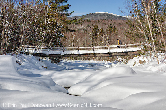
The put-in for the middle section is down a steep bank in front of the visitors center just under a suspension footbridge used for hikers next to the parking lot (44.0638,-71.5904).
For the upper section you can carry/drag your boat 3 miles up the Wilderness Trail (a former railroad bed) and put-in where the bridge crosses Franconia Brook near a National Forest wilderness campground. The walk (with an open boat on wheels) takes approximately two hours. Make sure you walk up along the north side of the river along the old railroad bed instead of the hilly road which follows the river's south edge.
### Loon Mountain take-out/put-in
Head back in the direction you came on route 112 towards Lincoln, go 2.5 miles to the entrance to Loon Mountain ski area. Take a left here and make your way to the lower parking lot under the bridge you just came over. To access the river **_above_** Loon Mtn Rapid, drive to the lower ski area parking lot on river left across the bridge from the Kancamagus (44.0567,-71.6340).
To access the river **_below_** Loon Mtn Rapid then park on river right in a picnic area located behind the steam locomotive.
### South Mountain Bridge Take-Out
The upper take-out is located behind the main shopping center in Lincoln off Dodgeville Rd (44.0473,-71.6596). Drive back into Lincoln. Turn left just after some stores and restaurants and just before the bigger shopping center. Proceed down towards the river and cross over the bridge that spans both channels. Take out on the river left channel under the bridge (half-way down the rapid).
### Woodstock Take-Out
Drive west thru Lincoln, under Interstate-93, and continue to a traffic light in Woodstock just past where it crosses over the Pemigewasset (approximately 3.2 miles). Turn left, then less then 1/4 mile take a left and park behind the Woodstock Fire Station. There is a small playground here with a porta-potty.
From the river, continue downstream past the South Mountain Bridge, after you pass under the high Interstate-93 bridge and then the railroad bridge take the river right channel. This channel will bring you back to the takeout just after the confluence with the main stem of the Pemigewassett river coming out of Franconia Notch.
Note: Do **NOT** take-out behind the IGA by the electrical substation any more. Although in use for decades, this take-out has been recently developed, is no longer secluded, and the homeowners association has barred boater from using it.
Difficulty Classes
I Easy
II Novice
III Intermediate
IV Advanced
V Expert/Extreme
VI Unrunnable
Current Conditions
5-Day Forecast
Whitewater data from
American Whitewater
American Whitewater